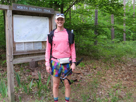
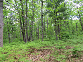
Then I spent some time on my ongoing trail signage project. There were two possible routes to where I wanted to go. Because I hadn't seen it for a while, I took the spur from the Marilla Trailhead. This used to be the main NCT. But when we got those lovely miles along Hodenpyl Dam Pond, this became just a spur to a trailhead. Nice deciduous forest.
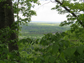
There are some really nice vistas from this piece of trail. The Manistee River is down in the bottom.
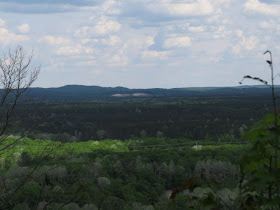
Here's Briar Hill again. Highest point in the lower peninsula.
My project involved checking the posts at the junction of the spur with the main trail. I was carrying the shovel, because there was supposed to be a Carsonite post a little farther on to remove. However, one of the 4x4 posts at the junction had broken off. Since I had the shovel, I re-buried it. It's just a little shorter now, but it's OK for a while.
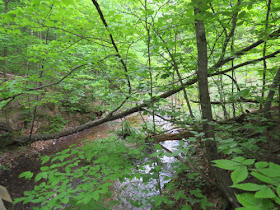
Then I went on to remove that other post. It's no longer there. At least I sure couldn't find it, and I had the GPS coordinates. Anyway, I made it to Eddington Creek, so I knew I was past the location.
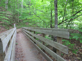
And Eddington Creek bridge.
Turned around and went back. Then replaced the shot-up Carsonite post and all its stickers at Marilla Trailhead. By then it was 5:30. I decided to just come home. There's lots more to do up that way, but at least I did a little bit. Because most of what I hiked was on a spur trail, not much of my walking counts as NCT miles. But my total for the day was about 3 miles. Hardly a hike, but the day was about projects, not miles.
In other news: Believe it or not, I did manage to sneak in a load of laundry!
North Country Trail miles for 2021 is at 321.
North Country Trail, Manistee County, Marilla Trailhead to Eddington Creek and back. Total 3 miles
 | See Hodenpyl Dam in Winter |
Best wishes to John on his hike. You had another day of accomplishing quite a lot
ReplyDeleteAnn- And I rewarded myself today!
ReplyDelete