But, as everywhere here, the creeks are all lined with shale. This is a good example.

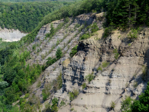
The very best though, is that the trail gives a number of views of this portion of the gorge of the Genesee River. This is sometimes called the Grand Canyon of the East, but that name is also applied to a deep gorge in Pennsylvania. No matter what you call it, it's impressive.

This is a closeup of that bump in the rock wall.
And here is a view looking upstream instead of down.

Just to give you a sense of this valley, here is a longer view of the floodplain. You can barely see the river down there.

And what is the point of this? Here we are at the Mount Morris Dam. This dam is 215 feet tall, and was finished in 1951. The purpose is flood control. Downstream from this location is the city of Rochester, which regularly suffered catastropic floods prior to this date. Unless there are serious storms, the water is just allowed to flow through the dam. There is no reservoir. However, in storms, the water is held behind the dam and then released gradually to prevent the damaging floods. Twice, the water has risen to within four feet of the spillway at the top of the dam. Now glance back at the floodplain picture. And keep in mind that this valley is 17 miles long. Think about how much water was being held behind that dam!

And this is the thing my dad loved about this park. He liked to go and look at the dam. I think he had experienced one of the Rochester floods, and he understood what a big deal this is.
We have now finished the Letchworth Branch of the FLT.
Letchworth Branch of the Finger Lakes Trail. 9.4 miles, approximately Ridge Road to the northern terminus in Mt. Morris
 | See Nice Trail |
3 comments:
I highly recommend visiting here - hiking if you can! I've been to the many parts; even dangled over the gorge on a geology expedition for college! Awesome! - Elaine
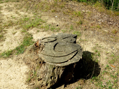
Stunning views. That first picture kind of looks like some ancient tribal carving.
Elaine- you see more of the gorge from the roads on the west, but the trail is on the east.
Ann- just chain saw in a stump!
Post a Comment