Entries to Win Afghan

Sign up to receive the Books Leaving Footprints Newsletter. Comes out occasionally. No spam. No list swapping. Just email me! jhyshark@gmail.com Previous gifts include a short story, a poem, and coupons. Add your name, and don't miss out!

Thursday, June 19, 2025

Day Eight- Being Flexible


Woke at 4 am to rain. We knew that was possible. We didn't really want to start the next backpacking leg in the rain because the first two miles are going to be difficult even if the trail is dry. So we went to plan B.

With intermittent showers we thought we could get in the two sections that we had planned to do the day after the backpacking. Spoiler- we managed the hikes, but not the dripping sky.

The Adirondacks are stunning no matter what the weather. Dramatic moments on the road as the storm clouds cleared out and the mist rose.
dramatic Adirondacks


We started with a drive to the Blue Hill Trail. That had to be hiked as an in-and-out because there is no vehicle access to the south end. There's a "road" there, but, um, you need a truck to drive it.

This is a beautiful section, although it probably won't be on the final NCT route. It was actually the most foot-friendly trail we've walked yet with fewer rocks and mud holes. It does climb 400 feet and then drop back down 200.
Blue Hill Trail


It goes past a nice beaver pond. Yeah, there are lots of these, but I haven't shown you many yet.
beaver pond


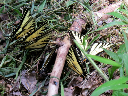
Many blue flags. Common, but always beautiful
wild blue flag


One of the things I love about the Adirondacks is that you never know what you may see as you drive around any curve in the road. I have no idea what peak this is, but it's pretty cool!
Adirondack mountain


We stopped at the campsite to check in with Diane who was having a nice relaxing day (which is what she wanted). The steady rain was done but there were little pop-up showers happening. We had one more short piece of trail to do.

Diane hiked a short way in with us on the snowmobile trail up the west side of Oak Mountain. She said she liked listening to us do the inventory stuff. The big news of that section is that it's all grass and weeds in the summer. Think pop-up rain. Think soaking wet. Think climbing up another 200 or so feet in wet berry bushes and ferns.

Then we came over the top on to Oak Mountain Ski Resort property where I helped build trail in 2020. Then it was downhill on nice clean trail, and we were done for the day.
grassy trail


Diane fed us another wonderful dinner of Cornell recipe barbeque chicken and macaroni and cheese! It's amazing to have hot food just appear without having to work for it. We are so thankful she wanted to come be part of this adventure.

This means that we will start the two-day backpacking tomorrow. There will be at least one more batch of rain tonight. Hopefully that will be the end of it. The backpacking starts with a big climb up a very rocky trail that is more or less a creek, so we'd like it to not be totally wet and slippery.

So no blog tomorrow for sure.

A total of about 8.5 miles today.

New York, Adirondacks, North Country Trail, Blue Hill Trail and Oak Mountain. 8.5 miles

See Food, Friends, Fire

Wednesday, June 18, 2025

Day Seven- Food, Friends, Fire


One of the requirements for a day off is ice cream!
people in a car with ice cream


Then Bill and I went hunting for our next free campsite, east of where we had been. We found an adequate one that was quite nice. Next event was the arrival of Diane, here to spot us for the next few days.
friends


Bill and I had set up our tents, and the potty cabana out in the trees. Diane quickly added her tent and we are suddenly a village.
tents in a campsite


Some actual resting occurred!

Diane wanted to bring food for us for the evenings and breakfasts. Sounded good to us! I forgot to picture the dinner, but it was a yummy bean and veggie one-pot meal, and homemade cookies for dessert.

For the first time in a long while an evening on a hike was relaxed enough that we built a campfire.
campfire


The mosquitoes haven't been as terrible as usual for June in the Adirondacks, but they ramped up a little yesterday, and the smoke helped keep them at bay.

With storms predicted or not, and every weather site disagreeing and changing every ten minutes, we will decide which phase of this trip to do next in the morning.

See Racing for the Motel

Day Six- Racing for the Motel


We had under seven miles to go to get to the car and a motel. We were on a mission!

We had to climb 700 feet and after that it was "all" downhill to Raymond Brook TH.

A loon sang throughout the night and I caught this picture in the morning of it shaking out a leg.
loon


It was a day of bad bridges...
broken bridge


And good, even new bridges!
new trail bridge


We began the long downhill with high hopes for speed. I "remembered" it as a gentle grade with mostly smooth trail through dryish woods. Ha! I only remembered the couple hundred good feet apparently. The trail dropped 1300 feet over several miles with really difficult footing and a number of steep areas.

One of the most fun things is this historic ski rescue shed from the 1930s. Yes, this is a ski trail. You can see how much snow was typical by the height of the shed.
historic ski rescue shed


I also forgot about this beaver flooding. The trail used to go right through that area (I know because there are blue discs on trees out in the water). Now it crosses the dam and climbs up to a ridge on the far side. Still mostly marked with flagging ribbon. Things happen slowly here. I would think that in three years it would have been marked with discs.
beaver dam


One more interesting encounter. There was a team of four researchers from the health department out doing a population study on deer ticks. She wanted to tell us all about it!
tick research


Another quarter mile to the car, motel in North Creek, shower, lunch (tuna melt for me, burger for Bill), laundry, sorting, blogging, etc. No one can trash a motel room like a couple of hikers!
messy motel room


Despite the elevation challenges, we finished around 1 pm. Not too shabby!

New York, Adirondacks, North Country Trail, Botheration Pond to Raymond Brook TH. 6.5 miles

See Longest Day

Day Five- Longest Day


If we could pull it off, this needed to be a long mileage day because the previous day we didn't make it very far. Our goal was Botheration Pond (the same area where I camped three years ago). But it was 10 miles away. That's a lot on rough trails when we are stopping to inventory things quite often.

Had to take a picture of False Hellbore Veratrum viride, also called Corn-lily. I don't think I previously had a picture of it in bud.
corn lily


That was fun. The not so fun part was that it was on the bank of Humphrey Brook. This was a terrible crossing in 2022. It hasn't changed. I had decided that I'd not found the actual crossing in 2022. So this day we looked carefully. We found markers that did lead us upstream, but we couldn't find any adesignated crossing. Instead of sliding down a gravel bank and wading with the fishes, we only had to wade the space pictured here. Better.
Humphrey Brook


But the other side is all grown up with alders and goldenrod and no trail. We pushed through all that. Found a trail, but no markers. It led us to this.
frying pan on a tree


We were momentarily flabbergasted until we realized that someone has established a campsite there. It's good that the trail is being used. Maybe not so good that people are leaving kitchen gear already. Anyway, we followed that trail back out to the main trail and got going in the correct direction. This all chewed up a bunch of time.

Saw the biggest American Toad I may have ever seen. He was well camouflaged for the dappled sunlight. But his size- more than 4 inches- gave him away!
toad


Here's some of the kind of thing we are doing. Most of the junctions have the familiar brown and gold Adirondack signs which we inventory. But some junctions aren't marked at all, like this one. The picture probably isn't big enough that you can see there is an NCT emblem along the trail Bill is standing on. But the left fork is part of a loop called King's Flow and it only has a DEC yellow disc. We need to collect info so that NCT hikers won't be confused at junctions.
trail junction


At Puffer Pond, we ate lunch at a shelter. There was a man setting up camp there who portages his canoe (a very light one, but still over 50 pounds total) and his pack all over the Adirondacks so he can fish. He had at least heard of the North Country Trail. We had a nice visit and then we moved on. Beautiful spot.
Puffer Pond


We still had over 2 miles to go and for sure a couple more rocky stream crossings. Thankfully we knew that the worst missing-bridge crossing had been rebuilt since 2022. We actually make it to the Botheration Pond official campsite about 5:30.
Botheration Pond campsite


This is the longest backpack I've done since being sick. A little over 10 miles. But we made it, and I wasn't even totally exhausted.

New York, Adirondacks, North Country Trail, Wakely Brook to Botheration Pond, 10 plus miles.

See Day Four

Sunday, June 15, 2025

Day Four- Will to Wakely


We failed to get a decent picture of one of the best events of the day. We were shuttled to the beginning of our hike by Will Brazill, the new Regional Trail Coordinator for Vermont and New York. So we got to spend an hour in the car getting acquainted.

Then he hiked with us for several miles, so we got to learn even more about him. I think he's taking on this job at just the right time for the association to see some great things happen in the Adirondacks. He stayed with us until the NCT turn off the Kunjamuk Trail. You can see the rocks and muck we hiked through. (Always- typical Adirondack Trail)
rocky muddy trail


This cluster of Tiger Swallowtails was certainly interested in something.
tiger swallowtail butterflies


I am beyond pleased to tell you that the entire route from Cisco Brook TH to Raymond Brook TH (22.5 miles) is sporadically marked with blue blazes and NCT emblems. At the present time the NY DEC will not allow the frequency of blazing we are used to, but at least there is something. One really good thing is that there is a turn blaze going from the Kunjamuk Trail to the Wakely Brook Trail.
blue trail blazes


The Wakely Brook Trail is a connector that the DEC built just for the North Country Trail. This is a typical stream crossing anywhere in the Adirondacks. This doesn't even have a name. It's a tributary of Wakely Brook. You step/hop from rock to rock and may or may not get wet feet. We've given up on dry feet. There's too much mud.
rocky stream crossing


One of the neatest features of the Wakely Brook Trail is a sheer cliff the trail skirts. It's called Pine's Point.
rocky cliff


And you get a pretty nice view of Humphrey Mountain.
Humphrey Mountain


We only made 6.5 trail miles. It took a long time to get the cars spotted, and there was a lot of mud even though we were in Siamese Ponds Wilderness where snowmobiles aren't allowed. (The snowmobiles compact the track and even tear it up a little, and then the water doesn't drain but just pools.)

We camped near Wakely Brook. We were within a quarter mile of where I camped three years ago. We did need room for two tents. This worked, but it was more slopey then would have been ideal.
two tents in the woods


The weather has held out for us. Our bodies are holding up, and data is being collected. So far, so good.

Adirondacks, NY. Cisco Brook, Kunjamuk, and Wakely Brook Trails. 6.5 miles

See Day Three- Mud and More