Entries to Win Afghan

Sign up to receive the Books Leaving Footprints Newsletter. Comes out occasionally. No spam. No list swapping. Just email me! jhyshark@gmail.com Previous gifts include a short story, a poem, and coupons. Add your name, and don't miss out!
Showing posts with label Kekekabic Trail. Show all posts

Tuesday, March 7, 2017

Mesabi Hike - Madden Creek to Kekakabic Trailhead

 
Saturday, August 16, 2009. This was a gold star day for us. All of our legs were working pretty well, and we finished a major connection known as "the back of the arrowhead."

Every scene just screamed "north country." And those weren't the only reasons we were happy. It was also our shortest hiking day.

wetland

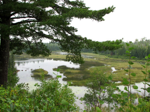
It was still all road walks, but it's hard to complain about it being too civilized. I liked this tree a lot, along Fernberg Road. North Country Trail enthusiasts know this road name well. It's the only way to connect from the Kekakabic Trail (the Kek) to Ely.

tree

And here we are at the Kek. This is where, just three months earlier. Five of us hiked through from the east to end that hike at this very same location. Lots more green stuff in August.

Kekekabic Trail head

Kekekabic Trail head

And the next stop was also the same on both hikes- the Chocolate Moose in Ely. Talk about good food!

Chocolate Moose

After that we had a date with a big guy. A really big guy. At the Voyageur Motel.

voyageur statue

We had to get things washed and sorted and repacked, because this hike was not over. Yes, we finished this section of the trail, but my goal was to complete all my unfinished North Country Trail miles in Minnesota. This meant a drive back to the north shore of Lake Superior, and a switch to backpacking on the Superior Hiking Trail/NCT.

I did do a number of blog posts about that hike, so I think tomorrow I'll just give an overview of those next few days and direct you back to those other posts if you want to see them. I showed a lot of pictures, but didn't give much continuity, so I'll focus on providing that.

"Back of the Arrowhead" completed: Chippewa National Forest to Kekekabic Trail, 8.8 miles that day, 182.2 total.

See Ely to Madden Creek
if you like this blog, click the +1   or

Like This!


Saturday, May 30, 2009

Early Yellow Minnesota Flowers

 
It was too early for many flowers to be out yet, but several were opening during the final week of our hike. I'm sharing these two because they are ones I had not seen before.

yellow corydalis in Minnesota

Above is Yellow Corydalis (Corydalis flavula). It is related to bleeding heart. I've seen Pink Corydalis on several hikes, but hadn't previously seen the yellow ones except in pictures. The pink ones are more delicate- almost so pale that they often are hard to see against the granite on which they like to grow. The yellow ones seem much more showy even though the plant is only a few inches high and each bloom about 1/2 inch long. We found them growing at the base of some rocks in the area that had been logged (see yesterday's post).

fly honeysuckle in Minnesota

The second one is American Fly Honeysuckle (Lonicera canadensis). This is one of the native honeysuckles, much more welcome than the alien Tartarian Honeysuckle bushes that grow everywhere in Michigan. The flowers were very pale yellow, maybe that's not quite so obvious in the picture. Each trumpet is about one inch long, but the bushes were several feet tall. Somehow I had thought that the Fly Honeysuckle had a sweet scent, but they didn't smell like anything at all. Honeysuckle is easy to identify, at least in general because it is one of the few shrubs with opposite branching. Also the flowers and berries are in pairs, often looking like two berries stuck together.

Wow, tomorrow is the last day of May. It needs to be contest day! I'll try to make one that isn't so daunting. Hope some of you will play!

See The Moles Missed This One
if you like this blog, click the +1   or

Like This!


Friday, May 29, 2009

Walking Into Spring


photo label

This is the first time I've taken this long of a trip in May. I've been out for five days in this month other years. But never before have I so completely walked from bare trees and the end of winter into green leaves and wildflowers.

The top picture was taken on our second hiking day. The view is of Lake Superior from the Superior Hiking Trail. As you can see it was a gray day and the trees are all bare and gray except for the conifers.

photo label

The second picture was on the last hiking day. We had just emerged from the greening trees in back of us into an area that had experienced a severe blowdown. Timber was salvaged, leaving the space looking about the same as if it had been logged (and difficult to walk through).

This afternoon I took a slow walk around my trail at home and picked some of the wild asparagus here. I thought that I might miss it all, so I was very happy to find some yet. It was rather mature, but I cut it up and made it into soup for dinner. I forgot to take a picture! Obviously I'm not back into blogging mode just yet-- trying to get my head around the schedule I was keeping before the hike.

I think tomorrow I'll show you some wildflowers from the hike.

Thursday, May 28, 2009

Home- The Hike Was Great!


hikers by Kekekabic Trail sign

We don't look like the brightest bulbs in the room in this picture, but here is the group (except me, I took the picture) that finished on the 24th at the Kekekabic Trailhead near Ely, Minnesota. We had a fifth hiker join us for the final five days. The weather warmed and the end of the hike was pleasant, for which we were not sorry!

Dinner at the Chocolate Moose in Ely was as wonderful gastronomically as the hike was wonderful hikin'omically!

We stayed in small motels/cabins on the way home with no web access. Marie and I arrived at my house last night, and spent today cleaning gear and putting it away before she left at 4 pm. It just all seems to have happened too quickly!

I've got so many things to catch up on!

spruce grouse

Here's one fun thing to share. This spruce grouse gave us a nice display on the next to the last day of the hike. After watching us for several minutes it flew to roost in a tree right over the trail where I guess it thought it was hidden. We hiked right under it! They are odd birds in that they are known for letting people get very close to them.

See Trail Work Day
if you like this blog, click the +1   or

Like This!


Sunday, May 24, 2009

Did We Make It?

 
campers sitting by a lake

Well, if all went as planned we have reached our car this afternoon, and are probably warm and snug in a motel.

There aren't too many hikes I've led with as many unknowns as this one. As late as the day before we left home, I was getting conflicting reports of "2-3 feet of snow still on the trail" and "mostly bare ground with a few snow patches." We had read of Nimblewill Nomad's terrible experience just a couple of weeks before we began our hike. We know the trail is difficult to follow (marking is not allowed in the wilderness which makes it even more difficult). I'm sure we've had an adventure!

But I hope that you've enjoyed the tour while I was in the woods, and perhaps learned a little more about trails. I also hope that I can do a live post tomorrow, so I haven't scheduled one. You'll know in another day!

I'm sure we've enjoyed some evenings similar to the one pictured above from 2003.

As I write this, we need to pull out of the driveway in 4 hours and 45 minutes. I still have an hour of work to do, and then I will catch a couple of hours of sleep. I tucked Marie in long ago, so she will be fresh to drive. She is a morning person, and I'm the night owl. Hubby just got up (3 am) to do the paper route, and I need to sign off. See you soon, I hope.

See The Blog Plan for the Arrowhead Hike
if you like this blog, click the +1   or

Like This!


Saturday, May 23, 2009

Volunteers


photo label

So, how does the trail stay open at all, given wind, fire, water... The answer is "VOLUNTEERS."

Almost all of the work of any kind (trail building and maintenance, through making phone calls, landowner negotiations, leading hikes, etc) is done by volunteers. Why? They simply love to be able to be part of creating inviting places in the forests, hills, prairies... to walk. More often than not, they are hikers who woke up one day and realized that they wanted to give something back to the trails that gave them so much peace.

Next time you take a hike, think about who it is that makes that pathway safe and clear for your enjoyment. In a park, it may be your tax dollars. But on many trails, it is volunteers.

See The Blog Plan for the Arrowhead Hike

Friday, May 22, 2009

Blowdown


photo label

In 1999, a devastating wind storm blew through the Superior National Forest. It flattened trees like a box of wooden matches thrown on the floor. This picture shows what some of the area looked like in 2003. It will take years for the forest to come back, and the fire danger has been so high that the question never was "will it burn?" But "when will it burn?"

There have been some controlled fires since then, and a couple of natural ones. In the spring of 2007 the Hamm Lake Fire burned across the trail. By now we will have seen the changes that wrought. I don't really know what to expect- a moonscape or a lot of fresh new green things. We do know that it makes the trail very hard to follow. We have GPS!

See The Blog Plan for the Arrowhead Hike

Thursday, May 21, 2009

Agamok Bridge


photo label

Tonight we are camping near Agamok Bridge. This is where the 2003 Volunteer Vacation trip ended. It's an amazing structure to come upon in the wilderness where no wheels or power tools are allowed. All the parts were brought in by dog sled one winter, and the bridge was assembled the next summer.

See The Blog Plan for the Arrowhead Hike

Wednesday, May 20, 2009

Begin the Kekekabic Trail


Kekekabic trail signToday we re-enter the Wilderness on the Kekekabic Trail. It was originally a fire road through the Superior National Forest, but decades ago was "lost" to the forest. Volunteers try to keep it open for hiking. Only hand tools can be used in designated wilderness.

Portions of this trail can be very difficult to follow. There was a huge blowdown in 1999, and portions have burned since then. Last fall two hikers were lost trying to follow the Kek. They were safely located the next day. We are using GPS to avoid their fate.


See The Blog Plan for the Arrowhead Hike
if you like this blog, click the +1   or

Like This!


Thursday, May 7, 2009

About the Kekekabic Trail


Kekekabic Trail map thumbnail

I am going to use our travel days to tell you about the trails we will be hiking. Today is the Kekekabic Trail (KEK), Say KEK-kuh-kah'-bik. The map above is clickable to make it larger.

One piece of the KEK can be traced back to the 1880's, as a wagon road to the Paulson Mines, but was primarily a road for fire management, built in the 1930s. It's hard to believe that it ever was a road though... it's very primitive. It was soon abandoned for that use as airplanes took over fire spotting. In the 1960s it was converted to a hiking trail, and was popular in the 70s. However the Forest Service stopped maintaining it and it nearly disappeared until the Kekekabic Trail Club was formed in 1990. Now volunteers attempt to keep it open.

That is a real challenge. In 1999 a huge straight line wind blowdown occurred. First people said the trail would never re-open. Then they said it would take 5 years to re-open it. Two years later, the KEK was ready for hiking again, but the fire danger was intense. Also, all the ground that hadn't seen sunlight for decades was springing up with brambles and young birch. Keeping the trail clear enough for anyone to find it became a real problem.

In 2007, the Ham Lake Fire burned across several miles of the trail. We are expecting to encounter a number of difficulties on this rugged trail.

See The Blog Plan for the Arrowhead Hike
See Kekekabic Trail Club
See North Country Trail Association