Entries to Win Afghan

Sign up to receive the Books Leaving Footprints Newsletter. Comes out occasionally. No spam. No list swapping. Just email me! jhyshark@gmail.com Previous gifts include a short story, a poem, and coupons. Add your name, and don't miss out!
Showing posts with label Ward Hills. Show all posts

Saturday, April 11, 2026

Spirit of the Woods Hike- April 2026


The monthly hike for April had to be tweaked twice! The plan was for Silver Creek Pathway (not NCT), last week, but it's been mostly underwater for weeks. Still underwater this weekend. So we went north from Timber Creek again.

Even with all the changes, we had about 25 people and three dogs show up.
hiking group


Most of the group did 6 miles or fewer (to 8th St and back). My goal was to do 8 miles again. One other hiker, Eric, wanted to go farther too, so we did! Notice the NCT emblem with black around the central star. That is a really old sticker and it still looks good. I can't even remember when that was changed to have a lighter color. Before 2005 for sure.


So, this is the section I hike ALL THE TIME, and the woods isn't turning green yet, so I struggle to get photos of anything remotely new. But Eric and I went north of 8th St, and then we decided to bushwhack over to the Ward Hills Fire Tower site. That is a favorite place of mine to visit.

Here's the foundation for the keeper's house, again.
foundation of an old house


And the view west from the top of the hill (toward Scottville and Ludington). The trees are all grown up, and the only times you get any view at all is when there are no leaves.
view west from Ward Hills fire tower site


It warmed up nicely by mid-day, and we ended up in shirtsleeves. The sun at least made the green moss glow.
mossy stump


We did a total of 8.2 miles. I feel pretty good, but didn't get a lot more done this afternoon.

Miles walked in 2026: 137.2
NCT Hike 100 Challenge 2026: 39.1

North Country Trail, Lake Co. Michigan, north 3.5 miles, then bushwhack to Ward Hills Fire Tower site, back to NCT via road, back on NCT to Timber Creek. NCT 6.5 miles, other 1.7 miles. Overall elevation range 360 feet.

See Eight Miles for Spring

Friday, May 26, 2023

McCarthy Lake - Day 427


This is the last Lower Peninsula hike that counts before my final day, Sunday, June 18. It ended up being short, because I want to save 6 miles for that day. Cathy hiked with me.

First feature was tiny McCarthy Creek. It has a little water in it this time of year. Blue flags growing- not in bloom yet.
McCarthy Creek


Then past McCarthy Lake. This is a small wetland at the upper end of the lake. The main water is farther out at the back of the picture.
McCarthy Lake


Here's a view of the open water. The creek actually flows out of the lake and runs north for about 2 miles until it empties into the Big Sable River. Following that just went on my to-do adventure list.
McCarthy Lake


That wasn't a long enough walk, so we drove to the road that goes to the Ward Hills fire tower site, and walked up that and back to the car. That added a little over a mile to our walk for the day, but that's not NCT miles. The view from that hill is almost totally obstructed, but this is what you can see looking west, so Scottville and Ludington are out there somewhere.
Ward Hills view


On the way back we saw a pair of scarlet tanagers. All this picture does is prove we saw the male.
scarlet tanager


The picture of the female is slightly better.
female scarlet tanager


In other news: my car was getting looked at while we hiked. Wheel bearing. Ouch. Fix next week, but not cheap. Then I bought groceries on the way home, and spent the afternoon getting ready for a vendor event this weekend.

Miles today: 3.4 that count. Total miles so far: 4702.9. Over 4700!

See Spencerville Sweets

Tuesday, August 10, 2021

Ward Hills Again

  Today, a fairly new friend, Monica, and I hiked 6.5 miles. We did a combo of North Country Trail, bushwhacking, and 2-tracks to make a loop and then we added a short out-and-back tail to make it a little longer.

We went to the Ward Hills Fire Tower site. I learned a couple of new things about this. For one thing, this is not only the highest hill in Ward Hills, I think it's the highest base elevation of any of the fire tower sites in the Manistee National Forest. I had assumed that would be either Udell or Red Bridge tower sites which are farther north in a hillier location. But this one is at 1160 feet, and Red Bridge is only 1101. Udell's base elevation is only 1000 feet. This was a 100-foot tower and was built by the Walhalla CCC camp. It was dismantled in 1972. Now you can only see the footings.

I hunted for the benchmark, but I've forgotten exactly where it is. Another reason to go back there. It's a site I like, even though the views are mostly grown in. Ward Hills fire tower site

The best part is the foundation of the keeper's house. I haven't been able to find out a lot of information about specific towers, but this is the only one I know of that had a house provided. Ward Hills fire tower site

I didn't take a lot of pictures. We were doing quite a bit of visiting. But I did snap one of my favorite bowls in this section. The trail snakes around the rim hills

This log was rimmed with a little orange fungus which contrasted nicely with the moss. orange fungus

Another nice find was some Angel Wings fungus. Supposed to be edible, but I haven't tried it. There has been some conflicting evidence on its edibility. I'll stick to the ones I'm certain of, thank you. angel wings fungus

Anyway, we hiked 5.25 miles on the NCT, and another 1.25 on roads. Hoping for more hikes with Monica!

North Country Trail miles for 2021 is at 360. I think Monica has her Hike 100 done.

North Country Trail, Lake County, MI, 8th St to Centerline Rd, and 8th St and Fire Tower access road for a loop and more. 6.5 miles

In other news: I edited, I wrote a chapter, I had a meeting this evening, and did a teeny-tiny bit on the trailer.

See Eight Miles for Spring

Saturday, March 20, 2021

Eight Miles for Spring

  This was a pretty perfect way to celebrate the entrance of Spring 2021. Cathy and I walked for 8 miles on the North Country Trail, and also took a little side trip. I just like the way the trail curls around the shoulder of this hill. This is the hill at the north end of Not Quite Endurance Edition, within the bubble of high land known as Ward Hills.

But very little snow today! You can see that the sky was blue, and despite a chilly start, I was hiking in shirtsleeves before we were finished. Pretty wonderful! hiker on a trail

There were spots of white yet in low areas that don't get the sun as much. This section is fairly hilly, and you can sort of tell that in the picture wooded hills in late winter

The adventure of the day was that we bushwhacked the extra little bit over to the Ward Hills Fire Tower Site. It looks like the last time I was there was three years ago. How can that be? Anyway, the views are better when the leaves are off the trees. The tower is long gone. I'm not sure when it was removed, but long before I ever hiked there. This is looking south, which is the best view. I can't quite identify the ridges, but suspect the farthest one might be a high E-W ridge near Hart, about 30 miles away. The fire tower hill is the highest point in the Ward Hills. view south from Ward Hills

To be honest, my favorite thing about the location is the foundation of the caretaker's house. I love contemplating what it looked like, and how the keeper lived there. foundation of Ward Hills Fire Tower keeper house

With someone else along to snap a picture, I even went down to check out the basement. There were pieces of a broken chair, but not enough to play house. foundation of Ward Hills Fire Tower keeper house

We did all our goofing off on the way outbound, covered 4 trail miles, turned around and came part way back before stopping for lunch. There was some neat moss on a nearby log. moss on a log moss on a log

My NCT Miles for 2021 is at 117. Cathy is going for the Hike 100 Challenge, and her total is at 22 miles.

North Country Trail, Lake County, MI, Centerline Road south for 4 miles and return, with a side trip to Ward Hills Fire Tower Site. Total miles 9.2

In other news: When I got home I hunkered down and spent some serious time on an editing job.

See Ward Hills Fire Tower Again

Tuesday, June 27, 2017

The Unplanned Ward Hills Adventure

 
The last time I did something this stupid I had Maggie to tell you the story so I could spare myself the embarrassment. (See link at end). This time, I'll just have to 'fess up.

I had planned on taking a walk of about two miles yesterday. Instead I made it something between five and six.

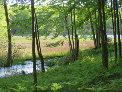
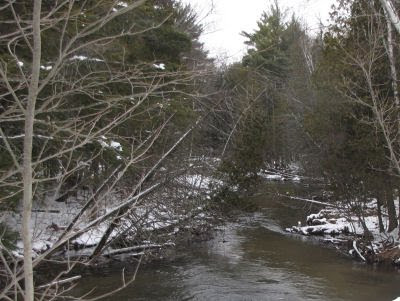
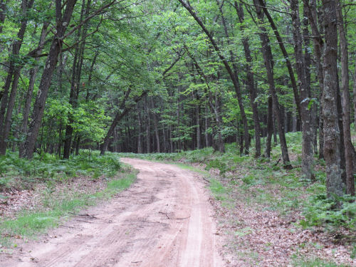
Let's start with the road that leads to the fire tower road. It's called Fox Trail. It's a real road, but is only a snowmobile trail in winter, and it's no joy to drive after a rain. There's no cell service out there at all. As far as I know, there isn't even a cabin in maybe ten square miles.

Fox Trail road

My plan was to park at the intersection, walk up the fire tower road, bushwhack across to the North Country Trail, hike south to Fox Trail and go back to the car. I've done it lots of times. But not lately. See where this is going?

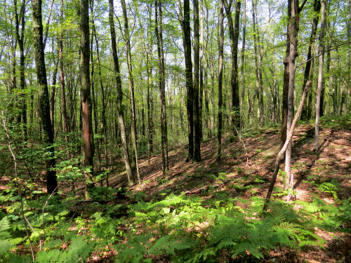
I knew I had to go back down the fire tower road a bit before cutting over to the NCT. What I had apparently forgotten was just how long "a bit" is. So I'm walking and walking through the woods and not finding the trail. Annoying, but not alarming. So after a while I pulled out my cell phone to see if there was enough signal to load Google Maps (the NCT maps require a real signal). My little half bar was just enough to show my blue dot way north approaching Centerline Road. Phooey. I had missed the trail completely.

The afternoon was overcast and it was pretty much impossible to pinpoint the sun to get a direction. But I turned around and headed back south, not wanting to walk out to Centerline and around by roads. That was a longer walk than I was interested in. I had things to do. And I knew there was a motorcycle trail that cut across the NCT somewhere. What I didn't have was any kind of mental picture of that motor trail map in my head. So now, I'll show you my "after the fact" map. You can click it to make it bigger.


The roads are white. The NCT is light blue. Solid red is the Big O Motorcycle Trail. FT is the fire tower. The dark blue dots are what I think I did. I left my car at the bottom of the fire tower road and walked up, came back down too short a way and ended up heading north instead of east.

I knew for sure where the motor trail crosses Fox Trail(left side of map). What I thought the motor trail did is the red dashed line. If I'd really thought about it, I would have known that was wrong because it doesn't cross the fire tower road. Saying that after the fact is easy. But my plan at that point was to either hit the motor trail or the NCT. Next slide.

Big O Motorcycle Trail

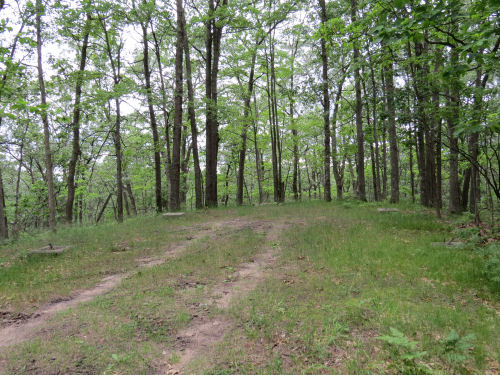
Can you see the motor trail? Half hidden by the tree on the right is a crossroads sign. I was literally six paces from the trail and couldn't see it. Anyway, now I had found the motor trail. I thought I must have somehow crossed the NCT without seeing it at all. I was actually at point 1, but I thought I was at 2 because I had a wrong idea of the motor trail. So I turned right and walked a short way. No NCT.

At this point, I realized how stupid the idea was that I had crossed the NCT and not known it. It's not wide, but it has a clear treadway and I was looking carefully. No cell signal of any kind to check my relative position. No sun. So I turned around and went the other way, but stayed on the Big O. I figured the worst that could happen was I'd come out to Fox Trail. That's when it hit me, that I knew Big O didn't cross the fire tower road, and I had pretty much no idea what the motor trail did other than cross Fox Trail and the NCT somewhere. I'd now been wandering around for about an hour, probably over half of that time since leaving the fire tower site.

Checked my cell, and had one bar. Good- I could get my position. Not good- to get a signal I had to be well away from where I wanted to be. Yup. I was clear up at point 3. You do understand that neither of those trails was on the map on my phone. That would have made it too easy. I layered those maps up for my own enlightenment after I got home. Turn around again.

Walked past where I had found Big O. Walked past where I had turned around the first time. Not 100 yards farther, guess what. Found the North Country Trail.

Big O and North Country Trails

What? You don't see it? It's right there in the mid foreground, crossing Big O. Let me help you. Here's a view to the right down the NCT.

Big O and North Country Trails

But I turned left. I just couldn't picture what Big O was doing, and although the red line looks like there are gentle curves, this is a motorcycle trail. It curves and twists and moguls all over the place. I was still semi-convinced I had previously crossed the NCT by accident.

Well, it only took me about 100 feet of walking to realize I was going the wrong way yet again. The trail joined a two-track and I knew for sure that was way north of where I wanted to be. Turned around again.

The trail quickly became familiar and I soon passed the spot where I should have found it on the original bushwhack from the fire tower. I know exactly what that place looks like. Now that I knew for sure where I was, all that was left was for me to be good and mad at myself for making such dumb errors. Oh, and to walk back to the car.

Found some cute little fingers of fungus like Mickey Mouse gloved hands waving at me. Or thumbing their noses.

white finger fungus

When I got back to Fox Trail, I could actually see my car, not a half mile back to the west. Was I ever really worried? Not really. It stays light till 10 pm at this time of year, and any direction of walking was going to take me to a road. Once I found the motor trail, I was golden. Just follow it and I'd come out somewhere. If I'd gone way east it would have been a longer walk, but do-able. Actual time of the whole adventure- a couple minutes shy of two hours, so I don't think I could have possibly walked more than 6 miles. I certainly wasn't going 3mph when I wasn't on any trail at all, and I fooled around up at the tower site for a few minutes.

Anyway, I now have the Big O Trail firmly overlaid with my mental picture of the NCT. Permanently, I hope.

You want to hear the final joke? This is the same place I did the similar stupid stunt before, only I was on the south side of Fox Trail that time.


See Maggie Says "Pay Attention in the Woods"
if you like this blog, click the +1   or

Like This!


Monday, June 26, 2017

Ward Hills Fire Tower Again

 
Today I had several adventures. I'll tell you about the one I planned. Maybe you'll hear about the others later. (Maybe not!)

I had to go to Irons to interview someone for my newspaper column. On the way home, about the closest place to take a little hike was to go up to the old Ward Hills fire tower. You can still drive up there, but it makes a nice walk if you don't.

Here are the footings for the tower. It's easy to see three of them, but the fourth one is there. People now drive right up there and camp.

Ward Hills fire tower site

It looks like the last time I blogged about it was in 2010, so it's time you saw it again!

You would need a tower to get a view there any more. Although the site is a hill that drops away steeply on three sides (you can pretty much tell that in the above picture) and more gently on the road side, the trees have grown up all around. Here's the only bit of a view you have to the west now. You can just see some blue hills in the distance.

Ward Hills view

Actually, the most interesting thing is the foundation of the old tower keeper's house. I sure thought I had blogged about that before, but I can't find it, so you do get something new. It was small, but I always stand there and imagine what the house would have been like. I think it would have been a perfect place to live.

Ward Hills fire tower keeper's house foundation

The other interesting feature is the benchmark from the 1980 Geodetic Survey.

Ward Hills benchmark

The temperatures were cool today, only in the high 50's. Hey, I like it. You'll get no complaints from me. I had a nice interview, an interesting walk, and learned several new things (the other adventures you may hear about). I wrote this month's newspaper column. I feel refreshed to face another work week.

See Walking at Ward Hills
if you like this blog, click the +1   or

Like This!


Thursday, January 5, 2012

A Ward Hills Mystery Solved

 
former Ward Hills ski area

This is a picture I took yesterday. See those two clear streaks coming down the front of the facing hill? The one on the left is NOT a continuation of the road. The road jogs left to go through a valley and not over the hill.

Those open cuts are two of the ski runs at the former Ward Hills Ski Area. The only mystery is that I wasn't positive this was the correct location until last night when I found a web site dedicated to a lot of local history (most specifically Big Bass Lake, which I haven't mentioned very much). The web page is More on the Ward Hills Ski Area. The post is a little confusing because it also talks about Big M, which is not in the same place at all.

I've done several posts on Big M, and one other on Ward Hills. Here's a really long shot of the same hill as above taken in February 2011.

Ward Hills

Ward Hills was always a small, family-friendly ski area. It only had a couple of rope tows. I remember the school took a bus load of kids every week in the winter with discounted prices. Our oldest (Sam- the one we don't hear from much) usually went. His only complaint was that the rope tow really chewed up gloves.

Serious skiers considered it a bit boring because the runs were short and straight, even if fairly steep.

But when it closed (in the early 1980s?) it was a real loss for people who are on low budgets because now the closest place for downhill skiing is Crystal Mountain, which is also lots more expensive.

There seems to be some sort of public lodge operating at the old Ward Hills site, but they haven't updated their Facebook page in over a year. Wouldn't it be great if they hosted an occasional ski event? Probably too many insurance issues for it to ever happen.

See Sauble
See SPW Ski Outing at Big M
See Snow Fun at Big M
if you like this blog, click the +1  

Sunday, October 23, 2011

Maggie Says- "Pay Attention in the Woods"


Maggie here. I am going to tell you what happened today because I know that Mom doesn't want to admit any of it. First of all, I want you to notice that I am wearing my orange jacket for safety in the fall. There are still a few colorful leaves on the trees, and when the sun comes out, which it did today, they are still pretty.

dog in autumn woods

Well, we drove to a place where we hike sometimes. We walk an old woods road over to the North Country Trail, follow it for a while, and then cut back to the real road and go back to the car. Just so that you understand what I mean, that's the real road that I'm standing in. Old woods roads haven't been driven in years.

But when we got there, Mom changed her mind. She decided to take a different road over to the NCT. Then she saw an even older road going off in the other direction, and decided to see where it went. So we did. But she promptly forgot that she'd turned off the first real road (Fox Trail) to the left.

The sun was out, so it was easy to tell that we were going north. That was fine. The sun made every patch of moss glow. I can't tell if the moss looks like green caterpillars, or if the caterpillars look like moss. Can you?

moss on stump

The farther we went, the dimmer and dimmer that old road got, until it finally petered out. Mom considered whether to turn around, or just keep going. She knew that Oak Road was to the north. She thought the NCT was to the east, and Fox Trail to the west. So she decided to keep going. How lost could we get? Humans call this bushwhacking. I just call it walking.

We continued north and came to a little pond that we've never seen before. It was pretty, but the water didn't taste so good. I tried it.

reflection in a pond


At the pond we joined another old road that headed northeast. Pretty soon we came to Oak Road. Just like Mom thought. But... she forgot that she had started by going west off Fox Trail, so she thought we needed to go west to get back to the car. Nope. So we walked all the way out to the paved road. I think she was trying to figure out if we'd gotten into a time warp and Fox Trail had disappeared.

It's funny how things look all wrong when you are expecting other things. She had forgotten that motorsports trails cross Oak Road in two places. She had never noticed two really big rocks beside the road. When we got to the pavement, we had to turn around and walk right back. Where the heck was Fox Trail? These are roads that she drives all the time. I just stuck out my tongue and laughed at her, but she didn't notice.

So we walked back past where we had come out on Oak Road, and sure enough, Fox Trail hadn't moved. When we were almost back at the car we passed the corner where we had first left Fox Trail. Mom just shook her head, and I could tell she finally realized what she had done.

I know she won't want me to tell this story, because her friends think she ALWAYS knows where she is in the woods. Maybe she pays attention better when someone is counting on her.

Anyway, we had a great walk and found a few bright leaves yet. It wasn't really that big of a deal. We walked about 5.5 miles.


maple leaves


if you like this blog, click the +1  

Thursday, February 24, 2011

Sauble


Today, I went out to do a couple of assignments with my job as a Field Data Collector. The road I drove was one that I've traveled many, many times in the past. But I'm trying to pay more attention to even familiar places. While double checking the topo maps, just to be sure that I knew what I was talking about, I learned that there used to be tiny settlement called Sauble. Actually, that is great info, because it gave me a way to tie these two pictures together, other than the fact that they are taken from the same road, Hamilton Road.
Ward Hills

This view is looking south. The hills in the distance are called Ward Hills. That might sound vaguely familiar, because it's a place that I like to hike. The hills are only a little bump, as hills go, but there used to be a small, family-friendly ski area there with just a rope tow. It's long gone. I never went there, and really don't even know exactly where it was.

At the bottom of the valley between me and Ward Hills, is the Big Sauble (usually spelled Big Sable) River, and the corner that is all that's left of the hamlet of Sauble.

Big Sable River

Here's the Big Sable River approaching Hamilton Road from the east. Farther east, the North Country Trail crosses it on the Vince Smith Bridge.

Big Sable River

And here's the Big Sable River heading west toward Lake Michigan. The Big Sable doesn't get as much press as most of our other rivers, because it's not really navigable, even by canoe or kayak.

Where it reaches Lake Michigan (20 miles away in a straight line), at Ludington State Park, it is dammed to form Hamlin Lake, and then reaches the big Lake in a wide, shallow swath that is one of the premier locations to watch migrating waterfowl in West Michigan. You can see Hamlin Lake behind us at A Day for Friends, or in On Lost Lake, a part of Hamlin Lake

This was fun for me... to try to explain to you how a little piece of what I saw fits into the local landscape. I hope you enjoyed it too.


See Walking at Ward Hills