When I realized I'd be hiking the NCT half of the Manistee River Loop on a Saturday, I very nearly went home instead of hiking. It is hugely busy, and I just don't like seeing that many people on the trail.
But, it's still an hour drive from home, so I decided I should just do it.
The section begins with over a mile of trail on the former bed of the Manistee and Northeastern RR. This ran from Manistee to Traverse City, and was primarily a logging line. It's not too pretty at this time of year, but nothing is.
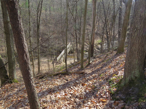
Right after that, the trail drops down to Eddington Creek, the one water source on this section. I've shown you a lot of pictures of this bridge, but here you go again.
Now we come to the first real tale. As I was descending to the bridge, I saw three guys just breaking camp down in the valley by the creek. You really aren't supposed to camp that close to the water, but the Forest Service puts up with a lot of misuse on this section. That's a topic for another time perhaps, but it's not the point of this story. Anyway, I waved to them, and they waved back.
I crossed the bridge and started climbing up the other side. They were just following the creek back to the bridge, and began climbing up the way I had just come down.
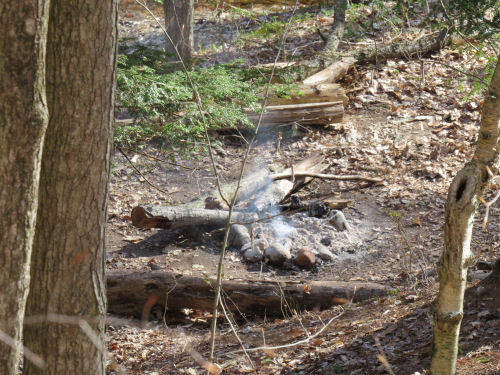
I reached the point above their campsite, and... they had not put out their fire! It wasn't blazing, but there had been no attempt to stir or wet the coals. Dang. With water right there. *shaking head*
I would have to do a really steep scramble to get down there, but I decided I had to do it. I rummaged in my pack for an extra plastic bag to scoop water and found a quart size. I slithered down to the campsite. Just then the guys appeared on the trail high above me on the other side of the creek. They were trying to figure out why I had gone to their site.
"You didn't put your fire out," I yelled.
"Is that a problem?" one of them asked.
"Yes."
"Should we come down and do something?"
"I'll put it out," I answered. I probably should have gotten really irate and chewed them out and told them to get their butts back down there. But perhaps they got the message anyway.
Please, folks! Leave NO trace is best, but at least try not to burn down the forest. It took four quarts (a gallon) of water and stirring the coals to put it out.
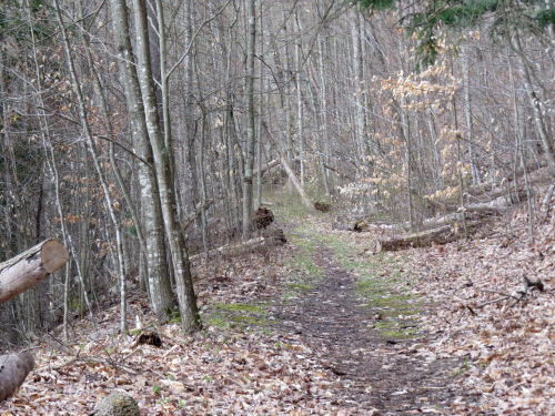
Today's miles are the hilliest anywhere within the Spirit of the Woods' section. But the grades are super-nicely laid out. I'm here to tell you this was done with a clinometer (a tool that measures slope). No one could do such a good job without one, well, or surveying equipment, but that seems unlikely. So, in this picture, you can see that it's hilly, and that the trail curves off around the right side of the picture.
Now look closely at the face of the hill straight ahead. You can see a faint green line rising from right to left across the hill. That is moss on the benched edge of the trail. It's an almost perfect straight line. You can really see these grades after the first snowfall. I need to come back here and get some pictures at that time of year.
This was built long before we were a chapter by Forest Service staff. They did a super job.
A lot of people don't like this side of the loop as much as the other side because you can't really see the river down in the valley and because it's so hilly. However, you have nice views of the valley through the trees. You can tell things are finally starting to green up. I love how you can just march along, up and down, because the grades are so carefully laid out... it's like cruising on autopilot.
I crossed paths with 24 male hikers and 6 female hikers, all young. There were two men riding mountain bikes (yes this section is open for their use), and one dog (leashed). This is way more traffic than I want to meet up with in 8 miles of trail. And there were many, many more users that I didn't meet. On the way back to the trailer, I went past the main trailheads for the loop and they were packed with cars. People were milling about. This is on a spring weekend that is supposed to have heavy rain tomorrow. OK, I said I would not get started about overuse on this section.
This hiker count does not include my final hiker encounter of the day. This is almost beyond bizarre.
I was coming down the access spur to get to my car, and I had just reached the kiosk when I realized there was someone behind me. I turned and there was a young man just a few steps behind me.
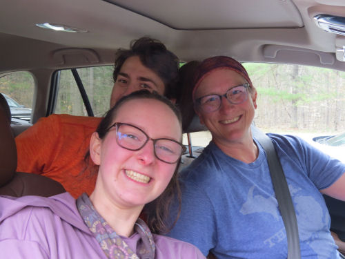
But behind him was Keira! And behind her was Monica! You remember, Monica is a fairly new friend, and the two of them hiked with me a few days in Michigan, and then backpacked the Kek with me.
The young man is Keira's brother, David. They were just completing the entire loop and were also returning to their car. We chatted, and I almost forgot to take a picture. I didn't want to ask them to get out of the car.
I scooted back north to get Sunny and say goodbye to my last hosts for this block of hiking weeks. Jim and Denise are the humans, and Dani is the dog (a Swiss Shepherd). They spotted me for two days, which was really nice of them because they are super busy people.
Now I'm home! I arrived in the pouring rain so only unloaded the things I really need tonight. I made an omelette for dinner, but I'm looking forward to getting the fixings for my usual dinner salads tomorrow. I may let myself goof off for one day, but then I have a ton of things to do. (including hiking about 45 miles of trail in my chapter area, and hiking even more to stay in shape for the real hills we will be on in the UP)
Miles today: 8.8 on NCT, plus 0.3 on the spur to my car. Total miles so far: 4657.1 with about 160 yet to hike.
 | See Sunshine |


No comments:
Post a Comment