On Wednesday and Thursday of this week I tested the possibility of doing a two-day, approximately 20-mile backpacking loop in Ottawa County, Michigan. The popularity of loops of this length is high, and the trails where they are possible experience a great deal of hiking stress from overuse.
The bottom line of my experience on this hike is that it is a fairly easy, but highly enjoyable hike. It does require more advance planning than some other loops, and you must camp at P.J. Hoffmaster State Park, which is not going to be a backcountry or private experience. However, all the campsites are wooded, and are wide enough that you are not jammed in as tight as in some state parks.
There are three public properties which are aligned south to north from Ferrysburg to just south of Muskegon. Additional property along the Grand River, to the south of these, has recently become public, but the trails are not yet established there. I heard informally, that there may be camping added, which might make a loop with camping at both ends possible. For now, to make this work, you must park at Coast Guard Park, hike north to Hoffmaster, and return south the next day.

Let me also say that I chose trail segments to make this hike as long as possible to make it two days. You could easily choose trails and eliminate the most southern property (Ottawa Sands) that would shorten the loop to about 14 miles, or even less, which could make a nice day hike loop.
My overall goal was to maximize the mileage and minimize the number of segments I had to do twice.
In general the trails are well-marked and well-maintained. I expected a lot of open, hot, ferny, sunny areas which aren't a lot of fun to hike in the summer. Instead, except Ottawa Sands, and a bit on the very eastern edge, the trails were wooded and shady. Because many of the loops are ski trails the junctions are marked and numbered. Very few of the distances between numbered junctions exceed a half mile, so you always feel as if you are getting somewhere. The next "milepost" is not far away. There were some unofficial trails, but generally there were 4x4" reassurance posts on the correct pathway. I think I only had to absolutely guess once, and choosing the most-traveled path was correct. The difference between rolling and hilly is subjective, more or less based on elevation change and steepness. Even hilly sections aren't really difficult.
Dogs are allowed in all three segments on leash (10 ft in Ottawa Sands, 6 ft elsewhere), except no dogs within 100 feet of designated swimming areas, which can be an issue at a couple of places on the loop I chose.
I parked at the Ferrysburg Coast Guard Park. This is day use only unless you have permission. If your car is there after 10pm without prior approval it will be towed. To get permission, you need to first be able to show that you have a reservation at Hoffmaster SP, and then contact the Ferrysburg city manager at 616-842-5803. I could only get them to say they will evaluate each request on a case by case basis, so I can offer no hints on how to assure that you'll be approved. He said mine was the third request this year, so they are not yet overwhelmed.
- - - - - - - - - - - - - - Part I. From Coast Guard Park I hiked south to do the loops through the Ottawa Sands property.
Here's a link to the
pdf map of Ottawa Sands. This small version is just to show you my route which is marked in yellow.

From Coast Guard Park parking, head toward the road (North Shore Drive) and find either the natural surface trail that heads west signed as "To North Ottawa Dunes" or the paved multi-use trail beside the road. Go west for about a tenth of a mile, cross North Shore Dr, and enter the parking for Ottawa Sands (day parking and porta potties). No swimming or boating of any kind on the lake. (It is currently free of invasive species and they are trying to keep it that way.)
Here is the route I took.
Point 1-8: 0.56 mi, sand treadway, mostly level with one small hump. This is in open sun along the edge of the small lake.
Point 8-7: 0.4 mi, sand treadway, level, sunny along lake.

Point 7-6: 0.18 mi, sand road, level through grasses, sunny. Here I saw two sandhill cranes. They kept their eyes on me, but did not fly in alarm.

Point 6-11: 0.36 mi, grassy/sandy, rolling. Approach Grand River and see industries on the far side. Freighters sometimes visible, but not when I was there.

Point 11-4: 0.26 mi, turn away from shore on gravel road, level, partial shade.
Point 4-3: 0.23 mi, gravel road, rolling, shade.
Point 3-9: 0.12 mi, wooded, level, shade.
Point 9-2: 0.15 mi, sandy, rolling, sun along lake shore
Point 2-1: 0.06 mi, gravel road, level, sun.
As I completed this southern loop, I chose to return to my car at Coast Guard Park to top off my water bottles and use the facilities. However, the multi-use path is nearly parallel with the Ottawa Dunes trail which goes from the parking to point 1, and you can easily just bump over to that trail without going back to the parking. However, there is no potable water until you get to Hoffmaster park, and nowhere to even filter any for the next 3 miles, when you would need to go off route to access Lake Michigan. I preferred to just make sure I was carrying enough.
So, adding these together and the return to Coast Guard Park, my mileage to this point was 3.05 miles.
- - - - - - - - - - - - - - Part II. Heading north along the west edge of Ottawa Dunes.
Here's a link to the
pdf of the North Ottawa Dunes map. This small version is just to show you my route which is marked in yellow.

From Coast Guard Park parking, head toward the road (North Shore Drive) and find the natural surface trail that heads west signed as "To North Ottawa Dunes."
Parking to Point 1: 0.3 mi, rolling, sandy/forest, mostly shade.
Point 1-2: 0.2 mi, rolling, forest, shade. (At Point 2, you can turn left and access the Ottawa County North Park Beach, but this is a dead end on natural surface, or a loop with the paved trail. Also accessible by car. Parking fee.)
Point 2-3: 0.49 mi, hilly, forest, shade.
Point 3-4: 0.35 mi, hilly, forest, shade.
Point 4-18: 0.07 mi, hilly, forest, shade.
Point 18-17 west fork: 0.34 mi, hilly, forest, shade.

Point 17-12: 0.18 mi, rolling, forest, shade. No skiing allowed on this segment so it is narrower and appealing for hiking.
Point 12-10: 0.51 mi, hilly, forest, shade. No skiing allowed on this segment so it is narrower and appealing for hiking.
Point 10-11 west fork: 0.21, hilly, forest, shade. (At this point, there is a trail west which leads you to the Lake Michigan Beach. Come to a T at the top of the hill and turn R. There are a number of unmarked junctions. Pay attention to which turns you make to get you back to Point 11 You will have to scramble down to the shore and climb back up, but it's not too difficult. This side trip is about 0.3 mi. each way.)
At Point 11, your next junction will be within P.J. Hoffmaster State Park.

My total mileage to this point: 5.7 miles. (Plus the 0.6 to the lake and back, but that's not part of the loop.)
- - - - - - - - - - - - - - Part III. Heading north along the west edge of Hoffmaster State Park.
Here's a link to the
pdf of the P.J. Hoffmaster trail map, which is NOT accurate. Here is a composite map from the new trail signs which is correct and shows the junction numbers. You should be able to click it and then copy, to see full size.

This version is just to show you my route which is marked in yellow.

Point 11 (Dunes)- 5 (Hoffmaster): 0.12 mi, rolling, forest, shade.
Point 5-6: 0.3 mi, rolling, forest, shade. At point 6 it's a little confusing. The popular Homestead Trail goes from here to the beach. I did not follow this. To head toward Point 11, go slightly downhill past a resin bench and turn right.
Point 6-11: 0.4 mi, hilly, forest, shade.
Point 11-10: 0.31 mi, hilly, forest, shade. This empties onto the east end of the Visitor Center parking lot. Either now, or on the return hike, you should visit the center. There are very nice displays about the history and ecology of the area. Toilets, water, vending machines.
Point 10-15: 0.1 mi, mostly level, paved, road.
Point 15-16: 0.38 mi, hilly, forest, shade. Come to road. Go 200 feet left on road then turn left into woods again. The camping tent symbol which is shown on the map at point 16 is for the large group campsite, across the road. This is not open to individual hikers.
Point 16-17: 0.25 mi, hilly, forest. shade.
Point 17-18: 0.2 mi, paved road, rolling.
Point 18-19 Walk-a-Mile Trail: 0.7 mi, hilly, stairs, forest, shade.

Point 19-20 Walk-a-Mile Trail: 0.5 mi, hilly, forest, shade.
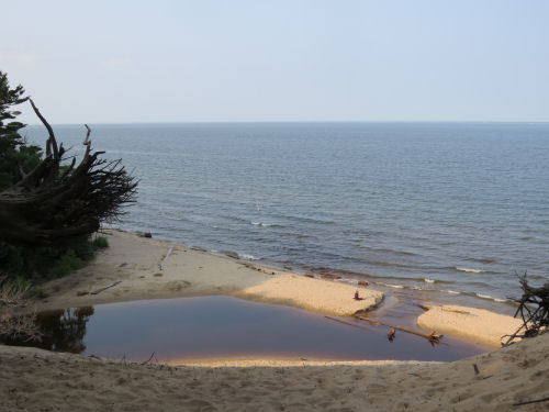
Point 20-29: 0.62 mi, Lake Michigan beach, level (with the angle into the water), sunny. Even with this year's high water, this was walkable, but you WILL get wet feet. There are banks and trees you will need to wade around. One foot waves, and I only got splashed to my knees. Pass a lifeguard station. You can scramble up here or go to the north swimming area, at the mouth of Black Creek. Just south of the creek, scramble up a well-used pathway through loose sand and reach Point 29 at a bridge.

Point 29-30: 0.2 mi, loose sand, level, part shade. Do not take the bridge, but follow along the south side of Black Creek and then the most used path which becomes a road and the west end of the camping loops.
Point 30-22: 0.1 mi, paved campground loop.


There are 297 campsites at P.J. Hoffmaster State Park, and they are almost all full all the time. You will need to have pre-registered, as I mentioned. Then walk to the campground office where they will check you in and issue a tag to put on your tent, while being amazed that you do not have a vehicle.
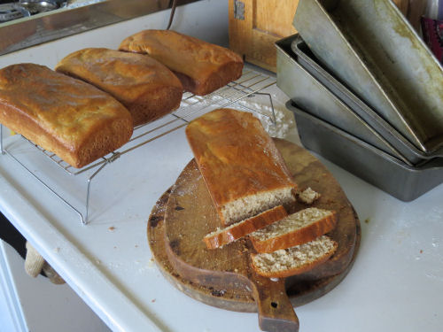
But you can see from my second picture that the sites are roomy, and I was lucky enough to get one that backed onto the creek. This is site 18 and it's right beside map Point 22. It apparently isn't popular with the RV crowd because of low-hanging trees. I liked it. There were kids playing in the creek till quiet hours. Sure, they were noisy, but it was great to see kids splashing, getting wet, riding bikes, running, swimming, and NOT playing with electronics.
Showers, toilets, water, vending. Camp hosts have books to borrow!
Total mileage for Day one: 9.88 miles.
- - - - - - - - - - - - - - Part IV. Heading south through Hoffmaster State Park.
My return route marked in yellow.

Unless you just follow the park road back to the Visitors Center, you must duplicate the beach walk. On a pleasant day, this certainly isn't a drawback. On a stormy day, you might want to do the road.
Point 22-23: 0.22 mi, cross bridge at 22, turn west and follow creek, forest, shade.
Point 23-25: 0.25 mi, level, grassy, sun.
Point 25-24: 0.3 mi, join old road leading to beach, hilly, shade.
Point 24-27: 0.1 mi, road peters out and just walk through loose sand to top of bluff over lake, shade.
Point 27-28: 0.1 mi, scramble down steep bluff to Lake Michigan beach on north side of Black Creek, sun.
Point 28-20: 0.7 mi, wade Black Creek (not even knee deep on me), continue south along Lake Michigan beach. Level, sun. Even with this year's high water, this was walkable, but you WILL get wet feet. There are banks and trees you will need to wade around. Two foot waves, and I got splashed to my crotch (I'm short).
Point 20-21: (map says more, but I say) 0.25 mi, level, Lake Michigan beach, sun. Continue past another swimming area.

Point 21-8: 0.54 mi. level, Lake Michigan beach, sun. Watch for broken bluff with loose sand trail leading up beach. There is a junction sign.
Point 8-9: 0.37 mi. hilly, stairs, boardwalk, shade. There is a scenic turnout on resin boardwalk to the left with interpretive signs, and stairs to overlook Mt. Baldy, the largest blowout in the park, to the right. Reach the Visitor Center. You should visit the center. There are very nice displays about the history and ecology of the area. Toilets, water, vending machines.

Point 9-14: 0.3 mi, rolling, paved road, sun/shade. At the T in the road, go slightly south to Point 14.
Point 14-12: 0.2 mi, rolling, forest, shade. Just before you reach Point 12, there is an unmarked trail going L (east). This leads to a picnic area with pavilion, and porta-potties.
Point 12-2: 0.32 mi, at point 12, take the L, lower fork, rolling, forest, shade.
Point 2-3 east fork: 0.51 mi, hilly, forest, shade.
Point 3-4: 0.05 mi, rolling, forest, shade.
Point 4-5: 0.5 mi, hilly, stairs, forest, shade.
Point 5 (Hoffmaster)-11 (Ottawa Dunes): rolling, forest, shade. This is another short section that must be repeated. It's the only trail connection between the two parks.
Day two mileage to date: 4.27 miles.
- - - - - - - - - - - - - - Part V. Heading south through the east portion of Ottawa Dunes.
My return route marked in yellow.

Point 11-10 east fork: 0.64 mi, hilly, forest, shade.
Point 10-9: 0.06 mi, rolling, forest, shade.

Point 9-8: 0.21 mi, rolling, shade/sun.
Point 8-13: 0.35 mi, rolling, forest, shade.
Point 13-14: 0.39 mi, mixed- hilly, openings, sun, forest, shade.
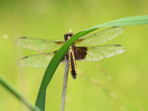
Point 14-15: 0.28 mi, rolling, open, sun. One of the perks of these openings on sunny days is seeing butterflies and dragonflies.

Point 15-5: 0.23 mi, hilly, mixed sun and shade.
Point 5-21: 0.08 mi, level, forest, shade.
Point 21-22: 0.18 mi, rolling, forest, shade.
Point 22-24: 0.36 mi, rolling, mixed sun and shade.
Point 24- east end of Coast Guard Park Rd: about 0.5 mi, rolling forest shade. beginning of section is clearly signed to Coast Guard Park. After that there are many forks. There is a playground and apartment complex to your left, then 3 soccer fields to your right. Continue on most used path until you join a paved multi-use trail and turn R, following this to the parking area with picnic pavilion, playground, tennis and basketball courts, and porta- potties.
East end Coast Guard Park- Trailhead: 0.2 miles, level, paved road. Toilet, water at Trailhead.
Total mileage the second day: 8.1 miles
Total mileage for the loop: 17.98 miles (Plus 0.6 to the lake and another walk around the campground)
You could certainly make this longer by adding loops (which would require some duplication of routes), or shorter by choosing other connections.
I had perfect weather for my trip, and it was a much nicer experience than I anticipated. Try it!