The last time I did something this stupid I had Maggie to tell you the story so I could spare myself the embarrassment. (See link at end). This time, I'll just have to 'fess up.
I had planned on taking a walk of about two miles yesterday. Instead I made it something between five and six.
Let's start with the road that leads to the fire tower road. It's called Fox Trail. It's a real road, but is only a snowmobile trail in winter, and it's no joy to drive after a rain. There's no cell service out there at all. As far as I know, there isn't even a cabin in maybe ten square miles.
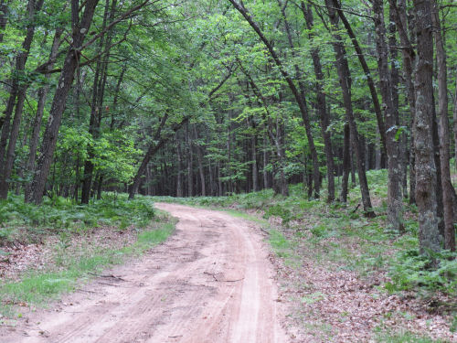
My plan was to park at the intersection, walk up the fire tower road, bushwhack across to the North Country Trail, hike south to Fox Trail and go back to the car. I've done it lots of times. But not lately. See where this is going?
I knew I had to go back down the fire tower road a bit before cutting over to the NCT. What I had apparently forgotten was just how long "a bit" is. So I'm walking and walking through the woods and not finding the trail. Annoying, but not alarming. So after a while I pulled out my cell phone to see if there was enough signal to load Google Maps (the NCT maps require a real signal). My little half bar was just enough to show my blue dot way north approaching Centerline Road. Phooey. I had missed the trail completely.
The afternoon was overcast and it was pretty much impossible to pinpoint the sun to get a direction. But I turned around and headed back south, not wanting to walk out to Centerline and around by roads. That was a longer walk than I was interested in. I had things to do. And I knew there was a motorcycle trail that cut across the NCT somewhere. What I didn't have was any kind of mental picture of that motor trail map in my head. So now, I'll show you my "after the fact" map. You can click it to make it bigger.

The roads are white. The NCT is light blue. Solid red is the Big O Motorcycle Trail. FT is the fire tower. The dark blue dots are what I think I did. I left my car at the bottom of the fire tower road and walked up, came back down too short a way and ended up heading north instead of east.
I knew for sure where the motor trail crosses Fox Trail(left side of map). What I thought the motor trail did is the red dashed line. If I'd really thought about it, I would have known that was wrong because it doesn't cross the fire tower road. Saying that after the fact is easy. But my plan at that point was to either hit the motor trail or the NCT. Next slide.

Can you see the motor trail? Half hidden by the tree on the right is a crossroads sign. I was literally six paces from the trail and couldn't see it. Anyway, now I had found the motor trail. I thought I must have somehow crossed the NCT without seeing it at all. I was actually at point 1, but I thought I was at 2 because I had a wrong idea of the motor trail. So I turned right and walked a short way. No NCT.
At this point, I realized how stupid the idea was that I had crossed the NCT and not known it. It's not wide, but it has a clear treadway and I was looking carefully. No cell signal of any kind to check my relative position. No sun. So I turned around and went the other way, but stayed on the Big O. I figured the worst that could happen was I'd come out to Fox Trail. That's when it hit me, that I knew Big O didn't cross the fire tower road, and I had pretty much no idea what the motor trail did other than cross Fox Trail and the NCT somewhere. I'd now been wandering around for about an hour, probably over half of that time since leaving the fire tower site.
Checked my cell, and had one bar. Good- I could get my position. Not good- to get a signal I had to be well away from where I wanted to be. Yup. I was clear up at point 3. You do understand that neither of those trails was on the map on my phone. That would have made it too easy. I layered those maps up for my own enlightenment after I got home. Turn around again.
Walked past where I had found Big O. Walked past where I had turned around the first time. Not 100 yards farther, guess what. Found the North Country Trail.

What? You don't see it? It's right there in the mid foreground, crossing Big O. Let me help you. Here's a view to the right down the NCT.

But I turned left. I just couldn't picture what Big O was doing, and although the red line looks like there are gentle curves, this is a motorcycle trail. It curves and twists and moguls all over the place. I was still semi-convinced I had previously crossed the NCT by accident.
Well, it only took me about 100 feet of walking to realize I was going the wrong way yet again. The trail joined a two-track and I knew for sure that was way north of where I wanted to be. Turned around again.
The trail quickly became familiar and I soon passed the spot where I should have found it on the original bushwhack from the fire tower. I know exactly what that place looks like. Now that I knew for sure where I was, all that was left was for me to be good and mad at myself for making such dumb errors. Oh, and to walk back to the car.
Found some cute little fingers of fungus like Mickey Mouse gloved hands waving at me. Or thumbing their noses.

When I got back to Fox Trail, I could actually see my car, not a half mile back to the west. Was I ever really worried? Not really. It stays light till 10 pm at this time of year, and any direction of walking was going to take me to a road. Once I found the motor trail, I was golden. Just follow it and I'd come out somewhere. If I'd gone way east it would have been a longer walk, but do-able. Actual time of the whole adventure- a couple minutes shy of two hours, so I don't think I could have possibly walked more than 6 miles. I certainly wasn't going 3mph when I wasn't on any trail at all, and I fooled around up at the tower site for a few minutes.
Anyway, I now have the Big O Trail firmly overlaid with my mental picture of the NCT. Permanently, I hope.
You want to hear the final joke? This is the same place I did the similar stupid stunt before, only I was on the south side of Fox Trail that time.
 | See Maggie Says "Pay Attention in the Woods" |
| if you like this blog, click the +1
| |


