Entries to Win Afghan

Sign up to receive the Books Leaving Footprints Newsletter. Comes out occasionally. No spam. No list swapping. Just email me! jhyshark@gmail.com Previous gifts include a short story, a poem, and coupons. Add your name, and don't miss out!
Showing posts with label exploring. Show all posts

Wednesday, July 27, 2011

Today's Good Views


Today I had a list of work assignments. I saw a number of back roads, REALLY back roads, that I'd never seen before. Took one wrong unmarked two-track, but didn't know it was the wrong one till I got back to a real road and was not where I wanted to be. Saw two lakes that I never previously knew existed-- one is totally private, so I'll probably never see it again. Both were hardly more than ponds... no great pictures there.

It was such a mixed bag, I'll just share my two favorite captures of the day. The very best would have been two sandhill cranes in my own field. But I didn't have the camera with me because it was raining, so I had left it in the house while walking Maggie. Hopefully the cranes will visit again. I also saw another red-headed woodpecker, a red-tailed hawk swooping low, and a turkey with a brood of chicks, but couldn't get pictures of those, either.

So, you will have to settle for things that move more slowly. First is the one Marquette Rail engine that they have painted in their yellow and maroon scheme. This is the same line that runs in back of my house, but this picture was taken about 10 miles away.

Marquette Rail engine 2004

The second picture is an unexpected view. We have some little hills, but not very many places where you can actually get a view. I've showed you a few, and today I found another. It was a complete surprise to me. I'd never been on this road before. It has the unimaginative name of State Road, and it's just a wide sand road that goes along a power line. But not in a straight line, and it is quite hilly. I was really surprised to come to the top of one, and to be able to see this view to the west.

wooded hills view

That's the scoop for today. They can't all produce spectacular images.


Thursday, March 31, 2011

Cooper Creek


Ellen had to go out of town, so already our weekly hike plan has a kink. But today was wonderful, with a temperature in the high 40s, and sunshine! Tomorrow it's supposed to rain, so I HAD to go out today. I decided to do some more exploring for the Adventure Loop I'm researching. I knew that it is easy to hike NE from Cooper Creek out to Forest Trail Road, but I wasn't sure how easy the route was to follow in the other direction. So I decided to do that. I drove out to the corner in the picture at Exporing Like a 10-Year-Old. Then I began hiking down the road.

After about a mile I came to a dead-end turnaround. Uh-oh! I indicated what the road does with the yellow line. I didn't remember this!

turnaround at end of forest road

Don't worry, it wasn't a serious problem. The real problem was that it was so long ago that I hiked through from the other direction that I couldn't remember quite how I got out to this road from the creek. I poked around a little bit off the end of the road. Here's a lesson... I noted a large red oak tree to keep my eye on as I left the end of the road. It was amazing to me how instantaneously that oak disappeared in a screen of saplings. I was paying attention, though, and had also noted that I could see a line of snow at the edge of the road berm. It turned out that was the feature to keep track of. My point is... anyone who wanders in the woods off trail knows enough to keep track of where you have come from. The lesson is that you can't always count on one particular feature being a good landmark.

Off the end of the road the land quickly fell off into wetlands. I suspected that it was the headwaters of Cooper Creek, but it didn't look familiar. I followed a faint, very old two-track for a ways. It had enough snow that I could follow my own footprints back. But the track and the snow petered out, and the creek still wasn't looking familiar. So I turned back. I had one other idea.

turnoff of forest road

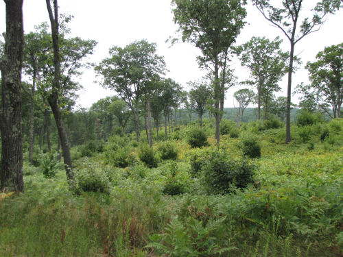
About a quarter-mile back I had noticed this grassy track going off to the right, as I was hiking in. Since this whole walk wasn't overly long, and the road was mostly clear of snow, there was plenty of time and energy for exploring side tracks. I don't want to overdo the pictures, but there were some areas still snow-covered, and some that were completely flooded, forcing us off into the woods to get around the "ponds." But, this is Michigan, and people will take trucks anywhere that isn't fenced off, so all of these places had been driven since our last dump of snow last week.

So we turned down that side track and it immediately headed off to the SW, so that was promising.

Cooper Creek

And, in about a quarter mile, there we were- right where I wanted to be. Maggie is standing on the near bank of Cooper Creek. It looks like the road continues, and it does, but the vehicular bridge is long gone. It might even have been removed on purpose when this all became National Forest. I hadn't been on this side of the creek since 2008. So how does one get across?

Cooper Creek bridge

Well, there is a bridge. It's downstream about 200 feet. The first time I was here in 2008 I didn't even see the bridge. It was August, and I just waded the creek. Actually, I was on my bike, so also had to carry it across.

I discovered the bridge the second time I came to the creek. But the bridge wasn't much use. There was a tree that had fallen on an angle across it, and it no longer quite connected to the north bank. It could be used in a pinch, but was pretty difficult. It was in the same condition last April when I hiked in from the other side again.

As you can see, it's now clear and solidly placed. Can you see the scrapes in the middle? I'm attributing the work to snowmobilers. I'm sure this would be a popular winter route, since it uses all old roads. The Forest has just clamped down hard on taking motorized vehicles anywhere one pleases, but it will take years to get even reasonable compliance. I'll have to look up whether this is one of the approved routes.

So, to sort of quote Rose... "that's what I did today!"


Friday, April 9, 2010

Rusty Woodsia?

Fragile Fern

Isn't this a cute little thing? The blade of this little fern is only 3-4 inches long. It grows out of the side of the gully that I walk down to access the creek in the cemetery.

I've been trying to figure out what it is for about three years. Here's where I think I went wrong:

The next question in my key is: "is the blade clearly broadest at the base?" What do you think?

While you are pondering this, let's talk about today, before I give you the answer. It was one of those days that I COULD NOT stay inside. The sun was shining, but the air was cool. I've been working on a "secret" project for a couple of years. You can read about it at Exploring Like a 10-Year Old. Today I went back and double checked a piece of it on foot. Walked about 8 miles!

What did you decide about the fern? I kept saying that it was broadest at the base. But that is apparently the wrong answer. After looking more carefully at a LOT of the blades, I guess I can believe in that decision. At any rate it led me to choices that made sense, sort of...

Next I had to decide if it has spores on a separate stalk or on the backs of the pinnae. That wasn't too hard, even though the spores aren't visible at this time of year. If they were on a separate stalk that stalk would probably be seen dried up in the old plant parts.

Next... I'm in trouble, because they want to know the shape of the sori. The sori are the spore cases on the backs of the leaves. Wrong season, and I seem to always be off hiking when this happens, because I've never seen them. So I was reduced to looking at pictures, but I've narrowed down the choices. I settled on one of the Woodsias- the size is right. There are seven choices! OK, there are some differences, but it seems to be Woodsia ilvensis, rusty woodsia.
Fragile Fern

Here's the first problem. The plant is supposed to be a lot more hairy than this. Also, the stipe is supposed to be brown.

For smooth woodsia the stipe is yellow-green and the back of the blade is smooth. That sounds more like what I see here. BUT... smooth woodsia only has 2-4 pinnules per pinna, while rusty woodsia has 3-9. This one is definitely the 3-9 count.

For a definitive answer I'll just have to catch this when the spores show up. Then it will be unmistakable. The plant gets really hairy and rusty brown. But... I usually seem to be off hiking at spore time. Stay tuned... it may only take me a few more years to get this. Meanwhile, I just think it's really cute!

Update Note: April 2011- This fern has been identified, almost certainly, as Fragile Fern, Cystopteris fragilis


See I Need Green Really Bad
See I Could Do This for a Living

Wednesday, November 5, 2008

I Could Do This For a Living!

 
Oh, wait! I am trying to do this for a living. Too bad I can't live on 5 cents a day!


Black Lake- partly in the Manistee National Forest

Today I went to check out the eastern end of this idea of mine. Drove down a dirt "road" to try to reach Black Lake. I think I could have made it all the way, but reached a corner of a loop I wanted to check out... one of the two branches was bound to go all the way through!

So I locked the car and hopped on my bike continuing down one of the forks through really deep sand ruts. But they only lasted a little while, and I kept making choices at Forest Roads (FR) with numbers that didn't match my map, but always working my way east. Pretty soon I got to Benson Road, a real county road (so far so good). Next I wanted to find another FR that headed east again to connect with the North Country Trail. Rode up and down Benson and finally took the only road going in the right direction. It ended at a logging site about 1/2 mile into the woods. And I'd had to walk the bike over a bunch of slash piles.

Let's see... turn around and walk the bike back, then ride around via roads, OR... walk on through the woods to get to Campbell Road. Well, the woods were pretty flat and fairly open. So I bushwhack-walked the bike through to the road! Found the other end of the road that I wanted and rode it back west... it dead ends at a cabin, so I guess that option won't work. Went back to Campbell Road and rode east on a FR till it crossed the NCT. What used to be dense woods here is now a clearcut due to salvage after big winds we had here last year. It's kinda sad, but there are now a couple of nice views. When it stops looking so raw, it might be something of a nice addition to the closed-in woods of most of the trail.

Then I needed to ride back to the car. So I rode back up to County Line and went west till I found FR 8367 and took it south. There were a LOT of junctions, but most of them had carsonite posts with FR numbers, so without much trouble I found Black Lake, and then back to the car.

Just one more out and back, after driving another 1/2 mile to connect to Koenig Road. This is starting to look like a viable route.

And what could be better than exploring on a warm fall day? The old 2-tracks are covered in brown crunchy leaves. I really like riding my bike down the old tracks. Only had to walk in a few places where the sand was too loose. Approximate distance: 14 miles! I am one happy, old, 10-year-old tonight.
See Exploring Like a 10-Year-Old
if you like this blog, click the +1   or

Like This!


Tuesday, November 4, 2008

Exploring Like a 10-Year-Old

 
Click to Mix and Solve
Click the picture and you can work the puzzle.

The day was hard to beat in so many ways! For starters we are having what may be the last really warm days of the season. It made 70 degrees in mid afternoon. And where was I? For once, NOT stuck inside on such a glorious day.

I have this dream of an adventure loop that encircles our county. Pieces of it are already in place and it has occurred to me that if I just figured out some connections that would work for the rest of it that it could be publicized.

So aided by maps and some suggestions from Ramona, my favorite Forest Service person, I headed to the woods with my bike. I wanted to explore a workable route to ride on forest roads in various stages of abandonment. Most of them have no marking.

I parked at a known intersection and followed what looked like a "nothing" path into the woods. It came out where I expected despite being a pathway not on either of the maps I had, and I just kept wiggling my way west on pathways, and I DID connect right up with a known trail system that I was looking for. Sweet!

Then I rode back and went the other way. I wasn't sure that this road went through at all. It got pretty faint, and came to a creek. I explored on the other side, and the road did continue so I carried the bike over and rode on. The road got better the farther I went till it was a nice sand forest road that came out right where I expected.

So I rode back to the car via better roads, moved the car, and continued to ride the "route" on more civilized roads (there is a section in the middle with no National Forest land so it will have to be just a road ride). Made it to US31, turned around and went back to the car.

Total time on the bike- about 3 hours, with more "off road" riding than I usually do. It was really great. What more can I say? I'm doing it again tomorrow on the next section, but there won't be quite so much serious exploring.

I have to say that I've rarely gone in search of forest connections with so few dead ends or curious twists that don't go where I expect them to. I did check out a few dead ends, but all my hopeful connections worked on the first try. Everyone needs a day like this once in a while, eh?

(Did you do the puzzle? Note the three big oaks.)

See Ellen and Joan Sneak in an Adventure
if you like this blog, click the +1   or

Like This!