Entries to Win Afghan

Sign up to receive the Books Leaving Footprints Newsletter. Comes out occasionally. No spam. No list swapping. Just email me! jhyshark@gmail.com Previous gifts include a short story, a poem, and coupons. Add your name, and don't miss out!
Showing posts with label canals. Show all posts

Friday, August 2, 2024

Canalway Trail Again

 This morning I met up with Diane for a little walk on the Canalway Trail near where we were a couple of weeks ago. This piece of the canal system connected Seneca and Cayuga Lakes.
canalway trail


This is a structurally interesting location with the canal and a road and railroad over it, and the trail threading its way underneath the bridges.
train under bridges


Here's an attempt to be artsy- looking down through layers to the water,
study in rectangles


We saw a red admiral- kind of beat up.
red admiral butterfly


I'm always thinking the black willows look like giant bonsai. I guess that's a contradiction in terms.
black willow


I'm back at Irene's tonight, and hope to be home tomorrow by this time. I get to see what her other lilies are. They are Henry's Lily, with very recurved petals.
Henry's Lily


Interestingly, they vary from pale to dark orange, and have these weird bumps on the petals.
Henry's Lily


I'm starting to get generally tired. I think going home will be good.

Miles hiked so far in 2024: 357.6.

See Canalway Trail Part 1
See Irene's Lilies

Tuesday, July 5, 2016

Buckeye Trail- Akron Points 25- 31

 
The last hiking day for this trip, and it was all over too soon. The temperature wasn't as bad as the day before, which was awesome enough, and most of the trail was shaded as well. We did get out early, and with a latrine at the trailhead there was no potty crisis (probably TMI, but these things are critical to hikers!). I finished hiking at 2 pm. The day was defined by the canal, since I was on the towpath trail the entire day.

This is just a study in cool greens at the waterway's edge.

study in green

I met Marie for early lunch at Canal Fulton, which is where we discovered the canal boat ride. We checked on times and made a reservation for the 2:30 run, which was the last regular one of the day. (There was an evening theater ride, "Death on the Canal," by a local author. That would have been fun, but it was more money and later than we wanted to stay.) The interpreter was very good, covering a lot of history in an interesting manner. He also played banjo and harmonica! The city is 102 years old, and had this plaque made for their centennial.

Canal Fulton centennial plaque

Lock 4 is complete with water gates and is in working order. It's where the boat ride turns around, although they no longer put boats through the lock (that was a little disappointing, although I've been through a lock at Grand Rapids, Ohio). With the lockkeeper's house restored, and people nearby, even fishing, it looks much as it would have almost 200 years ago except for the clothing and stroller!

Lock 4

Commentary on the canal would not be complete without showing you one of the mile markers which dot the way.

canal mile marker

Almost quicker than seemed possible I reached the end of the Akron map and the corner we hiked past on the Massillon map two years ago.

end of Buckeye Trail Akron section

Yes, of course, we got celebratory ice cream before taking the canal boat ride.

This completes for me what's known as the Little Loop of the Buckeye Trail, and as I figured out a couple of days ago, I only have 194 miles to finish that trail. (In three widely spaced locations.) But you know I've got the itch.

I have more pictures from this hike to share- plants and animals, and one other tour we took. Tomorrow we'll leave off the blow by blow, and go to some other Ohio topics. These are way more interesting than real life right now, anyway!


See Buckeye Trail- Akron 18-25
if you like this blog, click the +1   or

Like This!


Saturday, July 2, 2016

Buckeye Trail- Akron Points 5-10

 
The next day I was back on the trail. This is a day of not so great news, so I'll tell you the first baddie right now. Marie's leg had started to bother her a couple of days ago, and she'd been icing it at night and really stayed off it on our day off. But she didn't think she should walk a whole day. So she dropped me off at Boston Mills Road and drove around to Lock 29 where she would join me for the rest of the day. Or so we thought.

Although not a wooded scene, I think trail through places like this is very beautiful. The trail wound its way beneath Interstate 271 (with the Ohio Turnpike visible in the distance), then climbed the hill to the left and re-entered woods.

Interstate 271 from towpath trail

I came down off the lovely hill, with a great view over the Turnpike that I posted on Facebook.

woods

The route down to the village of Peninsula was a lot of fun because about half a mile was on an old closed street that had grown over, leaving just the footpath. But look at the treadway. It was a brick road! Very fun, almost magical, to walk through woods on old brick!

brick trail

Just a few blocks and turns and I reached Lock 29 and met Marie at the village of Peninsula. Here's where I made the biggest mistake of the hike. But I'll show you how I made it. No excuses, just the facts. Here's a map of Peninsula and the trail, taken from Google. You can sure see why it's named Peninsula.

map of Peninsula, Ohio
I actually had it in my head to use my phone GPS and make sure that we headed south on the towpath trail, but I also had it in my head that if we went south, as we should, the canal would be on our right and the river on the left as it had been earlier.

What the map text did not say (and sorry Buckeye folks, I'm not crazy about your new maps with the background faded down so much they are pretty hard to read) is that the trail/towpath actually crosses the river at Peninsula. So the canal-right, river-left thing worked for both north and south travel. Who knew?

Then I got caught up in a whole bunch of neat historical displays and stuff. Masons' marks on stones in Lock 29. A feeder canal built to feed Lock 30, wildflowers, baby wood ducks (will show another day), locks with interesting names like Lonesome Lock. Well, I never checked the GPS and suddenly we were looking at the Turnpike soaring ahead. Uh-oh! We'd walked north two miles.

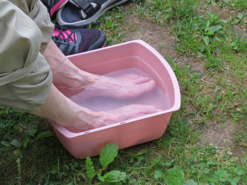
So Marie walked back to Lock 29 with me, and decided her leg was too sore to continue. It was indeed swollen and bright red. So we ate lunch and she drove to where we had stashed the end car and waited for me.

After I went the correct direction, first I crossed the river on the bridge from which I took the picture showing foundations remaining from the aqueduct that used to carry the canal across the river. You can't just dip a canal down a hill to make a crossing.

Here's an historical view of the aqueduct in the background with water pouring into Lock 29.

Lock 29 and aqueduct

The day had been planned to be 10 miles, but I managed to make it 14 for me, even though four of those didn't count.

I passed Johnnycake Lock (where passengers were stranded one winter and had nothing to eat for days but corn pancakes) and Deep Lock, which was an amazing 17-foot lift. The standard for Ohio was 9 feet, and most in New York are 10 feet.

The towpath trail was largely shaded, and I walked fast so I could rejoin Marie. I love the hiking for its own sake, but these trips we make together are as much about the friendship as the walk.

It was a lovely evening in camp, but Marie decided she will just spot me for the final days of the hike, and not walk.

sun on clouds.

Total miles (that count) this trip so far: 93.1

And now, in real-world time, it's Saturday night. I've felt yucky all day and am headed back to bed.


See Buckeye Trail- Akron 1-5
if you like this blog, click the +1   or

Like This!

Sunday, June 26, 2016

Buckeye Trail- Bedford Points 3-10

 
This was our fourth day of hiking, and we did even more miles, 14.6 to be exact. I know this is how some of you feel about long hot walks. You have trouble seeing the recreational appeal.

blaze with evil face

I was excited, though. The very first thing we did was to cross the Cuyahoga River on the historic Station Road Bridge. It was the old road bridge, built in 1881. It's the oldest metal truss bridge remaining in the Cuyahoga Valley. This is wrought iron, which had a brief heyday between wood and steel in bridge-building materials. In 1992, it was disassembled, shipped to Elmira, New York (near my original stomping grounds), refurbished and sent back here to be reassembled. Now it's a trail bridge for hikers and bicyclists.

(I was so excited to get going that I left my camera in the car and had to take pictures all day with my phone!)

Station Road Bridge

Then we began the first of many miles we would walk alongside the Ohio and Erie Canal. This is supposed to be the longest section that is still watered. All the waterways were somewhat muddy because of rain during the night. But it was still a very pretty walk. Oddly enough, here on the top bar of our T we followed it north. Later all the other miles along it will be southward when we do the tail of the T.

Ohio and Erie Canal

This is the Frazee House, built in 1826, the year before the canal opened. It was a private residence, although perhaps it served as a tavern or inn. It was closed to the public when we were there, so I can't tell you more. As I have mentioned, there are many, many buildings from this era in the area, easily identified by the design.

Frazee House

Here's the joke of the day. If the yellow emblem indicates a trail for horseback riders, and the blue one a trail for hikers (in Buckeye Trail blue), does the orange emblem point the correct path for salamanders to take?

trail marker post

Back to the trials of hiking. Not. We were living the cushy life on this trip. Dinner awaited us in the crockpot when we got back to the campsite. Note the jar of tea, only needing ice from the cooler, propane stove, toiletries kit (not backpacking pared down) and a countertop to set it all on. We are livin' the life, I'm telling you.

crockpot

Marie's feet were still bothering her, so she soaked in a tub of ice water. Another luxury not an option when backpacking. Cold streams are the best you can get there.

soaking feet

And for the final ta-da of the day, a hot air balloon sailed over the campsite!

hot air balloon

Well, you know that wherever the logistics fall along the primitive/cushy curve, I'm a happy camper.

blaze with smiley face

The next day, we took a break because the temperature was predicted to soar, and it did. I blogged on that day from the library. See Four Days Into Hike

So tomorrow I'll tell you about hiking day five. Miles covered so far- 48.9

See Medina 23- Bedford 3
if you like this blog, click the +1   or

Like This!