Entries to Win Afghan

Sign up to receive the Books Leaving Footprints Newsletter. Comes out occasionally. No spam. No list swapping. Just email me! jhyshark@gmail.com Previous gifts include a short story, a poem, and coupons. Add your name, and don't miss out!
Showing posts with label maps. Show all posts

Friday, May 23, 2025

Letting You In on the Plan


Three years ago to the day (I did not plan this, and was pleasantly surprised to discover the matching dates), here I was, poised to step into...

backpacker


Did you remember? ...the Adirondack Park. I knew the NCT maps were inadequate. I mostly found my way, but lost the trail several times, bushwhacked, backtracked, did whatever I had to to get through.

There are currently 174 miles of North Country Trail in the Adirondack Park. Here's a long shot of the area. The medium green is the 6-million acre park.


Ever since this hike, Matt Rowbotham (NCTA GIS Specialist, eg. he does the maps) and I have been trying to cook up a way to get me back there to get good tracks of the trails without my needing to pay for everything on my own.

Last year, that was a no-go. This year, I applied for and got a NCTA Field Grant. It will cover some of the expenses.

Why? Now that Mary Coffin unexpectedly died last fall, it's pretty certain that there is no one who knows the current Adirondack Route as well as I do. I could wait until the organization has enough money to fully pay for this project. But the older I get, the less likely it is that I would be able to be the one to hike all these miles again. Insert ego. I, I, want to be the one who does this.

More why? People are getting increasingly interested in the Adirondack portion of the trail, but the maps are so inaccurate they are possibly dangerous. There are no accurate GPS tracks of hardly anything. We need to fix that.

Who? Bill and I will be doing this together.

friends

What? We will be hiking and mapping 89 miles of off-road trail. Some of this will eventually change, but hey, the NCT changes all the time. Meanwhile, people need accurate maps. Part of what we are going to do will need to be backpacked because there is no road access. We are also going to do structure inventory (bridges, puncheon, etc)

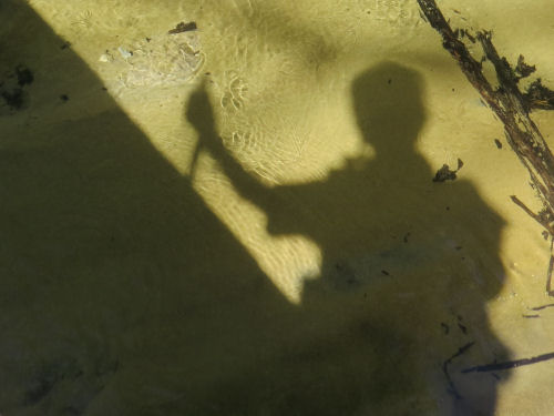
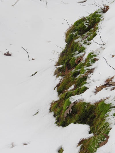
Whether they look like this, or better.

Little Woodhull Creek

We are being spotted in our endeavor by several people. Sarah (on the left), who hiked with me for three days in 2022.

hikers

and Joyce (left) who hosted Marie (right) and me last year. And Marie (of course)

hikers

And Diane, shown here completing her Hike 100 last year.

hiker

I am highlighting all of them, because they are chosing to travel quite a long distance to help in this endeavor. Yes, it will all count as volunteer time for us and them, but it's a huge project with a lot of moving parts that have to work smoothly because the locations are so remote.

I'll also get to meet the new NCTA Vermont-New York Regional Trail Coordinator, Will Brazill, who is spotting us one day.

So, perhaps you can sense my concerns about being in good enough shape to do this. There will be 5 days of backpacking (split into two sections), and the rest is day hiking. But it will be much more continual and intense hiking than I've done since the big hike and certainly since I've been sick. I'm feeling pretty confident that I won't endanger us by being unable to complete the task, but I'm not getting younger, eh? And I'd prefer not to be in continual pain.

Just as an aside, when I backpacked with David a couple of weeks ago, I asked him who was the oldest person he knows that backpacks. I was NOT fishing for compliments. He got a funny look on his face and said, "You."

As a final reminder of the Daks, and a glorious reminder of what may be ahead (if it's not a gray day when we get there), here is the view from Jones Hill. This will be on our last day!

view from Jones Hill

Only 2.5 weeks to finish preparations, do a few more conditioning hikes, and then... WOW... it will be off to New York!

See Here I Go

Saturday, May 10, 2025

Electronic Maps Training


Remember a couple of previous posts where Monica, Dan, Loren and I went to the woods to practice some mapping stuff? (link below for one of those). Today was the session we were planning for. Our North Country Trail chapter, Spirit of the Woods, held a training session on the NCT Interactive Map and also the Avenza app.

The time began at Elk Township Hall with a couple of hours of classroom time. We encouraged people to bring a computer or tablet so they could actually do the stuff we were talking about.
woman leading a training


Then we had a wonderful lunch. The Chapter provided sloppy joes, and people brought side dishes to share. As is so often the case at events where I have big responsibilities I did a terrible job getting pictures. But trust me, the food was wonderful!

For the afternoon we broke into small groups and each went to a different trail location so that we didn't have 20 people all glommed up together in the woods. Dan, Loren, Monica and I each took a group. There each person practiced using the Avenza app to help understand where they were and how to find the trail if you lose it.

The final part of that was that each person had a turn at being "lost." That person was blindfolded and carefully led into the woods by another person.
blindfolded person being led


Once far enough that they were completely out of sight of the trail, the blindfold is removed. Then that person used Avenza to find their way back to the trail. The idea was to build confidence. Everyone I've gotten feedback from so far has said that it helped them understand that they didn't need to panic, but that they did have the skills to find their way back to the trail. (The "leader" person had kept a track of their route, so if things went poorly, that person could lead them back, and final fallback was to call out, and the rest of the group still on the trail could holler back to guide them in)

How'd that go?

Here's that team, on their way back down the trail, easily finding it by following a few simple steps.
hikers


This took all day for me (and prep time over the past few weeks). I am rewarding myself by doing very little else for the rest of the day. Curled up with a book.

See This Way!

Monday, March 10, 2025

So Long, Marie- Hello, Bill

 It's really hard to get my head around the idea that exactly 25 hours ago I was on the train just leaving New York. Now I'm home.

Had to say so long to Marie.
friends


But after 12 hours on the train (maybe 6 hours sleep), I hopped in my car which was unmolested, and it started right up. Drove to Ann Arbor, and went to Bill's house.
friends


We walked downtown to go to breakfast and Bivouac (the primary camping/hiking outfitter in A2) to look for maps. We got one of the ones we wanted. But somewhere on that wall behind Bill is a picture of me and Marie, and maybe Mathilda, because Bivouac is where I purchased all my original backpacking gear except the pack in 1993.

The only flowers blooming here are on a wall mural, although most of the snow is gone.
mural of coneflowers and black eyed susans


We walked back to his house and had a blast looking at maps. We are cooking up a potential adventure for this summer. Not 100% sure yet, but probably. Here's a clue.
map snippet


Then another 4 hours to drive home. Snow pretty much gone here too!

Tomorrow, I'm sure you'll see more Flower Show. I need to stop adventuring and get back to work! Now it's time to rest.

Miles hiked in 2025: 46.4

Sidewalks and a couple of parks through Ann Arbor- 5.5 miles

See Thorne Preserve and Ferncliff Forest

Wednesday, May 12, 2021

What a Great Day!

  I worked hard in the morning, and then headed out for an afternoon on the trail. The North Country Trail, of course. Can a shadow look happy? I think this one does. shadow of a hiker

Almost immediately there was this lovely treat growing right beside the trail. Flowering dogwood, Cornus florida. The brach is arranged so gracefully. flowering dogwood branch

The flowers aren't all the way open yet. I haven't ever caught pictures of it at quite this stage. flowering dogwood blossom opening

My next call to adventure was this interesting map. I haven't yet explored this world. OK... it's just a cut birch tree. But doesn't it look like a map of some ancient land with a sheltered bay and two small pointed hills? pattern in a cut log

There were four creeks I crossed. This is Bear Creek. Bear Creek

And Tank Creek. I actually camped over beyond the upper left corner in 2016 when I did a short backpacking trip here. Tank Creek

Speaking of backpacking, I met one fellow, Loren, who is hiking the whole Lower Peninsula. It's so very, very cool to find that there are more than a handful of people who are doing longer hikes on the NCT now. hiker

I walked until I reached the mileage I wanted, and took a short rest on this log. And look! The sloth hiking team has been there. (You know, the ones who say, "We will get there when we get there.") sloth face in a cut log

Mostly just came directly home, but I did take one little mile of new back road. Talk about a dream day! The temperature was just warm enough for no long sleeves, but not too hot. Things are really getting green. The sunshine made the water blue. Pretty darn wonderful! dirt road with spring trees

I walked 10 miles, collecting info for the data book. Just 5 more Newaygo County miles to go (so 10 to hike them out and back). Total North Country Trail miles for 2021 is at 276.

In other news: I edited in the morning. I'm a little tired tonight- I didn't get to sleep until about 2 am, so I'll probably fall asleep early.

North Country Trail, Newaygo County, MI. Oak Savannah to north of Tank Creek and back. 10 miles total

See So Wrong About the Dogwood
See another sloth face

Wednesday, December 30, 2020

The Rest of my Loot

  As previously mentioned, the boots were my big gift, but I got some other nice things. Steve sent me this huge map. It's a Geologic Map of the US. It sort of looks like elevations, but it's actually rock type which, incidentally, mostly conforms to the topography. I love it! If I can find a poster frame large enough (it's huge!), there is even a place on the wall where it will fit. geologic map of the US

Two of the corners are held down with gifts, and two are not. Want to guess? I won't make you. (hint- It's not the mug or the channel locks!) Upper left is what's left of a fruit basket from Josh. We've eaten a lot already. And lower right is a cookbook from Magdalen House sent by my neice, Jo-Anne. (who says I can call her Jo-Jo, which makes me very happy for some reason!) I also got a gas card so I can afford to drive a few places to hike that I might otherwise pass up because of the expense.

In other news: Well, no walking happened. My exercise was confined to shoveling snow. We got maybe 4 inches, but it was really wet and heavy. Where the plow filled in at the bottom of the driveway a foot deep, I decided I might as well shovel that by hand. I got 3 packages ready to mail and went to the PO. Did some other errands and bookkeeping. That about took care of my day. Got in and out of the driveway with no trouble. Well, more editing and accordion practice. I'm not going to bother telling you that every day. Sufficient to say that I'm trying to maintain a regular practice time.

See Maybe I've Grown Up

Saturday, May 9, 2020

More About Hiking the Knobstone

 
I spent all day on maps again. Probably one more to go. I'm trying to get all the info I think I'll want onto one primary set of maps that I'll carry. This is what I've been doing on longer hikes for years and it works pretty well. The maps I ordered are probably tons better than whatever the trail association used to have, but they are in need of more work to be useful in the woods. I literally can't read the labels without a magnifying glass. There is an online map and a gps track. I'll check those out at home, but don't want to rely too heavily on electronics in the woods.

Anyway... today I'm feeling a little intimidated. I'm planning for this hike to be a personal challenge hike, with 15 mile days. An awful lot of those days are going to be seriously difficult. Here are 2 of the 46 maps sections.

Knobstone Trail Map

Even if you don't really read topo maps, I'm sure you get the idea that darker brown areas are very steep.

Knobstone Trail Map

And it's my understanding that this trail isn't known for switchbacks. They tend to take trails straight up and down the hills. Tonight I'm just a tiny bit wondering if I'm taking on too big a challenge. But I won't know unless I try. I'll have some sort of safety net to be picked up if I have to bail out.

I'm in really good shape, but um... I'm not 27 any more (unless you reverse those numbers). We shall see. Meanwhile, I'm planning carefully and anticipating.

Again- no other news. It's all maps. Life is good!

See Map Heaven

Friday, May 8, 2020

Map Heaven

 
A whole lot of things have transpired since I first ordered maps for a potential hike in December 2019. The big one, of course, is all the restrictions due to the virus. Another big one for me is that almost all my vendor events have been cancelled, which turns out to be a very good thing for the hike plans, because I can push the hike into June.

Meanwhile, back to maps. I had thought there was a longer trail in Indiana than I had gotten maps for, and the answer is that there is and there isn't. I got maps for the Knobstone (the southern piece), and the Tecumseh (northern piece without realizing it was considered part of the Knobstone), but not for the Pioneer section (the middle piece).

The Knobstone Trail is about 160 miles long, but the center section is largely road walk. I ordered the complete map set for it, which is what I got in the mail yesterday. I've decided that even with the road sections I am going to do this entire trail. I like being able to say, "I did the whole thing." I like that I won't have to figure out too much car spotting and moving around. Camping places are also easier to determine.

Here is about a third of the maps that I've been working on today. Even with the maps and guide coming from one source, they aren't all at the same scale, and the text is so small and blurry I literally can't read it without a magnifying glass. So, I'm putting them all on USGS topo base maps in the same scale. This is what I've typically done for backpacking trips. I add notes to myself and road labels and all that stuff. There is also a data book, which is not fleshed out very much, but it does have critical info about water sources and legal campsites.

topographic maps
Here are three map sections where there is real trail. The message here is hills. This is going to be a challenging hike. I think I'm up for that!

topographic maps

The Indiana DNR is currently saying that they are tentatively opening state land for dispersed camping on May 24. Hopefully that will be accurate, because I need this to be open. A big chunk of the Knobstone is in Indiana State Forest. Hiking in June is looking good.

Now I'm getting excited! Maps will do it.

There's another map milestone today too. I know, it's kind of a "who cares" moment, but I moved to a new map in my one online game I still play, Diggy's Adventure. I went from Atlantis to Greece. As new "mines" open up, this map base will be filled with the places I've visited and cleared. I've been playing this game for 3.5 years. I'm still enjoying it.

Diggy's Adventure Greece base map

In other news: Hmmm. Nope. I worked on maps.

See Seed Catalog Equivalents

Friday, January 31, 2020

West Side Allegan State Game Area

 
I promised more pictures from yesterday, and here you are. After I did the beautiful walk beside Swan Creek, I went to the west side of Allegan State Game Area and did a piece of the Wakazoo Trail there. It was much more level, and also more clear. This is why I concluded after the fact that I probably could have done the loop in two days.

trail through snow

I was planning to go as far as the campground, but came to this section where the trail was completely flooded. I'm sure I could have found a way around it if I had to. But I didn't have to, so I turned around and went the other way for a distance.

flooded trail

Here's a rough map of where the Wakazoo Trail goes in red. It's not laid over the base layer precisely, but it's close. And I'm confused as to where the trail leaves the southeast corner, going west. The map shows it south of 116th Ave, but there was a trail going west that is north of 116th. Since all their trails are blazed with yellow splotches, I'd need to do more exploring on the ground to be sure of where to go. That may have been a ski trail, although their info says ski trails are marked in blue.

Wakazoo Trail map

Nevertheless, this is certainly a place I want to come hike in nicer weather. With the purple Swan Creek Trails, and ~10 miles of ski trails that can probably be hiked in the summer as well, you could easily spend two or three days here hiking and camping. There are also equestrian trails, but they probably don't want hikers on those since horses can get spooked. I couldn't get a map of those.

It is a State Game Area so dispersed camping is only allowed from Sept 10 to May 15, and with a permit. However, there are several inexpensive campgrounds for summer use. Ely Lake is rustic and open all year- latrines, tables and fire rings only, 75 sites, but you can drive in. There is supposedly one other campground, family and equestrian camp. I could not find it, but I think it was at the end of an unplowed road.

Some bright moss.

moss in snow

And I especially liked this mossy bank that looks like it's floating in the whiteness.

mossy bank

In other news: I chilled, and also I worked on the plot for the next Dubois Files book.


See Take the Adventure You Are Given

Tuesday, December 31, 2019

Seed Catalog Equivalents

 
You know what hikers do in the winter instead of looking at seed catalogs, right? They start planning the next hike.

I'm already getting excited about this, and I haven't even figured out dates yet. I knew there was one longish trail in southern Indiana, but I had no idea there were several. I either ordered or printed out maps of all those over 10 miles in length.

maps of Indiana trails

If I could hike every mile it would be about 210 miles. But some are loops with a trail across the middle, so to hike everything there would be have to be some duplication, resulting in additional miles. But I printed them all out to give myself options to look at.

Anyway, I'm not going to try to do them all. What I want to do is put together about 150 miles of backpacking, which will be pretty easy. In fact, since two of the trails are not loops, unless I can get some help with spotting my car I would need to do those trails in both directions.

For sure I'll do the Knobstone Trail, the Tecumseh Trail, and if possible the Adena Trace loop.

Then I can add on from the choices of the Adventure, Two Lakes, Shirley Creek, Mogan Ridge, Birdseye, and Young's Creek Trails.

These are all in the portion of this map shown in pinks and oranges. In other words, not the flat part of Indiana.

maps of Indiana topography
I'll need to study the smaller maps that I just printed more carefully. Actually, if I do the Knobstone and Tecumseh trails in both directions that would be almost 170 miles. That would mean I don't have to impose on anyone else to help me, but I'd kind of like to see more trails.

If I did Knobstone and Tecumseh one direction each, and added the Adena Loop with its extra spurs that gets me to about 137. Then I could just tack on one of the other loops to get over 150.

Let the serious planning begin!

We did get more snow, but not a ton. Maybe 4-5 inches.

snow

In other news: I wrote all morning and formatted all afternoon. And I did the laundry. Enough for today!

See I Have Maps

Wednesday, October 10, 2018

Midland to Mackinac Project

 
If you know me very well, you know there is always another big project in the wings. After the strategy for this hike changed several times, I decided to use what I'm learning to perhaps help other people to find the trail.

I've been spending my evenings and days off working on maps and a guide. It's not going to be perfect. I didn't even think of doing this until about day four so the early sections have sketchy descriptions. Nevertheless, I know it's going to be better than just trying to follow the blazes, and the official map (which is approximate, but the scale is just too small to be helpful on the ground).

I can't finish it till I come back to pick up the 17 missing miles in the middle. Some places where I lost the trail have already been fixed. Other places, I'll suggest an alternate route.

There are 30 maps with USGS maps as the base. Here's a sample. This will be able to be printed on regular 8.5x11" paper or looked at digitally as an ebook.


And a sample of text that goes with part of this map.


These samples don't include introductory info, legends, etc.

I'm thinking of charging about $3.00 for this. It certainly should be worth the price of a cup of coffee.

Finishing it shouldn't be too big of a mouthful to chew. I've been keeping up with it as I go along. The maps take longer, but they are getting done.

Today's good news is that I rested, which I kind of needed. The bad news is that is was a beautiful day outside, and the only walking I did was a stroll through the local park and to the grocery store to buy a salad.

Tomorrow, a lady from Michigan Hiking and Backpacking is spotting me so I can go all the way into Mackinaw City, and on Friday another friend will spot me in the middle. That will leave me only one day's hike with no overnight to come back for. That should be possible to work out.

See Day Twenty-Three
if you like this blog, click the +1   or

Like This!