Our second hiking day was easy, only 7.4 miles with a little more than half on real trail. We covered Belle Valley map, points 22-26, Saturday, April 22.
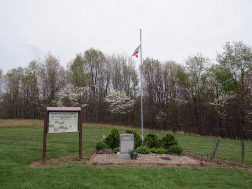
Early in the day we came to an interesting monument. This marks one of the three crash sites of the rigid dirigible Shenandoah. The ship broke apart in a storm in 1925. Surprisingly, 14 of the 43 men aboard survived. Later in the trip we drove to the other site that is open to the public. I have looked up quite a bit more information about this fascinating bit of history.
One of the hardest things to show in pictures is elevation changes on roads or trails. This picture does a pretty good job. We went down the hill and then turned left.

The day remained gray but dry. All the colors were soft. I just liked this pink (redbud)/ white (dogwood)/ tan (grass) combo picture.

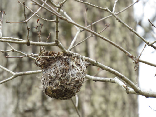
This was a great find that we'd never have seen with leaves on the trees. The nest is hanging from the branches, but it's much too small for an oriole (about the size of a tennis ball), which was the only maker of a hanging nest that I knew. I've learned it could be a vireo nest.
Most of the day's miles were along Wolf Lake, an impoundment, as most of the large lakes in the area are. Once again, the soft colors of the springtime trees were beautiful.

We reached the dam, and of course, lost the blazes. But we found them again and made our way into Belle Valley, our destination for the day.

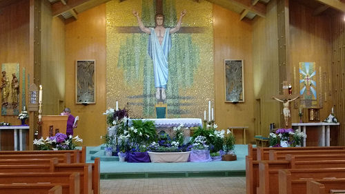
It was perfect that the day was shorter. We went to a restaurant and got a cup of soup to tide us over, then remained in town long enough to attend church. St. Stephen's was beautiful, which always aids worship for me.
17.1 miles total so far. We also passed the current turnoff where the North Country Trail heads southeast toward Wayne National Forest. This could be confusing, but when I hiked that section there was no official Buckeye connection. Marie and I did the NCT miles in the Wayne, but then connected back to the Buckeye by roads of our own choosing. Since then, an official route has been chosen. But the "rule" is always: the trail is what it is when you hiked it. So I don't have to go back and re-do my connections. I just have to finish the miles across the mouth of the loop that I never hiked.
 | See Day 1 |
| if you like this blog, click the +1
| |
1 comment:
That one picture almost looks more like fall than spring
Post a Comment