Although this was the last day, and only 9.4 miles, we still managed to get in some superlatives. But first things first. It's always sad to break camp. Nothing left but a yellowed square where the tent was. And the trash can.

The redbud was beginning to fade, but the dogwood was coming into its full beauty.

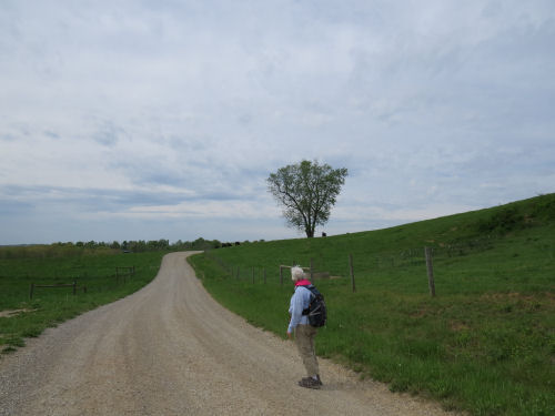
There is something about the curve of a lonely road that just calls to me. The loose gravel and my feet aren't friends, but that's another story.
We crossed the Muskingum River, a large tributary of the Ohio River at Stockport. The building across the way is a mill, now restored as an inn.

If you remember the "lesson" of yesterday, we've now reached the largest waterway in the area, so there's no where to go but up (unless you switch to floating!). The road curved back up a hill from the river at a ridiculous angle, climbing 900 feet in 0.7 mile. (Actually it's the tallest one to the left of the mill.)
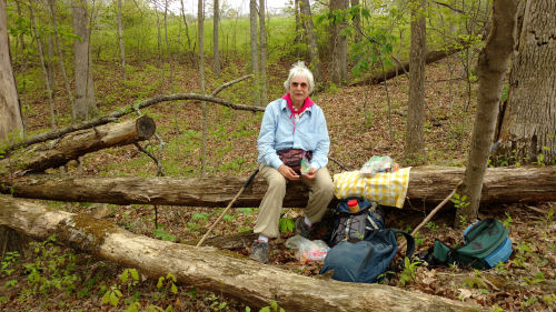
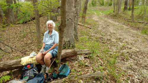
At the top we did have a nice surprise. We knew there was going to be a little more trail that was "off road." It began here. We had assumed from the looks of the map that this was simply an abandoned road. Actually that was true, but it turned out to be more like a farm lane, and was very pretty (no gravel either!). We found a comfy log for lunch. I'm not sure why Marie looks mad. We were having a wonderful final day. There were clouds threatening rain, but we thought we might beat it, and if not... there was a warm car ahead.
At the bottom of that road we forded Scott's Run.

On the one last piece of trail there was a register box, about two miles from the completion of my hike. Nice timing!

But, just to keep me humble, there was one final indignity- the worst hill of the entire hike on a road with loose gravel. We crossed the next ridge and dropped down to Aldridge Creek. Then we climbed 660 feet in 0.4 mile. Whew! But it made the ending feel so deserved!
Because the Buckeye Trail is a loop, there is no big deal end point. There was just a road sign where I connected to a previous hike at the corner of Lightner Ridge and Tabor Ridge Roads.


Please notice that we beat the rain! (But not by much) We immediately headed for Stockport in search of pie and iced tea, which we found at C-J's Restaurant. The pie was strawberry rhubarb, quite good.

Thus I have completed the entire Buckeye Trail including the "Little Loop" and the "Wilderness Loop" and the spur in to Cincinnati. I haven't checked my total miles, but it's something around 1450.
This is plenty enough for today, but I'll share flowers and some other post-trip details in the coming days.
Happy hikers!
 | See Day 6 |
| if you like this blog, click the +1
| |
2 comments:
Quite a workout with those climbs. Pie was a nice reward at the end of the day
Congratulations! That's a big committment over a long time!
Post a Comment