Entries to Win Afghan

Sign up to receive the Books Leaving Footprints Newsletter. Comes out occasionally. No spam. No list swapping. Just email me! jhyshark@gmail.com Previous gifts include a short story, a poem, and coupons. Add your name, and don't miss out!
Showing posts with label industry. Show all posts

Sunday, March 8, 2026

Empire State Trail Again


The Empire State Trail is a 750-mile multi-use trail/route that has two branches like a T through New York. The north-south branch goes from New York City (Battery Park) to Montreal. The east-west branch goes from Buffalo to Albany, largely along the route of the Erie Canal.

I've now encountered it enough times that I'm trying to add up what I've done of it. We did another 2-mile piece today along the Hudson River.
Empire state trail Kingston


The ice on the river is breaking up and because the air temperature made it over 50 degrees, it created strange moving fog banks that were really interesting to watch.
fog on hudson river


I loved this spot.
eerie branches in fog


This area is being made into a state park, Sojourner Truth State Park. Marie and I hiked in the area last year, and the jagged edge of the cliff in this picture is where we took pictures from last year.
cliff by Hudson river


Coming back, we also saw the Kingston-Rhinecliff Bridge through the fog. Marie and I hiked that in 2023- link below.
Kingston Rhinecliff bridge


This whole area was noted for brickyards which created most of the bricks that built New York City. These two pictures are part of a factory and smokestack from a brick works.
hudson river brickyard
brickyard chimney


Here's what I know I've hiked of the Empire State Trail:
about 1 mile to Rondout Creek
2 miles at Sojourner Truth park
2 miles Kingston-Rhinecliff Bridge
1 mile Historic Hudson Walkway
about 18 miles from Canastota to Rome, concurrent with NCT
? on Conservation Trail near Buffalo/Niagara (need to compare maps when home)

So total is something approaching 30 miles. I don't really have a goal (they don't offer a patch or even a sticker) but hey... I like making connections

We went to church, hiked, and crashed. I felt like cr*p all day and Marie didn't sleep well last night, so we read a little and napped.

Miles walked in 2026: 74.6

Empire State Trail, Sojourner Truth State park out and back 4.2 miles

See Kingston-Rhinecliff Bridge
See Conservation Trail
See Back to Canals

Saturday, February 16, 2019

Upper Enfield Glen

 
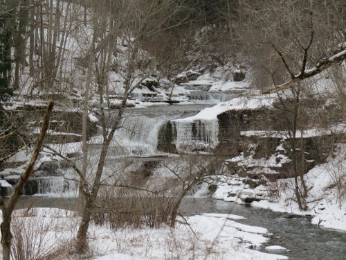
I'm taking you back to a few days ago with some pictures of Upper Enfield Glen in New York. The trails to the most spectacular of the waterfalls is closed for the winter, but this falls is visible from the parking area. They consider it so ho-hum, it doesn't even have a name.

waterfall at Upper Enfield Glen

I liked how the snow and moss and ferns were clinging to the rock walls.

snow and rocks at Upper Enfield Glen

This also unnamed falls is on a tributary, Fish Kill Creek. That funny "hood" is an ice cover that formed when the temps were so low and then partially washed away leaving a bridge.

waterfall at Upper Enfield Glen

There was a hamlet here, formed around a mill. When I was a kid, the mill wheel was still in place. It's now been removed but most of the gears are still there and visible.

mill gears at Upper Enfield Glen

And this mill stone is a study in shapes and tones.

mill stone at Upper Enfield Glen

Let's not talk about today's author event. See you tomorrow. I'll be on the move again. Back with Marie.

See Elaine and Carcassonne
if you like this blog, click the +1   or

Like This!

Saturday, May 6, 2017

Buckeye Trail Completion, Day 6

 
Now we were moving farther away from our camp each day, and putting the cars out took longer again, but even so we were hiking at 10:20.

This was our last day in the AEP lands. Those last two off-road miles were characterized by small steep hills with little creeks between. We crossed Onion Run, the collective for the un-named streams, twice while still in the woods. And we crossed a lot of the little trickles. No big deal, but think down and up.

steep valley

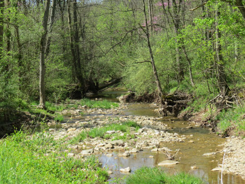
When we reached the road we were to join at the end of the AEP property, it continued along Onion Run. The day was heating up, and we were glad to sit in the shade beside the stream for a rest with the cool air rising from the water.

Onion Run

In fact, we crossed Onion Run three more times on road fords. These seem to be characteristic of southern Ohio on streams that are generally small. I suppose the protocol is that people know not to drive through if the water is really high.

road ford

I also found it amusing that although this seemed to be one of the most primitive roads we walked, it was the only time on the entire trip when I had 5 bars of service on my phone. Must have been a tower nearby!

Here's an oddball sighting. This tree stump has "stuff" oozing all over it. I think it's a Gelatinous Woodcrust fungus, but am open to correction.

gelatinous woodcrust
Want to see that closer? Too bad if you don't.

gelatinous woodcrust

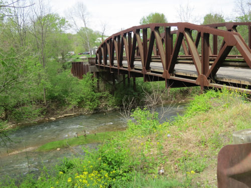
All those valleys close together means there are multiple streams through the area. This road bridge was a picturesque way to cross Meigs Creek.

Meigs Creek bridge

We turned right just across that bridge and crossed a non-picturesque bridge on a state highway over Perry Run. At that point we reached the lowest elevation of the day. Read largest waterway. Also read, next thing we did was go UP. And I do mean up. (But, even so, it was not the steepest climb of the hike. Stay tuned till tomorrow.)

The next three pieces of road were goofy. At least on the map. There are no roads (or trails) that go over the next two ridges. So we walked west around a "toe," then back east for a mile around the next toe, then back west three miles till we could join a road going south. Forward progress, maybe a mile as the crow flies.

We saw this cooling tower and assumed nuclear plant, but learned later that it is a large coal-fired power plant operated by AEP.

power plant

Our final mile of the day was a gentle walk along Olney Run. We were glad of that. The day had heated up to 86 degrees, and we weren't used to those temperatures yet! There were little rills and waterfalls. We enjoyed watching one during our final break of the day, although we didn't go to the water as all the access was through poison ivy.

The ivy was our biggest enemy on this hike. It was at the deadly invisible stage where there are three folded maroon leaves on a 6-inch twig. Unfortunately, this stage is extremely virulent so we have to be vigilant and wash often. We were either careful or lucky because neither one of us got more than a few dots. We consider this a major success.

Olney Run

We reached the car at 3:15, and this turned out to be our longest time. I think it was due to the heat which made us decide to take that extra afternoon rest stop.

Wednesday, April 26. Stockport map, points 5-12, 10.1 miles. Trip total at this point, 53.8 miles. We also passed the junction where the now official southern end of the Wayne NF loop comes back to meet the Buckeye Trail. But I had to walk a bit farther to complete the trail where I had veered off to the east.


See Day 5
if you like this blog, click the +1   or

Like This!

Thursday, March 2, 2017

Mesabi Hike - Parkside to Biwabik

 
We continued northeast on the Mesabi Trail, August 10, 2009. There were more interpretive signs than along the southern portion.

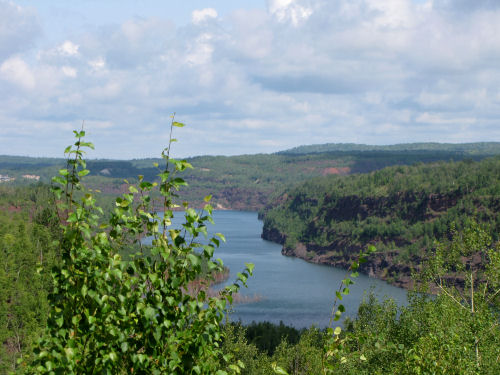
This lake, about 3 miles long, is actually a pit left from mining. Called the Rouchleau Group, the site covers the locations of fourteen small mines which eventually expanded to create this one canyon. Company "locations" (small towns) were built to house people, then torn down as the mines overcame the land.

Rouchleau Mine Group

This cut through the rocks was hand dug and blasted in 1893 for the Duluth, Missabe Northern and Iron Range Railway.

railroad rock cut

One of our best people encounters was here. This lady in the wheelchair is pushed by her caretaker 10 miles every single day! They both just enjoy being out and taking advantage of the paved trail.

wheelchair user

Just a colorful field of wildflowers- tansy, brown-eyed Susan, yarrow and asters.

wildflowers

Our basecamp was now at West Two Rivers. We had moved there Sunday night, and the place was deserted. Works for us! We like having a campground all to ourselves.

campground

Hiking day number 7, 16.3 miles. Total so far this trip 113.4 miles.

See Chisholm to Parkside
if you like this blog, click the +1   or

Like This!


Wednesday, March 1, 2017

Mesabi Hike - Chisholm to Parkside

 
This day on the trail, August 9, 2009, was all about mining history.

For example, at the town of Mountain Iron, this restored Oliver Iron Mining engine was on display.

Oliver Iron Mining Steam engine 806 with 0-8-0 wheels

Take a look at the wheels. Or the lack of wheels. It's an 0-8-0 arrangement, which seemed pretty odd to me. That means the 4 sets in the middle that you can see are all you get. Most engines have smaller leading or following wheels to provide better tracking (less likely for the engine to derail). With all of the weight on the eight driving wheels these engines had great traction. I learned that they were typically used for hauling really heavy loads slowly or for switching. Perfect for iron mining areas. Ore is heavy. This particular one was built by Baldwin Locomotive works in 1910 and used as a switcher until 1955.

Oliver Iron Mining Steam engine 806 with 0-8-0 wheels

On this day the trail followed a portion of the former Great Northern Railway (now BNSF), and was crossed by the route of the Mesabe Southern, a long defunct logging line.

Every town seemed to have some sort of transportation or industry display. How about a steam shovel?

steam shovel

The buckets are pretty big.

steam shovel

How big?

steam shovel

Then we were introduced to the tire.

big tire

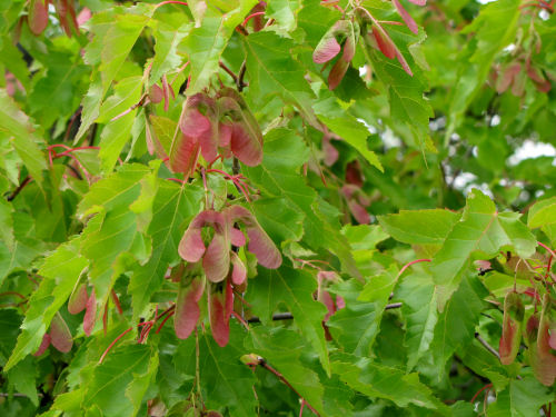
The most memorable natural feature of the day was Amur Maple (Acer ginnala) growing wild. I knew it already, having seen it as an ornamental hedge at the botanical garden in Ann Arbor. It's a really pretty small tree/shrub. What I didn't know, however, is that it can be invasive. It's native to China and Japan. It particularly likes coarse soil. "Perfect" for old mining lands. In Ann Arbor, the fine clay soil keeps it in check. In Minnesota (where it was brought in the early 1900's) it's running rampant.

Amur Maple

We moved to a new campsite, spent time playing around all these displays and hiked 14.0 miles from Chisholm to Parkside. Total to date for this trip 97.1 miles.

I mentioned earlier that a problem was developing. I'll get to that.

See Day Off
if you like this blog, click the +1   or

Like This!


Monday, February 27, 2017

Mesabi Hike - Kewatin to Chisholm

 
In local news: the great blue herons have returned. I saw one flying over this morning on the way to the river. I used to know where their rookery was, but they abandoned that one and I don't know where it is now. They are right on time, usually showing up in February or March.

I dried clothes outside for the second time this month. That is certainly a February record. Actually, even the one time was a record.

Now back to 2009- Friday, August 7:

We continued north on the paved Mesabi Trail. Iron mining still defines the area. Towns are proud of their heritage. Both of these displays were in Kewatin. This tough little engine is an electric 60-ton steeple cab, designed especially to pull cars from the depths of the mines.

Hannah Mining engine 304

Here are two of the small cars historically used inside the mines.

mine cars

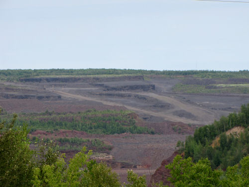
As we continued north, we got a glimpse of what modern mining looks like. This is the largest open-pit iron mine in the world, the Hull-Rust Mahoning Mine. It's 3.5 miles by 1.5 miles, and is 535 feet deep. Say what you will... raw materials for the things we insist on consuming have to come from somewhere.

Hull-Rust Mahoning Mine

The ore is carried through pipes above ground (perhaps with an internal auger) to locations where it can be collected for transport.

ore pipeline

We enjoy these cultural aspects of the trail as well as the natural ones.

However, the next event of the afternoon was not as much fun. I'd planned long days anyway, just to finish all these paved/road miles. But we hit a real unexpected snag.

There was no information posted about how long the detour was (my maps seemed to indicate it had to be at least two extra miles). There was no information as to whether hikers could get through with care, just not bicycles. There was no clue as to how far ahead it was. Should we continue and see if the way was passable, with the possibility we might have to backtrack to this point?

We chose to follow the detour signs.

trail detour

And follow the detour signs.

trail detour

A planned 16 mile day turned into nearly 20 miles. Marie says it's the longest day she's walked.

This sign was not us.

speedy

We limped into Chisholm. Pavement walking is hard. Literally. Our planned day off was theoretically a day away. But rain was predicted. We know how to flex. We drove back to Grand Rapids, broke camp and had a Super 8 night.

motel sign

We found out later the trail was completely passable. Repairs had been completed, but the signs had not been removed. Sigh. And the long day probably contributed to problems that began to develop.

Hiking day 5, 19.5 miles for a total so far this trip of 83.1 miles.


See Marble to Kewatin
See World's Largest Gravel Pit
if you like this blog, click the +1   or

Like This!