Entries to Win Afghan

Sign up to receive the Books Leaving Footprints Newsletter. Comes out occasionally. No spam. No list swapping. Just email me! jhyshark@gmail.com Previous gifts include a short story, a poem, and coupons. Add your name, and don't miss out!
Showing posts with label mountains. Show all posts

Wednesday, March 11, 2026

Amazing Ashokan


The morning today was just about as close to perfect of a hike as you can get. You know, right, that if there are 10 things that make a perfect hike and you get all 10 of them, it's a dream. Wake up. Nine would be amazing, probably 6 is about normal for a good hike. This was close to a 9. I guess you could wish for blue water instead of ice (but then we would have missed one of the most interesting things). You might have wanted natural surface and that we would have actually seen the eagle. But this was seriously wonderful.

The weather was great. Mid fifties, warming a bit more before we finished. We had gorgeous views. We got to watch something really interesting. I managed to ID some of the surrounding mountains. We met an interesting couple and had a surprising interaction with another man.

Marie took me out to the Ashokan Reservoir where we hiked once seven years ago (link at end). The reservoir was built in the early 1900s to provide water to New York City. This trail used to be a road, but was closed and turned into a trail when a new road farther from the water was built. This is the view east, and I think the jagged peaks are Snake Rocks.
Ashokan Reservoir


But not so fast. First we tried to do another piece of the Ashokan Rail Trail. I had not been on that before. However, the piece that has views of the reservoir was totally ice covered, and we opted not to do that. We walked a bit the other direction. This is one of the old mile markers indicating 16 miles to Kingston.


But we wanted to see the water, so we turned around and went to a different trailhead. You can see what a beautiful day it was!
blue sky with clouds


The whole edge of the reservoir is lined with native rock. It makes dizzying patterns.
rocks on edge of Ashokan reservoir


Our first interesting people encounter was with a man to whom we said, "Good morning." He countered with, "Why is it a good morning?" I don't think anyone has ever asked me that before at least after the casual greeting! I quickly said, "Because I am hiking with my best friend and it's a beautiful here."

This is South Mountain (which is west of the reservoir) on the right, and the larger one is Ashokan High Point which is the tallest peak surrounding the reservoir on the left. Ashokan is 3,081 feet tall.
South Mountain and Ashokan High Point


This is perhaps my favorite view from the Reservoir. The little nipple to the right of center is, I'm pretty sure, Slide Mountain which is the high point in the Catskills at 4180 feet. The eastern terminus of the Finger Lakes Trail has been extended to there, but I've not yet done that new piece. It will be an all-day hilly hike to get from the last parking area to the new terminus. At least 8 miles total. In front of that is Cornell Mountain with, I think, Samuels Peak in the front left.
Cornell and Slide Mountain


This is the roadway that crosses near the middle, and I'm pretty sure the peak in the background (these are all part of the Catskill Mountains) is Ticetonyk (TICE-tun-ike) which is from the name Mattias TenEyk who owned it.
Ashokan Reservoir roadway and Mt Ticetonyk


We walked all of the roadway today. This was where we watched the most interesing thing. The ice is breaking up, and there is one of the arches of that bridge where water is flowing from one side of the reservoir to the other. There were slabs of ice being swirled around in a huge circle on the downstream side. You can see a few in the picture above. It was like watching plate tectonics speeded up. We watched the slabs (plates) hitting each other. Sometimes one would go beneath the other (subduction). Sometimes the lower one would be tilted upright and some even flipped completely over. It was fascinating. I began to realize how big slabs of rock could get tilted and even flipped.

We even saw some mergansers.
common mergansers


Walking back to the car we met a couple who were training to walk the Camino de Santiago (in Spain) in the fall. (They were wearing backpacks and I asked if they were getting ready for a hike). The man has walked all of the Appalachian Trail, and they plan to walk the Superior Hiking Trail next year. They also have some other trails in Europe in mind because their son lives in Zurich. We traded stories and names.

We saw an eagle nest, but not the birds. The ice patterns were artistic. We saw an air boat that almost certainly belongs to New York City Department of Environmental Protection (which operates the reservoir) going over the ice to reach a buoy of some kind (water sampling?).

What a wonderful day! It rained in the afternoon, but that's OK. We played our game, fixed dinner, read a little in the book we are currently sharing, and then I had a Zoom meeting.

Miles walked in 2026: 87.8

New York, Ashokan Reservoir Rail Trail 1.2 miles, and Ashokan Promenade 4.2 miles. Total 5.4 miles.

See Ashokan Reservoir Hike

Thursday, August 1, 2024

National Hug Day

  Last night Lizzie was telling us that a few years ago she had made up a holiday called National Hug Day, and it was August 1. Then we realized that today is August first!

One (or maybe more) round of hugs was had before we had to say goodbye. Ellery, Erin, me, Lizzie, Susanne. I'll be back. They aren't that much farther east than I come most years.
hugs


Other than that, it was a hot road day. I did manage to find a route I've never taken before, so that helped. I cut across the Catskills. Always hard to safely snap pix while driving, so this will have to do. Unknowingly caught a pedestrian sign, so that's cool.
Catskills


There will be a mini advanture tomorrow morning to break up the driving a bit, but I'm definitely on my way home.

See Generations

Thursday, January 25, 2024

Rainy Day Fun

 It rained most of the day, but we managed to have some fun. In the afternoon we went for a drive so they could show me the town. We ended up on a ridge with quite a view.
view from Morris Winery


It was stunning... taken in the more literal sense. I was stunned. I had no idea we were so close to actual mountains. This is the western edge of the Appalachians. Also stunning as in gorgeous, even in the fog and mist.

I'm pretty sure the ridge right in front of us is called Chilhowee Mountain.
Chilhowee Mountain


I love the shades of the layers of hills. The mountain is about 10 miles away.
Chilhowee mountain


Let's zoom in once more for even more varied layers. Don't be fooled into thinking the blue-gray is sky. Look at the top. The sky is white. That gray is Chilhowee Mountain. Actual elevaton about 1800 feet.
Chilhowee mountain


It's a lot of pictures, but I have to show you Sugarloaf Mountain (what else, right?). It's just so cute sitting out there all alone. The Ocoee River flows between it and Chilhowee where it is dammed to formed Lake Ocoee.
sugarloaf mountain tennessee


Other than that, we did puzzles. We were talking about the rabbit puzzle I got for Christmas. Well, Lin has some of the puzzles like that made by the really good company, Liberty Puzzles. We had to get one out.
woman doing a jigsaw puzzle


There are many interesting pieces in these puzzles. Here are just a few. Sometimes you even had to combine several pieces to make the shape- for example there were about 6 pieces that made a car. There was a woman sitting at a table with a teapot and that was four pieces. And the shapes have nothing to do with the picture on the puzzle.
Starry River jigsaw


I loved this picture. It wasn't quite as hard as I thought it might be. We started last night, and I finished it this morning while Lin had a prior commitment. It's called Starry River.
starry river jigsaw puzzle


Not content to quit with one, we did another one this afternoon. This was easier. It's called Grizzly Bear. In this one, most of the animals in the picture had a shape piece of the animal that was also part of the picture. The frog had a frog shape in the middle, likewise the eagle and the porcupine, and more.
grizzly bear jigsaw puzzle


These are really high quality puzzles, and it was a treat to get to do a couple.

Joe has made some wonderful meals! They eat a lot of veggies, and you know this made me happy too.

Tomorrow I'll be back on the road.

See Bradley County Greenway

Tuesday, October 10, 2023

Gore Mountain


The afternoon of the day we went to Fort Ticonderoga (September 30), Marie and I did not return to the Celebration on the bus. We played hooky with Larry and went up the Gore Mountain Ski Area gondola. It runs all summer as a tourist attraction, and mountain bikers use the trails too.
Gore Mountain ski lift
people in ski lift gondola


The pictures from the gondola aren't as good because the plexiglas was very scratched, but this is looking down the lift.
Gore Mountain ski lift


There is a total of 1700 feet of rise from the bottom to the top. Needless to say, the ski resort has a number of lifts, but this is the popular one for tourists.

Now this is what I call a view! The blue peaks in the distance are the High Peaks. One of them is Marcy [high point in New York]. I could pick it out in person, but in the reduced size picture, I'm not so sure which it is.
high peaks from Gore


Since we could see Gore Mountain from the Moxham Mountain hike, I asked if you could see Moxham from Gore. The lift operator told me where to look on the way down. I think that cliff standing out by itself is Moxham. You know I love figuring out how I fit into the landscape.
Moxham Mountain


The name Gore Mountain has nothing to do with being bloody. At the Adirondack History workshop I attended at the Celebration, we learned that the whole central portion of the Adirondacks was surveyed not on N-S lines, but at a 45 degree angle to that. So where that area adjoins other areas surveyed in the normal manner, there are triangular sections. If you have ever sewed clothes, you probably know what a gored skirt is... a skirt made from triangles. Gores are also inserted in things like sails. Guess what those triangular sections of land were called. Now guess where Gore Mountain is located. I knew you could do it!

Well, ok... there is probably some etomological relationship between the meanings. They both may hark back to German and Old English where various forms of gehre and gar meant a spear or a spearhead, which are triangular, and the use of such an item to gore someone resulted in bloodshed... to be gory.

I edited in the day, and had a program this evening. That's enough for one day!

See Fort Ticonderoga

Friday, September 29, 2023

Meade and Beckham


We chose a short hike today because I needed to be back at the lodge in time for the workshops. We went up a trail that goes to Meade and Beckham Mountains. These are small, and they are east of the NCT route. I don't think I could identify where the trail fits into the view at all. But this is the vista from Meade.
Meade mountain view


From Beckham the view is to the south, and the body of water is Lake George, one of the larger lakes of the area.
Beckham mountain view


One amazing thing about this hike is that these two mountains are privately owned. Yes, you read that right. The owner keeps this trail open, and he is out there checking on it almost every day. We actually ran into him.
hikers


I attended two excellent workshops, one on the NCT mapping program, and one on some of the history of the Adirondack region. Then I led a workshop on tips for hiking the trail in the Adirondacks.
workshop


Now it's time to get ready for dinner. Nonstop fun!

See Moxham Mountain

Thursday, September 28, 2023

Moxham Mountain


Marie and I signed up for the Moxham Mountain hike. The primary reason was because I wanted to see something that was new to me. It turned out to be a wonderful choice.

In the bus, on the way (picture taken through window), we had this view of the entire mountain. We were getting ready to hike from right to left up to the little hump, down into the saddle and then to to top of the hump with the sheer face.
Moxham Mt


Even part way up, we began to have nice views.
Adirondack view


Part way up the little saddle, we could see the cliffs of the south side of Moxham. Yes, we are hiking to the top.
Moxham Mt


The trail got rockier, with a lot of our walking on ridges and rock outcrops.
hiking up Moxham Mountain


Finally, we were at the top and were rewarded with this spectacular view! The existing North Country Trail is on the front ridge on the opposite side, with the Hudson River in the bottom of the valley.
view from Moxham Mt


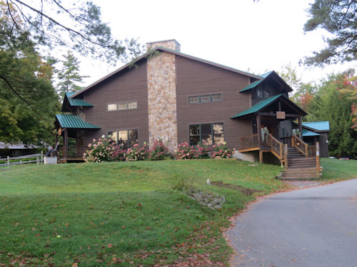
Here is the lodge at the camp where the Celebration is being held. We have tents or bunkhouses for sleeping.
Forest Lake Camp


Last night we heard a talk by the Deputy Director of the Adirondack Mountain Club. It was very informative, and they are welcoming the NCT to the Adirondacks. Believe me, our trail would not be here without that acceptance.

See On the Way

Sunday, March 12, 2023

Philadelphia Flower Show - Chandelier

  This was another of the major commercial displays and was created by Arrange, Floral, and Event Design of Haddonfield, NJ. Their premise was that electricity is an element of nature such as lightning and fireflies. They created a fanciful chandelier.
Philadelphia Flower Show Chandelier


Here's a closeup of the middle.
Philadelphia Flower Show chandelier


One of the drawbacks of the "electric" theme is that the colored lighting masked the natural beauty of the plants- in this exhibit, the falls of orchids. This was the one complaint our group had over and over about this year's event. But sometimes the theme just seems to create inherent problems.

One reason Marie and I left so early yesterday to go to the train station was that I asked if we could drive up on the east side of the Hudson on the Taconic Parkway. I had been on it once before and knew a little about it, but I wanted to cement more of the info in my head, so that is my new thing to learn for the day. It is a partially limited access highway that is only open to passenger vehicles (like the Blue Ridge Parkway). It follows the edge of the Taconic Mountains, and is scenic in nature.
Taconic Parkway
I knew it was old, but now I know that it was envisioned in the 1930s by Franklin Roosevelt. Gilmore Clarke, a New York architect designed it. He also designed the Central Park Zoo and the landscaping of the 1939 New York World's Fair.
Taconic Parkway


The Taconics are geologically part of the Appalachian Range although they are often mistaken as part of the Catskills and/or the Green Mountains of Vermont. This is a view across the Hudson with the Catskills just peeking out below the clouds.
Catskill Mountains


I didn't sleep much Friday night. Last night I was on the train and slept intermittently. Everything on the whole trip went well, but the net result is that I'm too tired to even focus my eyes. I think I need to go to bed and listen to something until I fall asleep.

It was a wonderful trip- back to work tomorrow.

See PFS- Eye Candy

Tuesday, March 7, 2023

Kingston-Rhinecliff Bridge

  We did something so interesting today that I have to blog about it instead of the Flower Show. Even though there was a really stiff wind, we walked across the Kingston-Rhinecliff Bridge. A pedestrian lane has recently been added. You were never allowed to walk or even bicycle across it before. It's now part of the Empire State Trail, which I was on briefly last May. See Back to Canals.

The traffic was loud, but the ped lane is separated with a concrete barrier, so you feel safe enough.
Kingston Rhinecliff Bridge


This is a bridge across the Hudson River. The new thing I learned today is all wrapped up with what I thought I learned yesterday. The mountains that I said were the Shawangunks are not. The ridge you can see along the right side (west) of the river in this picture are the Gunks.
Shawangunks


Amtrak runs down the east side of the Hudson.
Hudson River


On the return walk, well, WOW! There were the mountains I showed you yesterday, way too far north for the Shawangunks. These are part of the Catskills. I believe it is Overlook and Plattekill Mountains (3136 feet and 3500 feet), but after yesterday's epic failure at identification, maybe you shouldn't trust me. I'm pretty sure this time, though. That dark blue ridge you can just see above the guardrail is Blue Mountain.
Overlook Mountain


Anyway, we walked almost 3 miles. The real challenge was that the wind made it difficult to even stand up on the return walk.

See Loving the Mountains