Entries to Win Afghan

Sign up to receive the Books Leaving Footprints Newsletter. Comes out occasionally. No spam. No list swapping. Just email me! jhyshark@gmail.com Previous gifts include a short story, a poem, and coupons. Add your name, and don't miss out!

Friday, February 5, 2021

White and White

  We holed up all day today. There just wasn't any good reason to go out. snowstorm

Sure, I could have managed a snowy hike somewhere, but I was resolved to get some things done, and I managed to remain disciplined for most of the day. snowstorm

I wrote a chapter, Worked on two projects, did some mending, and made yogurt. Then the discipline began to unravel.

This is the puzzle I finished the other day. It's called "Twister." I thought it was going to be hard, but it was exceptionally easy. The pieces were cut very oddly, and that made it much simpler. There are supposed to be 240 items caught up in the tornado. I confess, I did not count.
jigsaw puzzle Twister


Now, I've started another one. This one is definitely hard. It's quite interesting. Stay tuned. Wonder if I'll be as good tomorrow. I think I'll have to run the snowblower, so there's that.

See First Snow

Thursday, February 4, 2021

Dead Horse Marsh in Winter

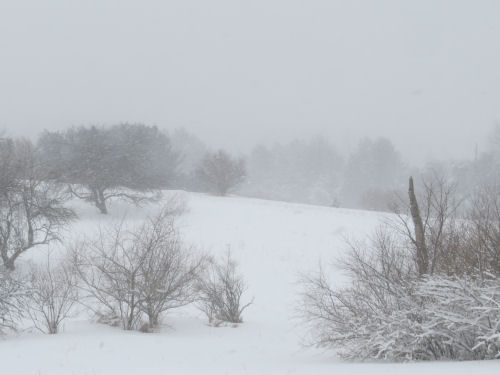
  Loren and I hiked again today. We decided to take a look at Dead Horse Marsh in winter. Link below to see what it looked like this past spring. Our NCTA chapter built this 600+ foot boardwalk because of the years that it does look like this past spring! Dead Horse Marsh

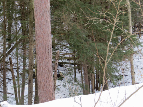
A lot of the jackpine that had grown up during the ten years since the last high water event are dying- all the ones right along the boardwalk in the picture above are dead. That's actually a good thing. This marsh is a rather unique wet meadow, and for that to be preserved, it needs to be open. This is a long view away from the boardwalk. Just a few larger dead trees, which the birds love. Dead Horse Marsh

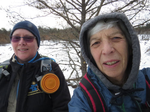
The selfie to prove we were there and sufficiently bundled up. Actually, it was pretty warm- right around freezing. friends

The most interesting "find" of the day for me was a better understanding of the topography of that section. We walked to Taylor Road (just a two-track) before we turned around. But I had never noticed before how much higher the land is before you reach Taylor Road. Turns out it's forty feet higher. I know this isn't huge, but for all the times I've walked this (and it used to be the section I maintained, so I've walked it lots) I hadn't noticed this. Between Dead Horse Marsh and Taylor Road, I would have told you there were some little hills and a number of wetlands. That is all true. But it turns out that the "little hills" are really all part of one lozenge-shaped hill that is about a mile long (N-S), and half a mile wide. This raised area is (like pretty much everything else here that isn't a relic sand dune) a remnant of the terminal moraine of the last ice age. All those little wetlands are perched (yes that's what they are called) on this hill.

A perched wetland is one that has no natural inlet or outlet. It is only fed by rain and general drainage from the surrounding land. Since wetlands were my specialty topic in grad school, I knew this already. Most of these wetlands are filled with leatherleaf. In fact, this is where I collected the leatherleaf to make the fake mistletoe ball for the cover of Dead Mule Swamp Mistletoe.

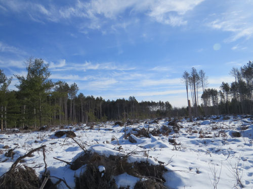
I drew a line across this picture because you can't really see what I was trying to show in the photo. The line is the height of land after we turned around. But I had just never really noticed, in the summer with all the greenery, how the trail climbs to the top of that hill. There are numerous high points at 750ish feet (Taylor Road where the trail crosses is about 710), and the trail winds between those and down into little channels between those knobs. Now, I'll think of them as eroded drainage channels. height of land

We ate lunch at the first of those high points, and sat looking away from the trail, down off the north end of that hill. Well, the humans did. Koa mostly looked at our sandwiches! winter valley

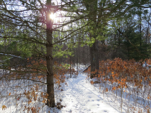
Greens of the day include some nice moss, and wintergreen adorning a pine cone. moss wintergreen

We hiked just a tiny bit over 6 miles. NCT Hike 100 Challenge 2021 is at 63 miles.

North Country Trail, Mason County, MI, Tyndall Road to Taylor Road and back. 6.1 miles

In other news: I got some groceries in anticipation of the big snowstorm we are supposed to get tonight, came home and cooked myself a treat of a hamburger (which I hardly ever do- maybe twice a year), and did a little bit on a couple of projects.

See Dead Horse Marsh this spring

Wednesday, February 3, 2021

Seeds- Common Cocklebur or Clotbur

  Even though I sent back the digital magnifiers that were supposed to take pictures but didn't work, we can still do seeds from time to time. Here is an unpopular plant- Common cocklebur, also called clotbur. I took some pictures of leaves in the summer, but can I find them? No. So, you'll probably see this plant again when I do.

The fruits are even more tenacious than burdock. Not only do they have little barbed prickers, but they aren't soft like burdock. These kind of hurt when you try to pick one up. One easy winter distinction from burdock is that these seed pods are oval (burdock is round). common cocklebur

While there used to be up to about 15 species of Xanthium recognized in North America, it's pretty much been reduced to about three, with the differences considered regional variation of the same plant, Xanthium strumarium. It may be nasty, but it is native. common cocklebur

They grow in waste places, roadsides, and edges of fields. common cocklebur

Here's a closer view of the fruits/seed pods. You can see those velcro-like hooks. The two little projections from the top of the pod are called the beaks. They sort of make it look like some prickly insect. The two skinny ones are halves of the first one I cut open, and I also accidentally cut the seed (lower right) in two.
common cocklebur


This is only the seed case. The seed- that smooth pointed oval that looks a little like a sunflower seed kernel- is actually inside. The cases are surprisingly tough. I had a hard time cutting one open to get the seeds out. There are two seeds lying longitudinally in each fruit.
common cocklebur


Supposedly, eating the plants has been known to kill people and animals. However, also supposedly, some Native Americans used the seeds for medicinal and hallucinogeic purposes. I was very surprised, after cutting a couple of the pods open and handling it, to discover it has an odor rather like sage. One place said the seeds could be ground with corn meal to make a flour. I'm here to tell you that unless someone found a better way to open those pods, that would be a ton of work. I had to use an exacto knife and something to hold the bur, and press really hard.

In other news: There's not much. I worked on a couple of projects and did a little cleaning. Took a short walk. Ho hum.

See Seeds

Tuesday, February 2, 2021

Pure Ludington Winter Walk

  Cathy and I did a fast five miles through town today. Most of our route was on residential streets, but we took a loop through the carferry docks. Please note another sun and blue sky day! Wow, wowowowowowow! Can't beat it.

If you live near Ludington, or have followed my blog for long, you know about the ferries. Otherwise, see links below for more info if you want. You can see both ships in this picture, but the operational one, the Badger, is the farthest from the camera. This is the Great Lakes- ice, snow, storms. It only runs from May- October, when it makes two trips a day to Wisconsin and back. Ludington carferries

The closer one in the above picture is the Spartan, sister ship to the Badger. She has not been in operation for years, but is docked in Ludington. I just liked the various mooring lines. Spartan carferry

The Badger has been designated a National Historic Landmark, and part of US Highway 10. I hadn't actually seen that it has been painted on the gate at the end of the loading apron. I like it! Badger carferry

We continued along the lakeshore, past the marina. In the winter, with no boats, you can see the lighthouse across the way! You'd never see that in summer. All these slips are filled in warmer months. Ludington Marina

The wind was cold, and we did 17-minute miles. A good workout.

In other news: I finished chapter 30, did a couple of odd jobs, and after our walk went to bell choir practice.

See Twin Queens of the Lakes
See Pure Ludington Evening

Monday, February 1, 2021

Timber Creek South

  Took a longer hike today. Started by going south on the North Country Trail from Timber Creek (US 10). Woohoo! I picked another day with sunshine. My average for hitting sunny days this year is great. snowy trail in sunshine

This low area on the trail is a favorite of mine. I love the canopy of hemlocks. hemlock grove in snow

About two and a half years ago, a microburst of wind flattened all the trees in this area. It used to be dense forest, just like you now see at the edges. Timber salvage was done but the area is still very bare. Since this happened in another area along our trail about ten years ago, I can tell you that it will probably start filling back in after another couple of years. blowdown area

My route today included both off-road trail and roadwalk. This is just a tree along Wingleton Road. I'm a total sucker for bare branches against blue sky! winter branches against blue sky

We have to cross the Pere Marquette River on the road bridge. This is the view downstream. Pere Marquette River from Upper Branch Bridge

Then we pop back into the woods, and the trail follows the bank of the river for a short distance. Pere Marquette River

When I got home and looked at this picture I had to chuckle. This is a set of steps that take you up to the top of the bluff along the river. I wanted to tell you that they are made from logs cabled together and laid down the sandy hill. This is a pretty good construction technique in sand because the steps just "float" on the surface. They never get washed out. But what it looks like is some sort of ziggurat! You can't see that the river is on the left. You can't tell that the valley on the right also climbs up to the top of the bluff. It sort of looks as if this is a really stupid route- why climb that hill when you can just walk around it? Anyway... you can't walk around the hill. You must go up! steps on a snowy hill

About a mile into this section of trail, all human tracks ended. Right here, there hadn't even been deer or squirrels using the trail. It was just me and the trees! snowy forest

There is a small unnamed creek on this section that I always enjoy visiting. It's just a hidden gem in the woods. Today, I tried to get a picture from a different angle than usual. You can just see the bridge through the trees. trail bridge through trees

After this, there was another 3/4 mile or so, which included another stretch of road, to get to the north end of Bowman Semi-Primitive Area. I put a foot on the trail, off the road, just to say I'd connected, and turned around.

Total miles today: 10.5; NCT Hike 100 Challenge 2021: 57 miles.

In other news: Not much. I finished reading a book and attended a virtual book festival this evening. More to come all month. I am participating as both a reader and an author.

See February 2020 Hike