Entries to Win Afghan

Sign up to receive the Books Leaving Footprints Newsletter. Comes out occasionally. No spam. No list swapping. Just email me! jhyshark@gmail.com Previous gifts include a short story, a poem, and coupons. Add your name, and don't miss out!
Showing posts with label Koa. Show all posts

Thursday, November 20, 2025

Slightly Out of Focus?


Mentally, I was very focused today, but the foggy, misty weather made all the pictures a little bit fuzzy.

My "new" position with the Spirit of the Woods Chapter of the NCTA is Land Protection Specialist. So... I'm no specialist yet, but I'm learning a lot really fast. We didn't think there were hardly any landowners to deal with on our section of trail. So far, we've identified quite a few. The Forest Service knew about most of these, but the Chapter didn't. Some of what I did today related to a meeting with a landowner I had on October 27.

But first, the hike.

Six of us met at the north Highbridge access to the trail and hiked east along the Manistee River (which is actually trail west- because if you keep going in this direction you end up in North Dakota). They were looking for suggestions of where to hike, and I needed to get to this location before real winter sets in, so I asked if we could do this. Yup.

This is the picture everyone takes of the Manistee River in this section. Mainly because with the power line cut you can actually see the river.
Manistee River at power line cut


I just like this because it shows how the bluff falls off pretty abruptly down to the river.


The valley was all foggy today. That's pretty too!
foggy river valley


I'm pretty sure these are tiny yellow mushrooms and not a slime mold.
tiny yellow mushrooms


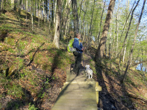
I walked part of the way with Loren and little Koa. This is on the esker, a favorite feature on this piece of trail.
hiker and dog on an esker


So, back to my "purpose" for the hike, other than just a nice hike. We now have an agreement in writing that allows the trail to cross a small bit of private property. Because this is the end of a switchback on a steep hill, we really need this access. The owners agreed to put the agreement in writing, and we promised to get the blazing spiffed up yet this fall. We will get the correct signage up in the spring. The government shutdown meant we couldn't get the signs until just a few days ago anyway.

So, all I did was to freshly paint the non-standard arrows at the corner, touch up and add to the standard blazing near that turn. But the minimum hike in is two miles, and it's an hour from my house, so I hadn't gotten there yet. Now it's done.

This picture shows the uphill leg of the switchback. I added the "confidence marker" blaze- circled on the right- just after the turn. A confidence marker is an extra blaze soon after a turn that lets people know they have made the right choice. The circled blaze farther up on the left was already there, but I freshened it.
blazes painted at an abrupt trail turn


This shot is coming up to the turn on the lower leg. Those arrows have been there a long time. They aren't standard, and we will try to replace them in the spring. For now, I brightened them up. And the circled double blaze on the tree, I added. I also added a turn blaze coming from the other direction.
blazes at a trail turn


I also scouted out, by vehicle, another potential trail re-route that we just found out about. Can't say any more yet. But it was a very productive day at it relates to my new position.

Not much else happened. The morning was cold and damp, but not really raining. Hiking was a good outdoor use for a somewhat nasty day.

Miles hiked in 2025: 450.6
NCT miles hiked in 2025: 249.8

North Country Trail, Highbridge north parking to the esker and back. Total- 5 miles

A lot of these same locations in better weather are at the link below.

See A Test Along the Manistee

Saturday, February 17, 2024

Cold, but Sunny

 It was 16 degrees this morning, but a small group of us decided to hike a few miles. The awesome news is that the sun was out most of the time!
blue sky through winter trees


This is the same section I hiked last week (link below), but things certainly look different today. And look at the shadows!
shadows in winter


Six of us met and broke new trail in the snow.
winter hikers


We had two dogs with us. You know Koa, and you know that she is pretty small, about 20 pounds. But look how tiny Roxy is! Roxy is a Tibetian Spaniel. I'd never heard of that. She will only grow to be about 15 pounds. She's so tiny that she got to ride in a pack the whole way, and even with her warm coat and being in a pouch, she curled into a ball and hunkered down. You can see the little lump in Peg's front carrier in the picture above.
two small dogs


Naturally, the topic of greatest discussion was the blue sky. And what a lovely shade of blue it was!
blue sky above red pines


Other than that I did some editing and writing. Walking in the snow was hard. I stressed my sore knee a bit.

Total miles hiked in 2024: 102.7 of which 18.7 is North Country Trail.

North Country Trail, Lake County, MI. Timber Creek TH to FR 6428 and back. 5.2 miles

See Before the Rain

Thursday, May 13, 2021

"Old" Trail Section, New Season

  Loren and I met up this morning to look at a section of trail where the Eco-Seeds volunteer crew had done some work a couple of weeks ago. One of the things they did was to replace the supports on this small bridge. You can see the new lumber. small trail bridge

They also installed some steps on a couple of steeper slopes. It's always good to have some enthusiastic younger muscles to work on some of the construction projects. trail steps

The white birch are just beginning to get leaves. white birch against a blue sky

This piece of trail follows the south shore of the Manistee River for a short distance. It's certainly wonderful to see the trees greening up! Manistee River

But the big surprise was the wildflowers. I've mentioned before that most of our chapter's trail is in dry sandy hills. There aren't a lot of wildflowers in those areas. But here, down along the river, and climbing to the top of the bluff, there were lots! I'll have to remember this. It was quite interesting that there was still some bloodroot in bloom. It's mostly done by now. bloodroot

Lots of toothwort, but the sun hadn't really hit the flowers yet for the day, so they were closed up and a little droopy. The flowers don't open flat, but a little more than this. toothwort

Miterwort was a welcome sight. It really likes damp places. It was growing at the base of a tree. The roots probably create a little cup of moisture.
miterwort


And there were quite a few trilliums, too. Also saw trout lily, and woodland horsetail. trilliums

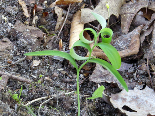
I liked this one- it's just a Solomon's seal opening its leaves, but the curls are so perfect! solomon's seal leaves

I had to take a new picture of the pups. They've had haircuts, and you'd hardly know they were the same dogs. I don't think I've ever seen Corky (the white one) shaved. two small dogs

Anyway, it was only 4 miles, but it was a great hike- learning new things about a familiar section. We put out some new stickers on posts too.

North Country Trail miles in 2021 is at 280.

In other news: Did shopping and errands, and I'm getting ready to leave in the morning for more errands in Grand Rapids and then a vendor event on Saturday. I hope to squeeze in a little hike tomorrow. We'll see.

North Country Trail, Manistee County, MI, Highbridge to Chicago Avenue and back. 4 miles

See More NCT Hike Fun

Thursday, March 4, 2021

Uneven but Sunny

  Loren and I took a hike on the North Country Trail. It wasn't as difficult as the icy trail at the state park on Tuesday, but the packed trail was really uneven. It was a joint-jarring walk. But... the sun was shining and the temperature climbed above freezing. All good! sun through pine trees

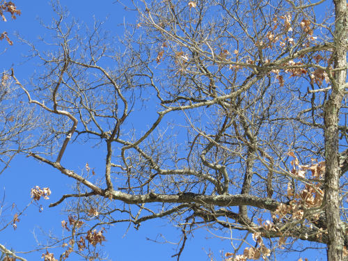
The sky became that brilliant shade of blue that just amazes me every time I see it. The gnarly oak branches are a nice contrast. blue sky through oak branches

This strange linear burl seems to have all kinds of protuberances. Looks like some sort of spiny animal crawling up the tree.
burl


I know it's not much color, but the lichen and moss mingling on this tree are at least not brown and gray. lichen and moss

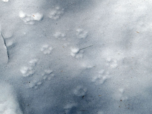
Who made these little tracks? dog tracks

Dear little Koa, of course! She's always an enthusiastic hiker. black cockapoo

We managed to walk outbound 2.6 miles before the trail became just postholes through an icy crust. Then it was no fun any more, and we turned around. But it was enough.

NCT Hike 100 Challenge for 2021 is at 78 miles.

North Country Trail, Lake County, MI, Freesoil Trailhead south 2.6 miles and back. Total 5.2 miles.

In other news: I continued to work on editing.

See Icy and Windy

Thursday, February 11, 2021

Moods of the Winter Woods

  Loren and I snowshoed today. Our primary goal was just to see how much we could do before we got too tired. We started at Timber Creek on the North Country Trail.

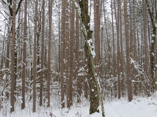
Remember, we got significant snow over the weekend. That made different parts of the woods look different. This is a red pine plantation. Can you find the blue blaze? winter woods

Still a lot of red pine here, but quite a lot of understory catching the snow on branches. winter woods

A little farther and young white pine were growing up between the deciduous trees. winter woods

How did we do? The first mile or so had been previously snowshoed, so that wasn't bad at all. Not long after that, it looked as if the hikers turned around, but there had been a fat tire bike that had gone on. Then even those tracks disappeared. That was a little weird, since it wasn't obvious that the rider had turned around, but suddenly there was no track. We went about another half mile, for a total of two miles out. Then we turned around. In the picture below we were still in the previously snowshoed track. winter woods

Koa was hilarious. Loren said she had barked her "I need to poop" bark even before we started, but the trail was a trench that was halfway up her back. She didn't want to go into the deep snow, so she managed to hold it for more than two miles. Finally, on our way back, she couldn't hold it any longer! So, the humans got to clean up after her.

The return trip was graced with a few snatches of sunlight. Amazing how much better that makes a person feel! winter woods

So, we managed a total of 4 miles. I was tired, but my knees didn't hurt, so that was good. It was not a good day for equipment. The binding on one of my snowshoes broke and I had to jury-rig it to finish the hike, and one of the clips on my snow boots broke (not the new boots).

Hike 100 Challenge for 2021 is at 67 miles

North Country Trail, Lake County, MI, Timber Creek north, 2 miles and back

Best thing other that that was another gorgeous sun pillar for the sunrise. sun pillar

In other news: I managed to work a little bit on a couple of projects, but I actually fell asleep this afternoon. I don't take naps too often, but I did today!

See A Worthy Sun Pillar

Thursday, February 4, 2021

Dead Horse Marsh in Winter

  Loren and I hiked again today. We decided to take a look at Dead Horse Marsh in winter. Link below to see what it looked like this past spring. Our NCTA chapter built this 600+ foot boardwalk because of the years that it does look like this past spring! Dead Horse Marsh

A lot of the jackpine that had grown up during the ten years since the last high water event are dying- all the ones right along the boardwalk in the picture above are dead. That's actually a good thing. This marsh is a rather unique wet meadow, and for that to be preserved, it needs to be open. This is a long view away from the boardwalk. Just a few larger dead trees, which the birds love. Dead Horse Marsh

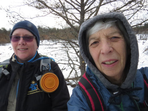
The selfie to prove we were there and sufficiently bundled up. Actually, it was pretty warm- right around freezing. friends

The most interesting "find" of the day for me was a better understanding of the topography of that section. We walked to Taylor Road (just a two-track) before we turned around. But I had never noticed before how much higher the land is before you reach Taylor Road. Turns out it's forty feet higher. I know this isn't huge, but for all the times I've walked this (and it used to be the section I maintained, so I've walked it lots) I hadn't noticed this. Between Dead Horse Marsh and Taylor Road, I would have told you there were some little hills and a number of wetlands. That is all true. But it turns out that the "little hills" are really all part of one lozenge-shaped hill that is about a mile long (N-S), and half a mile wide. This raised area is (like pretty much everything else here that isn't a relic sand dune) a remnant of the terminal moraine of the last ice age. All those little wetlands are perched (yes that's what they are called) on this hill.

A perched wetland is one that has no natural inlet or outlet. It is only fed by rain and general drainage from the surrounding land. Since wetlands were my specialty topic in grad school, I knew this already. Most of these wetlands are filled with leatherleaf. In fact, this is where I collected the leatherleaf to make the fake mistletoe ball for the cover of Dead Mule Swamp Mistletoe.

I drew a line across this picture because you can't really see what I was trying to show in the photo. The line is the height of land after we turned around. But I had just never really noticed, in the summer with all the greenery, how the trail climbs to the top of that hill. There are numerous high points at 750ish feet (Taylor Road where the trail crosses is about 710), and the trail winds between those and down into little channels between those knobs. Now, I'll think of them as eroded drainage channels. height of land

We ate lunch at the first of those high points, and sat looking away from the trail, down off the north end of that hill. Well, the humans did. Koa mostly looked at our sandwiches! winter valley

Greens of the day include some nice moss, and wintergreen adorning a pine cone. moss wintergreen

We hiked just a tiny bit over 6 miles. NCT Hike 100 Challenge 2021 is at 63 miles.

North Country Trail, Mason County, MI, Tyndall Road to Taylor Road and back. 6.1 miles

In other news: I got some groceries in anticipation of the big snowstorm we are supposed to get tonight, came home and cooked myself a treat of a hamburger (which I hardly ever do- maybe twice a year), and did a little bit on a couple of projects.

See Dead Horse Marsh this spring

Tuesday, December 29, 2020

Bowman Lake Loop with Loren

  Loren and I did the 6-mile loop at Bowman Semi-Primitive Area today. It's one of my favorites. It was a chilly 15 degrees when we started. Although it warmed into the 20s later. winter trail

Bowman Lake is always lovely. Not a lot of color today, but that's OK too. Bowman Lake

Just an interesting dried fungus on the end of a log fungus on a log

Koa wanted people treats. I think Loren was shocked! Haha. hiker and small dog in winter

We did 3 miles north on the Bowman Trails, and then the 3 mile return on the North Country Trail. I usually seem to hike it in the other direction, so this was slightly interesting. We met several other hikers!

The boots are making a sore spot on my right ankle bone. I'm going to assume I just need to get them broken in a bit more. But it may mean I wear something else for a day or two.

North Country Trail miles for 2020 is at 276.

In other news: I did some editing and bought a few groceries.

Bowman Lake Trail and North Country Trail, Lake County, MI. 6 miles total

See Bowman Semi-Primitive Area