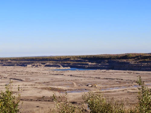
I'm getting a lot of mileage out of our Sunday trip to the Index Finger of Michigan. But it was very cool. I was simply dumbfounded that the world's largest limestone pit/quarry is located there. I had no idea. This is a 12.5 square mile site. They've set up a nice viewing platform with some interpretive materials. I suspect the location of that was an old home site, because of the road lined with old old maples that took you in to it.

I framed the pictures somewhat carefully because the tops are beginning to die out. Nevertheless, they are magnificent trees.

Looking to the left, which is just slightly east of north (and after living on the other coast for 45 years, it's really hard to think of left as north when facing the water!), you can see an angled chute or elevator. That is 1.6 miles away. Just to the right of that there is a dome, partially hidden. That is the power house at 1.7 miles distant.

The central area of the quarry.

This is the long view of what I showed you the other day. The bulldozer is 14 feet high, and the far production wall is 2.6 miles away.

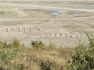
This bit of interpretation is 3/10 of a mile away. I think this is great, because who's going to remember what they read on the sign? But they probably take pictures of this, and it's a much more graphic memory aid. And it's no coincidence that the barge, Calcite, whose pilot house you saw was built in 1912. It was the first of six, sister, self-unloading barges that specifically served this quarry.

The chain link fence had some decorations too. I suspect there was a contest for employees' children to design a safety poster, and the best ones were enlarged and printed as banners. Here's one.

Hope you enjoyed the tour!
 | See 40-Mile Point |
| if you like this blog, click the +1 | |
4 comments:
Those old trees are beautiful. Whenever I hear about a quarry I just automatically think of Fred Flintstone :)
Very interesting. I enjoyed that--a lot.
We did!
Very nice tour!!!
Post a Comment