Sorry, I'm still sorting flower show pics, and one of my assignments took me past a place I had previously promised you. You might remember that I have showed you the high point in Mason County as viewed from my kingdom. That's at The Highest Point

The high spot is the hill behind the radio tower. It's a bad place to be stopping a car, but it's not a busy road, so I grabbed a couple of pictures. Here is the view to the east.
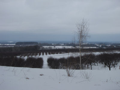
And then, I tried once again to see if I could find our hill, to the northeast. Even in the winter, the answer is "not really."

I thought the camera might help, so I zoomed in

As always, I can easily find the Scottville water tower. So we should be just a mile to the west of that, but it's impossible to see anything due to the trees.
 | See The Highest Point |
5 comments:
You are searching for "you" hill.
Then you can name it after you.
lol.
Looks like a nice area. Every time I ever try to pull of the side of the road to take pictures it never fails, I always attract traffic
rainfield- I have unofficially named it Mulberry Hill, since we can grow those trees so easily.
Ann- I should go back on a clear day, park somewhere safer, and get some better pix.
Can you locate your home with Google Earth? I have so much fun with that.
Carmen- yes, but the resolution isn't good in most rural areas. I thought I would use a part of that map to show where these places are some time.
Post a Comment