This day (Monday) we knew that we had a bit of a challenge. The first couple of miles of trail weren't trail at all... yet. A route had been scouted by a man named Bill Menke, who is well known in North Country Trail circles. He's currently the Regional Trail Coordinator for Wisconsin and the Upper Peninsula, and he's a trail builder extraordinaire. Bill is the person who first taught me to look at how a trail is placed on the ground, and why some choices are better than others. He had been through here with flagging tape, but four years previously!
So our first challenge was to hope that the flagging tape was still in place. You can see in the picture above that there are two bright ribbons. This was the sight that greeted us from the end of the logging road, and we were glad! Knowing that Bill laid out this route was also very useful. We could trust that he had not taken the route directly down any steep slopes, or run it along the bottom of a wet valley. Bill lays out good trail.

However, there were a few points where the tapes had come down or broken... whatever, we had to really hunt for the next one. This picture looks pretty much like a person standing in the woods. That's exactly what it is. One of us stood in sight of the last ribbon and the other one hunted for the next one. Most of the time, this did not take too long. However, we did spend almost an hour hunting up how to leave a point of interest where there had been an old building of some kind. By then we were almost at the end of this section, and could have just skipped "the route" and gone to the next piece of trail. It was easy to figure out, as we were near Cole's Creek, but we were determined to find Bill's route, doggone it! We eventually did find it, and followed the flagging tape to an open meadow.
The meadow is really the former bottom of Silver Lake Basin which emptied when a dam broke several years ago. They are refilling it slowly so that the vegetation which has grown up doesn't just rot all at once. Cole's Creek is one of the feeder streams. Below, you can see me testing a log to be sure it is safe to cross. We had a nice stop here to get water and dry our tent since it had rained the night before.

The next challenge was to find previously built trail. Lorana told us that it hadn't been maintained very well, because it's a long hike in there with no road access. So we chose a route to bushwhack up the slope out of the basin, with the hopes of recognizing the trail when we crossed it. With very little problem, except for pushing through alders and hemlocks we found the trail, and it wasn't bad at all. We have seen some really bad trail in our 20 years of these hikes. While it's true that this section needed a bit of work, it wasn't nearly as terrible as we had been warned.

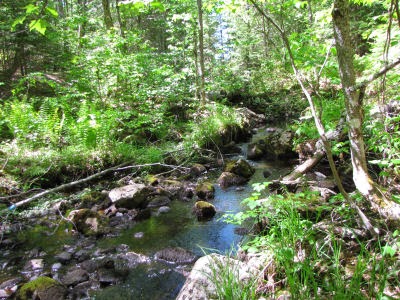
The rest of this day was very hilly and rocky. The trail went continually up and down steep hills with rough treadway, and we only made one mile an hour for the next four hours. Whew. But it was beautiful even so. This is Wildcat Canyon, a small rocky creek.

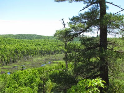
A little later we were high on another bluff with this view of the Dead River upstream from where it feeds Silver Lake Basin. I'm trying to refrain from posting an overwhelming number of pictures. We also passed a lovely small pond and more big rocks than we could count... all of which make me ooh and aah.
 Finally, at the very end of the day, we reached this rocky waterfall with no name. It sluices down a natural flume into a pool below. We treated water and soaked our feet because we knew that we would be camping in just another tenth of a mile. And we did just that in a nice meadow, having covered about 9 miles of difficult trail.
4 comments:
Another lovely day on the trail. That was fun, and I enjoyed the great pictures that you shared.
Love your pictures, although rough trails I imagine it was quite enjoyable also.
Incredible journey, you two. The pictures are just beautiful though it looks like a rough trek, at times. I admire your stamina.
Something I've never had to do yet is to figure out where the trail is. It's something I've actually fantasized about, thinking of the challenge.
Post a Comment