Entries to Win Afghan

Sign up to receive the Books Leaving Footprints Newsletter. Comes out occasionally. No spam. No list swapping. Just email me! jhyshark@gmail.com Previous gifts include a short story, a poem, and coupons. Add your name, and don't miss out!

Monday, December 5, 2022

Pictured Rocks 3 - Day 370

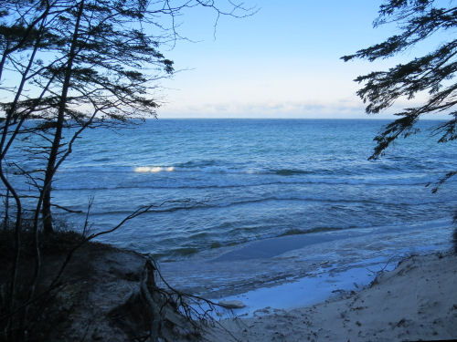
  This was the last day for a long while that I will have to hike in on a spur trail to access the NCT. But when we got to the beach, guess what? Lake Superior was still there. *wink*
Lake Superior

This picture was taken yesterday, but you can see how the cliffs ahead of us are diminishing from what you saw yesterday down to not much at all. That is the part we were walking today.
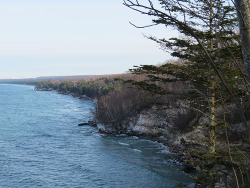
Lake Superior shoreline

Quite often, the trail is right on the edge of the lower bluff, about 20 feet above the narrow beach.
trail on bluff

We crossed the rustic but stable Beaver Creek bridge. There is a huge logjam of trees downstream of this at the mouth of the creek. We think that might have taken out an earlier bridge.
Beaver Creek bridge

This is probably the most photographed car in Pictured Rocks. This time, I have attempted to identify it. My efforts involved asking friends who know cars. I guessed 1940s, but Vanilla specifically says it's a 1940 Chrysler. Possibly model Windsor. Car buff, Bill C., says it's a 1940 Plymouth. Grill looks like Plymouth. Fender looks like Chrysler. Maybe a custom build?
1940 Chrysler

Also this time, I attempted to drive it away. Nothing doing. The only way I was getting on down the trail was to keep walking.
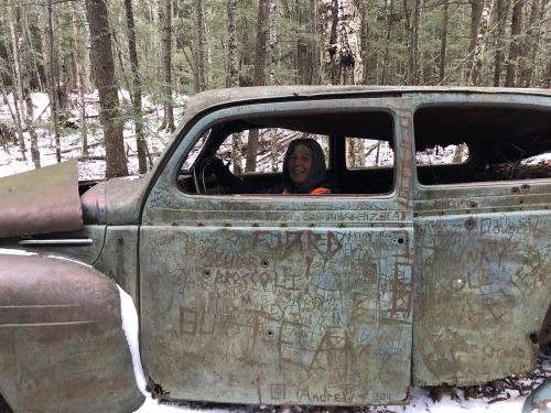
1940 Chrysler

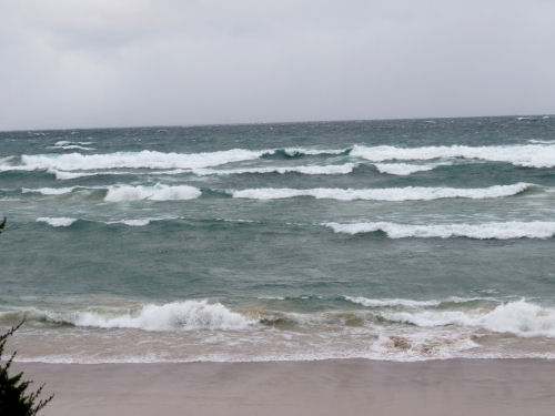
The lake was kicking up some big surf today. This picture does not begin to capture what we were seeing, but I'll share it anyway. The inner curve of many of the waves was a clear emerald green. Sure wish I could have gotten a good picture of that. The camera picked up the blue tones, making it look aqua.
green waves

Bill likes to check the freighters out on the lake. This one was only a couple of miles off shore. It's the Algoma Innovator, a self-unloading dry bulk carrier put into service in 2017. It's 650 feet long.
Algoma Innovator

The trail was mostly clear with little topography. We finished in good time. I need to get to bed because tomorrow we are moving the trailers early and then hiking a full day.

Miles today: 12.8 that count (plus 1.5 on a spur trail). Total miles so far: 4227.2. And the miles yet to go has slipped below 600!

See Pictured Rocks 2

Sunday, December 4, 2022

Pictured Rocks 2 - Day 369

  We were so fortunate that our second day in Pictured Rocks, with the bulk of the interesting formations, was a sunny day. Lake Superior was an astonishing color.
Lake Superior

This section is just one gorgeous headland after another.
Pictured Rocks

Grand Portal Point is somewhat unique in that the top is bare rock.
Grand Portal Point

Bill had to get his picture there too.
hiker on Grand Portal point

The views just never stop. This is one of the nicer pictures.
Pictured Rocks

All too soon, we could see the formation at the east end of the more spectacular ones, Chapel Rock. It's that square bump with columns that is in front of the cliff.
Chapel Rock

I have to wonder how much longer this will last before the lake claims it. It's looking much more fragile than the last time I was here. Again, you used to be able to walk out into the "chapel" between the columns. Now it's fenced off for both the protection of the people and the formation. It would also be difficult to get in there now. The tree on top is famous, because if its one root to the mainland breaks, it will die.
Chapel Rock

I also love the details as well as the overwhelming impressiveness of the cliffs. The waves were a constant presence, even though the wind wasn't nearly as strong as yesterday. Sometimes they swished with the rolling sounds of waves on beach. Sometimes they boomed as they hit the cliffs or piled into caves. We could even feel them hit beneath our feet sometimes.
waves on rock

This is a reminder that these cliffs are constantly changing. I don't know how recently, but this entire face has fallen in the last few years. The rock colors are bright and not stained, nothing is growing in the cracks yet. I'm pretty sure the trail used to go across here. Now it swings inland around the back of this cove.
rock slide

We went through several short stretches of ice forest again. But this is my favorite ice picture of the day. It's like feathers.
ice pattern

Finally, I loved this tiny hole in the base of an immense cliff. It won't be a tiny hole too long. Water is already washing through it with every wave.
hole in rock

I have lots more pictures, but I'm going to stop with these. It's still a lot. This is such a unique and special place along the North Country Trail. We could have hiked faster, but we kept stopping to watch the waves, look at the rocks, and say, "Wow!"

We are so happy that it looks for sure as if we'll be able to complete Pictured Rocks. We are now done with the area of high cliffs, but there are more miles that are still within the National Lakeshore. The weather looks great. This morning was the coldest yet this season, but I added an extra layer and I was just the right temperature.

Miles today that count: 8.3 (plus 4.4 on side trails- we made a wrong turn or it wouldn't have been quite so many). Total miles so far: 4214.4.

See Not So Fast

Saturday, December 3, 2022

Not So Fast - Day 368

  Mother Nature put up a bit HALT sign this morning. Sometimes I feel like I'm playing the kids' game, "Red Light, Green Light." We expected snow showers and some early winds.

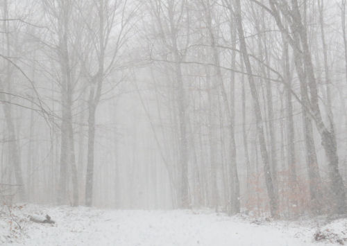
What we got was an hour of rain last night which laid down ice under about 2 inches of snow, and then gale force winds. Some places along Lake Superior showed winds in excess of 50 mph. Sorry. I'm not hiking in that. What we did do was drive to check out the roads we want to access to complete the park. The bottom layer of ice wasn't too problematic, and we were able to get to all the access points. But here's what the morning looked like. The snow was in bands, so some spots were like this, and in other places it was not snowing at all.
snow storm in woods

Lake Superior was looking unfriendly, and just taking that picture in the wind made us very glad we decided to not hike.
Lake Superior


I spent the afternoon napping and writing my next column about this hike. I think we are good to go for tomorrow. There's not enough accumulation of snow to close the roads, and the wind has died down. But this is how things go when you are trying to hike through the winter.

See Pictured Rocks 1

Friday, December 2, 2022

Pictured Rocks 1 - Day 367

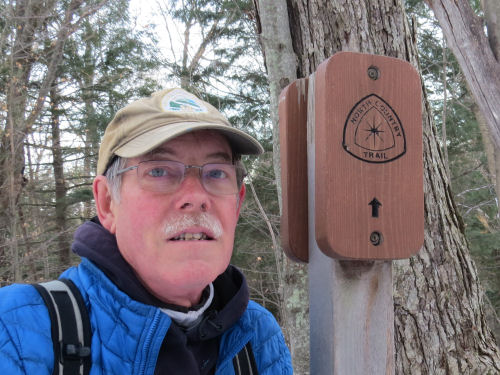
  We successfully hiked part of Pictured Rocks today. Four days should complete it, and right now, the weather looks clear for longer than that. I feel really good about being able to hike sections as planned and not continually having to change things. I love the new laser-cut signs being used in the park. Pictured rocks has always had trouble with people stealing the trail emblems, and I'm sure these are really tempting. Shucks, I wanted to take one home! I was surprised to learn that there are no blue blazes at all, just signs like this one, or with additional info at the junctions. If that was true before, I certainly had forgotten.
NCT sign

The first really interesting feature you come to from the west is one of the most famous, Miners Castle. Probably most everyone knows it used to have two turrets, but in 2006 one of them collapsed into the lake. Of course, you can't go anywhere near it now. But I have pictures of our family climbing all over it in 1976.
Miners Castle

I think the white ice stripe coming down the cliff in this picture is Bridal Veil Falls. One web site says it's not visible from the NCT, but this is in the correct location. One thing for sure is that Bridal Veil is usually dry in summer. Whatever waterfall it is, I haven't seen it before this hike.
Bridal Veil Falls

The hike today was relatively level. We did have to climb from Munising to the top of the sandstone cliffs. Then after Miners Castle, we dropped down to Miners Beach, and then climbed back up through about a billion years from Jacobsville Sandstone, through the Munising formation, to the top of the AuTrain Formation- a mere 350 million years in about 200 feet.
Mosquito beach cliff

Lake Superior is often harsh, but here's a softer look.
birch trees by Lake Superior

The lack of snow was excellent for hiking, but may not provide the winter landscapes some of you were hoping for. However, where there were small waterfalls or where waves tended to splash high, an interesting phenomenon occurred. The wind blasted the spray against every twig and branch, creating ice forests. Today was warm, and we actually had to watch out for falling ice. Can you see how these trees are coated along the trunks and branches?
icy trees

Some of the formations were either eerie or fantastic due to the role of the wind in their creation. They looked like teeth and angel wings and birds.
ice formations

We got one view of the side of the cliff decorated with these ice sprays.
ice formation

Right after all the "ice forests" was a stretch where wind blows the sand right up over the cliff edge and covers everything. Instead of crystaline beauty, this looked like a desert. The contrast was stark and exceptionally fantasy-landish.
forest covered with sand

Miles today: 13.5 (plus 1.9 on a spur to get to the car). Total miles so far: 4206.1. Over 4200!

See Year Two... And, Go

Thursday, December 1, 2022

Year Two... And, Go - Day 366

  Today's walk was pleasant. I enjoyed the way the little bit of old snow created white shapes, and the dusting of new snow turned the leaves to pastel.
snow in woods

I'm always fascinated when the cut ends of logs show a star pattern from being cut just above a node where new branches emerged when the tree was growing. This one was even more interesting, in that some fungus had grown only on certain textures of the cut wood, enhancing the shapes.
log cut end

Just another appealing picture of the trail today through woods. The old snow was crusty, but usually it had a clear treadway.
snowy trail

The landmark today was that we walked through Valley Spur Ski Area. This is the lodge. The skiers would like more snow ASAP, but we were happy to walk less slippery trails.
Valley Spur lodge

The biggest challenge of the day was that we had to take a late start because Bill had an online appointment that was not negotiable. We didn't put feet on the trail until 10:45. That meant we finished in the last of the sunlight with a road walk. See the alpenglow?

Another thing that held us up in the morning was getting information that was SO worth the delay. Last night we figured out a way to walk through Pictured Rocks as day hikes. Right after we finished making that plan, Bill found a map that showed all the secondary access roads (the ones we needed) as closed starting December 1, and only open to snowmobiles. Well, there's no snow, but how serious are they about closures? Would we get ticketed, or worse, towed if we drove in to these internal trailheads? We were able to get a concrete answer that we would not be in trouble. They just like to be consistent with their winter preparations, so they use that date. We promised to use good judgement, but there's nothing in the forecast but some light flurries for the next few days. We think we are golden to get through.

We finished the hike just at dark, using the blinking mode on my little light for safety. We celebrated good miles and the workable Pictured Rocks plan by getting olive burgers and tater tots before heading "home."

One thing that was neat, although it was too dark to get a picture, is that Munising was having some sort of evening Christmas shopping/family event. One street was all blocked off and we couldn't figure out why. Then we saw a team of horses pulling a wagonload of people. There were free rides through town!

Miles today:14.7. Total miles so far: 4192.6.

See One Year