Entries to Win Afghan

Sign up to receive the Books Leaving Footprints Newsletter. Comes out occasionally. No spam. No list swapping. Just email me! jhyshark@gmail.com Previous gifts include a short story, a poem, and coupons. Add your name, and don't miss out!

Wednesday, November 30, 2022

One Year - Day 365

  This sunset was from a few days ago, but it's pretty, and it's a good end-of-year picture.
sunset

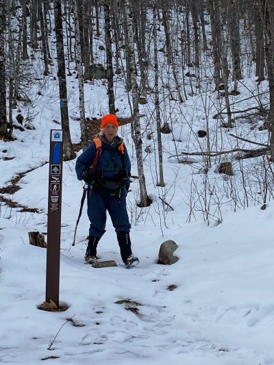
Originally, I was hoping that I'd be walking into Timber Creek trailhead today. That is now about 641 miles ahead of me. But I do have 4177 trail miles behind me.

Last night I was really discouraged. The weather forecast was terrible. It looked like winter was going to arrive with a vengeance across the entire Upper Peninsula. I wasn't willing to keep creeping along at under 10 miles a day for more than another two months.

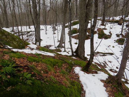
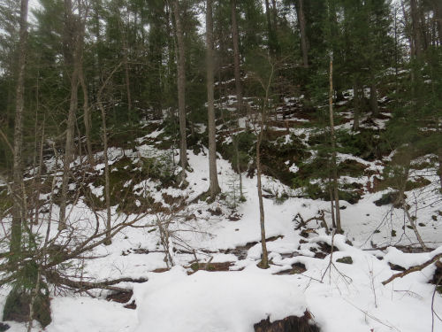
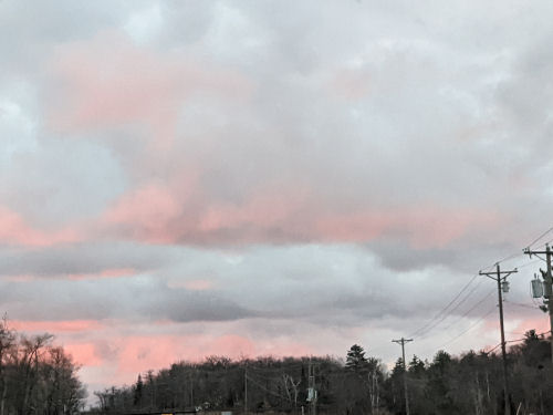
Today, here's the situation. The western UP got buried again. There is over a foot of snow in the specific location I need to hike yet. I'm officially declaring that orphaned for the time being. (Barring some total weather anomaly where Christmas in the UP becomes tropical.) But the predictions for where we are now turned out to be completely wrong.

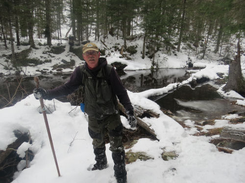
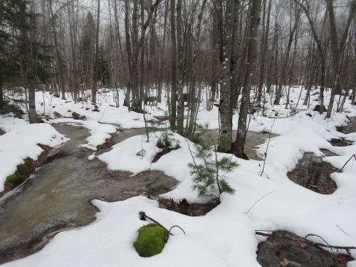
Bill is going to stay for a while yet, for at least a week. The terrain is easier, the weather looks chilly but dry, and there is very little snow in the eastern UP. We are going to try to really knock out some miles. We got together this afternoon and worked out a plan that looks quite do-able. After Bill leaves, if I can get someone to spot me and the weather holds, I'll continue hiking.

However, I've decided that if the weather becomes unmanageable, I will take a break and go home for a while. I WILL have to come back in the spring to get the 95 miles I have to temporarily abandon. Am I disappointed? Yes. Can I accept this? I think so. All you home peeps... if you see me during that interval, ok, but NO celebrations until I WALK back into Timber Creek which I will save for the true end. Got it?

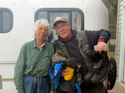
Sue and the pups left today. Much thanks is due her. She's helped me for more total days than anyone else in the past year. And I know it's a pretty thankless job. Now it's Bill and me for the next little while.

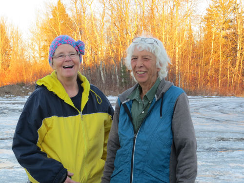
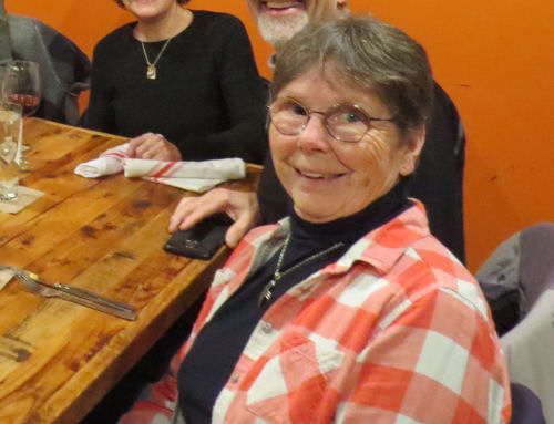
I also want to thank our last host, Lorana. She's become more than "just" a trail friend. We figured out that we must have first met in 2007 at the Bemidji NCTA Conference. She hates having her picture taken, but I think this one from the night the chapter took me to dinner is nice.
woman at restaurant


No miles today. I just plain goofed off all morning. Then I did a couple of small chores, and Bill and I moved our trailers to our next location and planned the next week.

See McCormick Wilderness

Tuesday, November 29, 2022

McCormick Wilderness - Day 364

  After another 90-minute drive in the dark (this one by Sue) to deliver us to a remote starting location, I revisited the waterfall there. Bill and Sue had not yet seen it, so they did get a tiny reward. We arrived a little later than the other day, so the color in the picture is better. It's the same waterfall as two days go.
waterfall

But this time I hiked west. Before long, we entered the McCormick Wilderness and crossed this small creek that had been all muddied up by someone. Very recently, too. The splashed mud was still fresh.
muddy stream

Can you guess who made that mess? A moose.
moose track

In fact, we saw lots and lots of evidence of moose activity in the easten half of the McCormick. This picture may not look like much, but it's a spot where a moose had slept. There was a nearby pile of poop- the freshest I've ever seen. It wasn't steaming, but it hadn't been there long.
moose bed

The other thing I didn't remember about the McCormick was how many huge rock formations there are. This is just one of many.
large rock

We found another moose bed, and there were tracks all over the place, often using the trail as a relatively easy path through the woods. This is definitely the largest moose track I've ever seen. I wouldn't say it was the size of a dinner plate, but a nice dessert plate size. And you can see the marks from the dewclaws. When these are visible, it usually indicates a big, heavy individual. Probably this was made by a big bull moose.
big moose print

So, what was it like going through the McCormick? The eastern half has not been cleared since that first heavy snowfall they had in October. We had to use Avenza a lot in there because of the number of trees that were down. We'd find a piece of treadway, but then it would disapear under a pile of trees, and we couldn't find it on the other side. Remember, no blazes are allowed in the wilderness. There were a lot of rocky hills and flooded places in the valleys. We just spent a lot of time working our way around all these obstacles and trying to stay aligned with the trail line on the Avenza app. It was easy to tell when we were in the treadway. The section gets enough use that there was a slight depression, and the trail opening was clear of small shrubs.

The western half has been cleared since the storm. It was easy to follow the treadway, I think we checked Avenza maybe twice in those 3 miles. There were also fewer steep hills in that half.

One fun feature that I wasn't aware of before is that the trail goes right by the high point of Marquette County. It was an easy walk to get to the top. We had to go! This is my 6th Michigan County high point. The hill itself has no name.
hiker on high point

Bill said, "Overall, I thought this day was pretty easy." Joan said, "Are you kidding? I would call it strenuous." I really struggle with climbing over so many fallen trees that are crotch high.(Or, alternatively, to walk around them with hidden holes under the snow where branches are trapped.) It took us 7 hours to hike the 8 miles. In the early afternoon it started to snow/sleet/rain with the emphasis on rain. But we made it to the western trailhead of the McCormick, our intended goal.
McCormick Trailhead

I've now successfully closed the 20-mile gap between the above point and Red Road that required the long difficult drives to remote trailheads. It took me 3 days instead of the two I'd hoped. It is taking a lot of resources and time to hike very few miles. The weather may be horrible tomorrow. The forecasters can't seem to agree. However, I'm beat. We need to reorganize the plans again (AGAIN!) and re-think this. If I can't even make 10 miles a day, perhaps I need to take a seasonal break. There are still about 100 miles west of here that I skipped, and they are getting dumped on again tonight.

I'm taking a rest day tomorrow.

Miles today: 7.9. Total miles so far: 4177.9.

See A Bigger Surprise

Monday, November 28, 2022

A Bigger Surprise than Anticipated - Day 363

  The surprise I had in mind is telling you that Bill is back! And this picture was taken at the end of the day. That way you know there is a happy ending even if we both look tired. We had another surprise about 3.5 hours into our hike.
hikers

We set out to fill in the piece I was not able to complete yesterday. We began with a great view of the Dead River Valley. (After Michael again delivered us with a 90 minute drive to the middle of nowhere)
Dead River Valley

Sunrise from the top of the ridge was pretty awesome. I'm not a sunrise person as you know, but if I have to be up, that's a good place to see it from.
sunrise from a ridge

We conquered a lot of rocky hills.
hiker in saddle of hills

And successfully got across Wildcat Canyon Creek on rocks.
snowy creek

Michael had told about this log bridge at Cole Creek.
Cole Creek

Bill crossed first. He fell off the log not once but three times, wetting everything but his head and one shoulder. Yes, he gave me permission to tell the story. This is how fast things can potentially turn serious. This looks like an ordinary picture, which is deceptive, because he was soaking wet.
wet hiker

I got across the log safely.

Decision time. I had the means to build a fire, but Bill did not want to do that. He thought the solution was to keep moving as fast as he could to generate body heat. So he started hiking as fast as he could toward our pickup point. I could not have kept up with him, so I followed his tracks to be sure they stayed on the trail, and watched my phone for any hint of a cell signal to reach Sue and Michael. I finally got messages through to both of them. I didn't know where either one was, so I didn't know who could get there quicker.

I told Sue to bring blankets, hot drinks, and dry clothes if possible.

It turned out she was shopping at a Goodwill, so she bought some generic clothes and a blanket, picked up a hot drink and scooted for the end point.

Michael was doing trail work, and was 20 minutes away from his truck, but he started heading there as fast as he could.

Once, Bill lost the blazes and was wandering around at the bottom of a valley. I was concerned that he might be getting cold and disoriented, but then he found the trail again. Whew! I figured that since I was following his tracks, and he was between me and whomever got to the pickup point, if something happened, I'd find him. He did leave some messages for me, written in the snow, that he was OK.

Finally, Sue texted me that she had reached the meeting point, and Bill had not yet arrived. Whew! I knew Bill would not stop if no one was there. He shouldn't stop. He would keep going until he got to a house, but the first one he could have reached was another 3+ miles farther. I was also concerned that he would not recognize the turnoff to get to the car, so I was hoping/praying that either Sue or Michael would get there in time to "catch" him.

Eleven minutes later, Bill appeared. Sue texted me that she had him, and all was well.

It took me another 20 minutes to get there- Bill was hiking that much faster than I. But that was fine. I was in no danger. I just couldn't go that fast on the snowy hills.
hiker in winter


We delivered Bill to Michael's house where he is staying so he could get a hot shower and start drying his boots.
friends


So, we are sharing this to remind us all how quickly things can change. You might say we should have stayed together, but I could not hike fast enough to let Bill stay warm, but I could get arrangements made for a safe ending. I could also monitor Bill's stride, and if he started walking as if he were disoriented, I could call 911. And I could have gotten a fire going if I caught up to him and he was in trouble. We also had 2 space blankets with us, if they were needed.

All is well, we are hiking as usual tomorrow.

Miles today: 5.5. Total miles so far: 4170.0.

See Alternate Adventure

Sunday, November 27, 2022

Alternate Adventure - Day 362

  With some amazing help from a local volunteer, Michael, we drove out of town at 6:30, and he delivered me to a remote trailhead at 8 am, on very bad roads. My goal was to hike 12 miles. I was a little concerned about the distance, but not as concerned as I should have been.

Right at the beginning was an interesting waterfall. The picture doesn't show it very well because the water is the same color as the ice. It's flowing down a chute from upper right to lower left.
rocky waterfall

This is a beautiful but rugged section of trail. I loved the places where the snow had melted off, leaving mossy rocks.
rugged trail

It's always hard to show elevation change in photos. This is the bottom of one valley, and I hope you can see the trail angling up the rocks on the other side.
rocky trail

However, the biggest challenge was that all the low spots were flooded, and I had to work my way through these.
flooded trail

So, anyway, I was making just over one mile an hour. Not good. 12 miles= 12 hours. That was going to have me coming out of the woods at 8 pm. In case you haven't noticed, it gets dark at 5 pm. The only place to bail out was 3 miles in. On the very tippy-top of a rocky hill at mile 2, I had cell service. If I was going to change the plan, I needed to tell someone what I was doing. Sigh. I decided to bail out at Wildcat Canyon. Sue and I communicated, but she was nowhere near me, and was doing some errands of her own.

No problem, really. I had a county map on Avenza. I knew exactly what roads I needed to walk to get back toward civilization. I started down the road, and Sue would come to me when she could. It was a beautiful day, even if I wasn't on the trail. This picture looks artsy-fartsy because my lens was fogged up, but you can see the color of the sky!
winter sky

I had walked 2.8 miles and a truck pulled up behind me. The driver said, "What on earth are you doing? I've been following your tracks for a really long way." So I explained, and he told me to hop in and he would take me out to the main road where I would be able to contact Sue again.

We connected with Sue at a road junction, and Michael was also there because I had also sent Lorana a message about where I was. However, somehow I must have touched the screen again when I thought I had the location set, and what I sent her made it look like I was lost, so she had called Michael, thinking they might have to search for me. So I stressed her out for nothing. I'm really sorry about that. Note to self- be double sure you haven't moved to locator cross-hairs when you take a location.

The guy in the truck, Gary, was glad to help. He'd been hunting, and similar to how I do "drive-by botany," he was pointing out fresh moose tracks from his moving truck. He agreed that the tracks I saw yesterday were wolf, just based on the length of stride. He didn't have to drive out of his way at all, and he saved me a LOT of non-trail walking. I told him he was now Trail Angel Gary.
man by truck

Then Michael suggested a way we could knock 3 miles off the other end of this section, if I still had the energy to hike. I sure did! So we scooted for the east end of the planned hike where he led us down some totally unmarked two-tracks. I was able to hike those miles back to Sue. One of the treats of that section was an area of large hemlock trees.
hemlocks

The day did not go as planned, but I managed to hike a reasonable amount of trail. This will make the remaining section do-able in one day, even if I have to go slowly.

Big surprise coming up tomorrow- stay tuned.

Miles today that count: 6.3 (plus 2.8 that don't count). Total miles so far: 4164.5.

See West Branch Peshekee

Saturday, November 26, 2022

West Branch Peshekee - Day 361

  Today I filled in the section that I've started two different times and bailed out. Not today! I did it. The day was somewhat defined by the West Branch of the Peshekee River. You might remember that the Peshekee River, oddly, flows south. The west branch is sort of a bunch of branches.

This is the main West Branch. It is a serious waterway.
West Branch Peshekee River

Connie assured me the bridge is fine even though it's really under construction. The stringers for the new decking are in place above the old bridge. The hardest part was climbing up to walk between the new stringers.
West Branch Peshekee River bridge

However, this bridge belongs to someone else. The current owner did not think I had any business crossing that bridge!
red squirrel

The weather was warm- almost 50 degrees- and the wildlife had been out. I saw tracks of moose, bobcat, showshoe hare, (squirrels, mice, grouse, rabbits-all ho hum), and I'm pretty sure, wolf tracks too. I was thinking it was probably just a large coyote, but I found a pile of scat and it sure looked wolfish to me. The tracks were also very large and the animal was loping along. I"m not a tracking expert by any means, but it was all pretty darn big for a coyote.

There are two other crossings of various channels of the West Branch of the Peshekee. These are much more tame- really sloggy wetland drainages of all the little lakes along here. These both have nice solid bridges.
bridge

These water crossings are wide, and definitely require a bridge, but the streams aren't as active as under that first bridge. It's weird, I don't remember any of these crossings from our first trip here, although I think the route is essentially the same.
West Branch Peshekee

By this time, I'd entered Craig Lake State Park. I really had forgotten how rocky and hilly it is there. That was a surprisingly tough ending to the day, but I made it!
Craig Lake SP

This fills another gap I had left behind.

Miles today: 9.7 (plus a little extra at each end to get from/to the car, maybe another half mile). Total miles so far: 4158.2.

See Through the Woods

Friday, November 25, 2022

Through the Woods, Not Over the River - Day 360

  Today, I walked a very new piece of trail through the woods tthat replaces a great deal of roadwalk. It was hilly, but the biggest challenge was to get across this stream. I know, it looks like the aftermath of a landslide, but there's water rushing between those rocks. Those rocks that are covered with ice and snow. But I made it without getting any wet feet or other body parts.
rocky creek

Then I dropped down to follow the Sturgeon River, but not cross it, for the last three miles.
sturgeon river michigan

Finally, I caught sight of the Camelback Bridge, my destination for the day.
Camelback bridge

The warm days have melted a lot of the snow. I think these natural collages are as good as any at craft fairs.
fern leaf
striped rock

I guess I've reached the point where I'm always hungry. Someone left me a big sugared donut in the woods.
snow looks like donut

We were met at the end of the day by Connie from the Peter Wolfe Chapter. She brought me a pair of better gaiters to use, and some better bags for wading. Then she took us out to dinner!
friends

That all took time, then I had to mend the gumby pants (they and I have to last 2 more months!), work on logistics, and finally blog. Tomorrow could be tough, so I need to get to bed soon.

Miles today: 7.0. Total miles so far: 4148.5.

See The Light in the Forest

Thursday, November 24, 2022

The Light in the Forest - Day 359

  For Thanksgiving, I decided to take a hike. It was a beautiful start to the day. I'm used to sunsets over a big lake, not sunrises.
sunrise on Lake Superior

It's been cloudy for a while, so it was really neat to have sunlight shining through the trees.
sun in forest

I took a whole bunch of pictures, but most of them aren't what I had hoped. This one isn't bad. The beech leaves stay on the trees, sometimes all winter, and the low sun made them glow.
sun on beech leaves

In the afternoon, I filled in a missing piece nearer Marquette, passing by Lakenenland. This is a sculpture park created by one man who makes art from junk. There are lots of pieces, but here are two. I hope to stop by another day to get a picture of my favorite.
big cat sculpture


tractor made from saws

One really nice thing about this property is that the owner has built a truly wonderful shelter for use by NCT hikers. It has a closed front. There are now several four-sided shelters along the trail, and in mosquito country, this is a blessing. The inside has a table, benches and cots. He also keeps some basic food items there.
deluxe hiker shelter

The sun had gone away again by afternoon, but the view of Jeske Flooding was still attractive.
Jeske Flooding

Miles today: 10.3. Total miles so far 4141.5.

See Just Keep Moving