Entries to Win Afghan

Sign up to receive the Books Leaving Footprints Newsletter. Comes out occasionally. No spam. No list swapping. Just email me! jhyshark@gmail.com Previous gifts include a short story, a poem, and coupons. Add your name, and don't miss out!

Monday, October 31, 2022

Chequamegon Day 4 - East - Day 335

  We have pretty much finished the Chequamegon National Forest. Tonight you just get a fast post with some nice pictures. I solved 3.5 "real life" problems this evening, and I'm running out of time.

These nice stepping stones have been placed across Whiskey Creek. This is a great solution instead of a bridge in streams that don't get major flood flows.
crossing Whiskey Creek

Beaver Lake is very large with an official Forest Service campground. However, that's down a spur, and we weren't taking side trips today if we didn't need to. That meant we didn't get any super clear views of the lake, but this one isn't bad.
Beaver Lake

Next up was Lake Three which is much larger than what you see here. The main body of the lake is beyond that narrow opening.
Lake Three

We took a nice rest stop at the Brunsweiler River. This has a major Forest Service Bridge. There were good rocks to sit on too.
Brunsweiler River

Most of the leaves are down now, but in some places they are still golden brown. They glow in the sunshine. I know this good weather isn't going to last much longer, but I'll sure take it for now.
autumn in woods

The biggest surprise of this area for me has been that I did not remember so many rock formations. This is reminiscent of Ohio in the way it looks, but not in terms of what's actually there. As has been true since Minnesota, these are volcanic rocks that were uncovered by the glaciers. In Ohio, the rocks were the sedimentary layers of the Allegheny Plateau.
Wisonsin rocks

I am incredibly happy to have one technical issue solved that I've been trying to get straightened out for almost two weeks. In fact, that is such an upper that I've almost forgotten how tired I was after hiking today.

Miles today: 16.1. Total miles so far: 3914.4 (over 3900... and you can see what the next 100 will get me to)

See Chequamegon- Marengo

Sunday, October 30, 2022

Chequamegon Day 3 - Marengo - Day 334

  We are still in the Chequamegon (perhaps meaning "land of the low-lying beaver lodges") National Forest. Today's hike was mostly defined by the Marengo River valley. Here is that valley from one of the overlooks, looking downstream.
Marengo Valley

Where the trail crosses, the Marengo River is not yet very big. Its headwaters are within the forest. However, it becomes a major tributary of the Bad River which flows to Lake Superior.
Marengo River

The valley is a broad glacial valley that scoured out the pre-existing valley of the Mid-Continental Rift. The exposed older volcanic rock appears as surprising cliffs as you approach the river.
Marengo cliffs

This is the view from another overlook that looks more upstream. It's surprising to find such rugged terrain and views in northern Wisconsin. Yes, we descended into the valley and then climbed out again.
Marengo River valley

Other features today included Porcupine Lake, looking serene in early light as we began hiking.
Porcupine Lake

The Long Mile lookout tower is still standing. There were once 14 fire towers in the Chequamegon. Most are no longer standing. You could see a long way, but the views were into the sun, so I didn't get any good pictures.

Another cultural feature is the remains of a Swedish settlement. There are a few foundations, and some stone piles. This is the foundation of a barn on the Welin Homestead. The area was settled in the 1880s, but I couldn't find anything about how long it lasted. Into the early 1900s for sure. The soil was so marginal that most of the men became loggers, leaving the women to care for the farms during the winter when logging was done.
Swedish Settlement

Even though we had to go down and up the valley, there was less overall elevation gain today than yesterday. We finished in good time and were treated to dinner by another trail couple.

Miles today: 14.1. (plus just over another mile of spurs to get to all the overlooks) Total miles so far: 3898.3.

See Chequamegon Day 2

Saturday, October 29, 2022

Chequamegon Day 2 - Day 333

  Bill and me... walking along. The weather continues to hold, so I am continuing to hike without a day off. So far so good, although today was tougher than anything recently. Joyce hiked part of the day with us again.
hiker shadows

Bill's fancy electronic watch said we did a total elevation gain of 2600 feet. It was just all rolling hills. Only one climb seemed significant. But they add up.
trail in woods

The Drummond Woods area is a section of virgin timber that was not cut in the late 1800s. Here are 2 white pine. Maybe they don't look so big, but that's because I got back far enough to show the whole tree.
old white pines

The biggest lake we passed today is Lake Owen. It's very convoluted, and the trail follows the shore a long way. However, there aren't too many places to get a clear picture like this without a lot of trees.

Our current hosts have an annual bonfire to which they invite trail friends and neighbors. Tonight was the night. Lots of good food and fun.

Miles today: 15.0. Total miles so far: 3884.2.

See Chequamegon- Wilderness

Friday, October 28, 2022

Chequamegon - Wilderness - Day 332

  Today we entered the Chequamegon National Forest (say shuh-WAH-muh-gun).
Chequamegon NF sign

And within the Forest, we walked through the Rainbow Lake Wilderness.
Rainbow Lake Wilderness sign

What's that all about? you might ask. Wilderness is a word that to many people simply means a fairly unpopulated region with some woods and lakes. A better word for this might be "backcountry." Then there are places that use the word "wilderness" rather loosely. In Michigan there is Wilderness State Park and Porcupine Mountain Wilderness State Park. Neither of these is a wilderness.

In 1964, the Wilderness Act was passed. This created federally designated wilderness areas which have a special set of laws to preserve them from the effects of human activity. There are now over 111 million acres protected under the act. Most are in Alaska, or the continental West. Certainly, the most famous one through which the North Country Trail passes is the Boundary Waters Canoe Area Wilderness. (the Kekekabic and Border Route trails)

Wilderness is protected from all motorized or wheeled vehicles (even canoe dollies) and motorboats. Trails may be maintained, but no power tools may be used. Good old crosscut saws to the rescue. There is a minimum of signage allowed. No development, mining, commercial enterprises, or roads are allowed. However, areas may be designated as wilderness that show the effects of previous human activity. This is certainly true in most eastern wilderness areas.

At any rate, the NCT passes through the BWCAW, the Rainbow Lake and Porcupine Lake Wildernesses within the Chequamegon, the McCormick Wilderness in the Ottawa NF in Michigan, (and perhaps some day through the Rock River Canyon Wilderness- where the Eben Ice Caves are). There are Wilderness areas in the Adirondacks that have many of the same regulations, but these were designated under the Forever Wild Act of New York State in 1894 and are not part of the Federal Wilderness program.

The two small Wilderness Areas in the Chequamegon show heavy past use. The trail through Rainbow Lake Wilderness is largely on grades of old narrow gauge logging railroads. A term applied to Wilderness areas is "self-willed," which basically means that no matter what their past use, they will now be allowed to change in whatever ways happen naturally. The moss is winning in this section, protected since 1975.
mossy logs

When I hiked this before, in 1996 (and a few pieces since then at NCTA conferences or meetings), I had never known that there was a fire tower site. Now, it's marked on the map. Bill and I went to the top of the hill and found the survey marker. We also saw what may have been the tower keeper's house location, or perhaps just a garage. The structure has been removed, but there was a very square depression.
survey marker

There are quite a few beautiful small lakes in this wilderness. Rainbow Lake is one of them, but this is Reynard Lake.
Reynard Lake

Here's today's artsy picture.
birch bark

Joyce, a member of the Chequamegon Chapter, came out to hike with us in the afternoon.
hikers

Miles today: 15.5. Total miles so far: 3869.2.

See Rockin' the Hikin'

Thursday, October 27, 2022

Rockin' the Hikin' - Day 331

  We did hike today. I just can't blow off these good weather days. We got a late start because I couldn't make up my mind about some logistics.

There is still some stunning color from time to time. We walked through a lot of land that had been logged today, and the young aspen and sucker oaks are still bright.
autumn aspen and oak

Looking for an attractive autumn wreath? How about a completely natural one?
red oak

We saw quite a few really large white pines yesterday and today. This picture was from yesterday, and I think we saw a couple even larger ones today.
man hugging tree

They all seemed very healthy with many strong viable branches yet.
white pine

Bill said, as I took yet another similar picture, "You really like those aspen trees, don't you?"

Yes, I do. This is today's best effort.
white aspen trunks

Bill and I started hiking at 8:45 and finished at 3 p.m. After that, I needed to move the trailer. Got to my new location just before dark, but I'm now settled in, and my new hosts fed me dinner. Very nice.

So many thanks to my previous hosts, Mark and Julie. They are pictured here with daughters, Beth and Anna. Their son, Luke, was not there when it was picture time. I really wanted to stay there longer and get better acquainted. Their whole lifestyle is geared around being self-sufficient as far as food and bartering for other items. And Julie shears her sheep, spins the wool, and knits. Of course, many of you know I have a super soft spot in my heart for children like Anna. We had a blast!
family

Miles today: 15.6. Total miles so far: 3853.7.

See Brule St Croix Portage

Wednesday, October 26, 2022

Brule-St. Croix Portage - Day 330

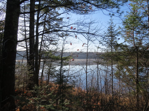
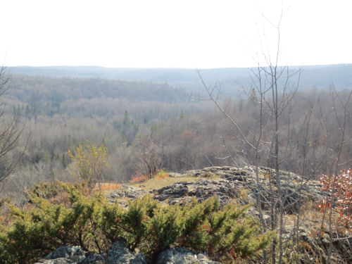
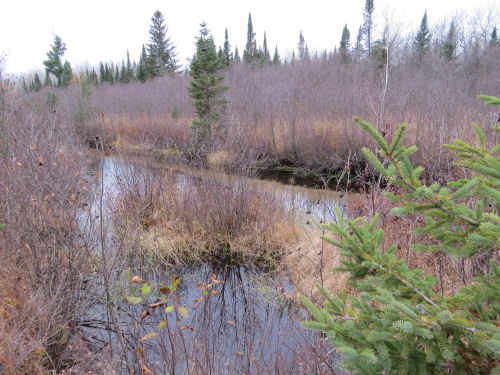
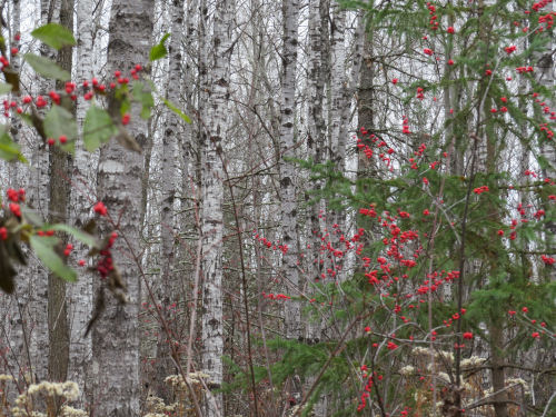
  This is one of my favorite places on the NCT. This is an historic portage. Actually, this first picture is looking across the valley of the Bois Brule River to the bank on the far side.
Bois Brule river valley

When the last glacier retreated and the land rebounded, a ridge arose across a river in this valley that had previously drained Glacial Lake Duluth to the southwest. Bogs formed beside the ridge in the valley of the former river. Remember yesterday's Brule Bog Boardwalk? That area. From the bog, water now flows both south and north in the former valley. The river that heads south is the St. Croix River which ends up in the Mississippi. The river that flows north is the Bois Brule, which now goes into Lake Superior instead of out of Glacial Lake Duluth.

But, are you picturing this? These two rivers, now in different watersheds, are quite close together. You know what happens in places like this when humans show up on the scene and want to travel to different places. It's a portage. Just about three miles separate navigible waters of these two rivers.

Native Americans used this pathway for centuries. The earliest record of a European explorer using it is in 1680, by Greysolon duLhut (for whom Duluth is named). After that it was used by many travelers for many purposes.

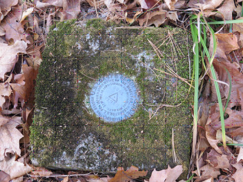
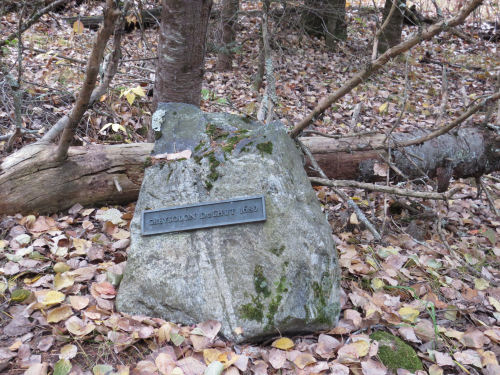
Fast forward to 1933. The Daughters of the American Revolution decided to commemorate this historic portage with the names of some famous users. Here is the rock with the name Greysolon duLhut.
rock commemorating Greysolon DuLhut

I wont show you the other rocks, but here are the names: Greysolon duLhut 1680, Pierre LeSueur 1693, Jonathan Carver 1768, Michel Curot 1805, Jean Baptiste Cadotte 1819, Henry R. Schoolcraft 1820, and George R. Stuntz 1853. You might say that not all of these are famous. Indeed, I had trouble finding information about some of these people. However, I wrote a bit about each of them in North Country Quest.

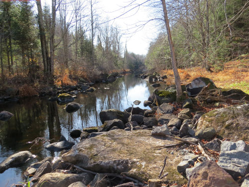
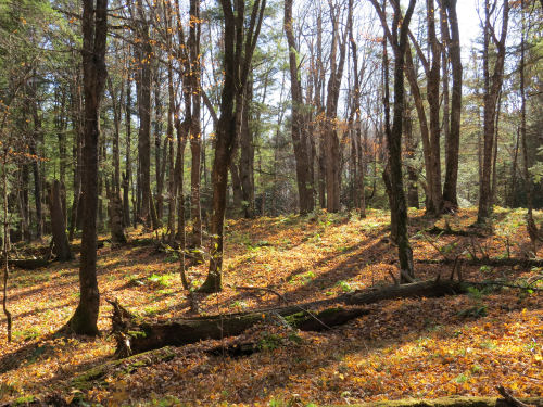
So, on the North Country Trail, you climb from Upper St. Croix Lake along this portage route, now passing by each stone. Then you descend to this place on the Bois Brule River where you could put in your kayak and float north.
Bois Brule River

It's very cool that the NCT follows this portage, but that's not all of the story.

In the 1950s, vandals pushed all seven rocks off the edge of the bluff where they tumbled to the bog and were buried by each year's accumulating leaves and debris.

Enter the routing of the North Country Trail, and a man named Chuck Zosel. He made it his personal quest to clear the portage to be part of the trail and to find the commemorative stones. He eventually found every single one! They are now restored to the pathway.

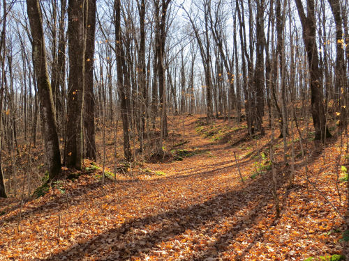
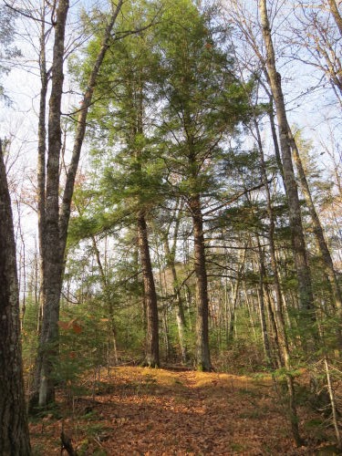
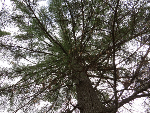
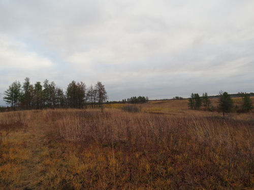
Here is my favorite scenery picture of the day in Mott's Ravine, a Wisconsin State Natural Area.
fall color

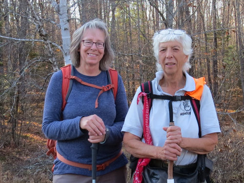
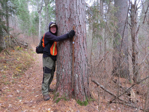
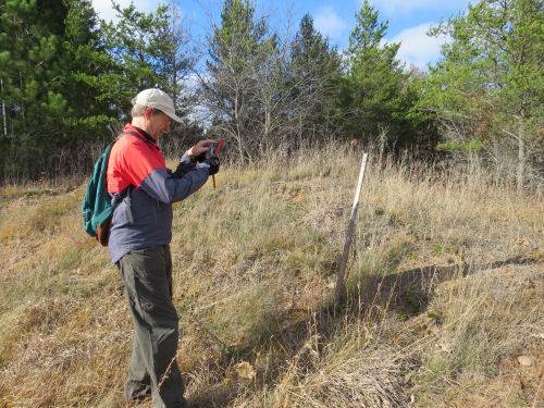
What could make the day even better? Long-time volunteer, Peter Nordgren, drove an hour each way to hike five miles with me! Here he is taking a picture of a post that needs replacing. Once you have an eye for things that need fixing, you can't stop. Oh yeah, and Peter brought us huge fruit turnovers!
trail volunteer

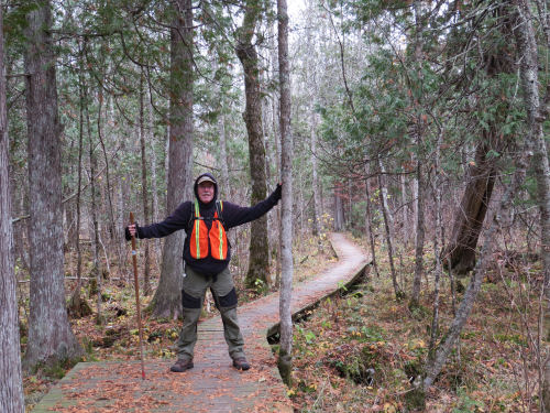
And here we are together at an NCT sign.
hikers

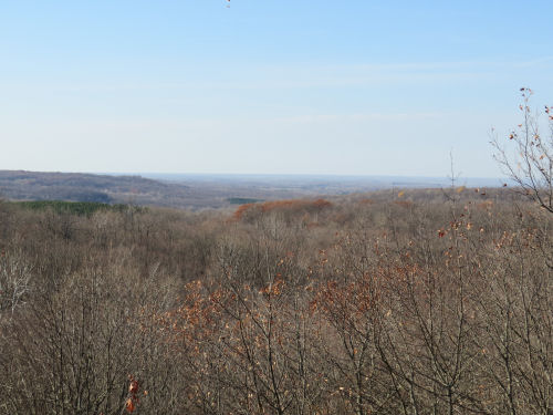
Is this enough? No! We also passed what is known as the Gaylord Nelson Portal. He was a Wisconsin Governor, and then a US Senator from Wisconsin. He wrote the National Trails Act, and he also was the founder of Earth Day.

I have some pressing "real life" issues I may have to attend to tomorrow. I have wanted to keep hiking without a break because the weather is good, but I'll see where things stand in the morning. I am due for a break... my body could use it, but it will be a busy day even if no hiking is involved. I just hate to forfeit a decent day to hike.

Miles today: 14.8. Total miles so far: 3838.1.

See Pine Barrens Savanna

Tuesday, October 25, 2022

Pine Barrens Savanna - Day 329

  I have been looking forward to this section of trail. One piece of it was done when I was here before (I was the first hiker to walk it other than the crew that built it), but a lot more is now complete. This is the Douglas County Wildlife Area, parts of which are called the Bird Sanctuary.
pine barrens savanna

It is a unique ecosystem along the North Country Trail (although I think the NCT still goes through a smaller one in the UP). This is a pine barrens savanna, and the geology is a glacial outwash plain that is sand and gravel. The plants tend to be more shrubs than trees and it is maintained by fire. I believe all the little ponds are remnants of kettle holes. They have no inlets or outlets. These form when a block of ice falls off as the glacier retreats, gets buried in the outwash and then melts. It leaves a depression full of water. They either dry up or are fed from rain and/or springs.

This pond is slightly bigger and has an island, which for some reason has larger trees. Not typical of the savanna, but pretty.
kettle hole island

North of the village of Solon Springs, we walked the Brule Bog boardwalk, also new since I was there last.
Brule Bog Boardwalk

One more attempt to get a nice picture with aspen trunks. This one is very Christmas-y with no snow involved.
aspen with red and green colors

BONUS SECTION: More horsey stuff!

First Julie fed us truly delicious potato soup and apple pie squares, then she hitched up Joe.
hitching a horse

Anna says she's ready!
smiling girl

Bunny (the horse) says she had her turn this morning. Now she'd rather stay home and munch hay. (Julie trains horses, so there is much hitching and unhitching almost every day.)
cream colored pony

Julie said, "Walk on, Joe." Joe is a really calm and reliable horse. He can be ridden, hitched singly, in a team or even in a team of four. Julie says he's a good lead horse, but will also accept other positions in the team. He reponds to voice commands.
horse hitched to a carriage

Good thing Joe is calm, because Julie asked me if I wanted to drive. Well, sure! I think this is the first time I've ever done this, although I may have briefly held the reins of a team at an event in Baldwin once. For sure it was the first time I've had any instruction in how to do it. I got to drive around an open field at first, and then on some winding paths, including one nice tight turn (for me). It's a lot like driving the bus (ancient history now) where you have to make sure you have enough turning room so the back wheels of the bus, or the carriage wheels in this case, don't cut the inside of the turn.
horse and carriage

We all had fun, and I didn't dump anyone out of the carriage. However, I did decline to let Joe trot with me holding the reins. Maybe I'm not THAT fast of a learner. Julie had him trot a bit, and we even cantered up a couple of hills. That's actually easier for the horse, because he has more momentum. What fun!
people in a horse carriage

Joe knew it wasn't Julie driving him, and he tried to look around and see who the rookie was!

Miles today: 14.8. Total miles so far: 3823.3 (and the remaining miles may now be below 1000- as near as I can figure with the one re-route I know about.)
See Bill's Back