What a day today! 68 degrees and sunny. Counting connectors and a side trip I hoofed it 13.1 hilly miles in 5 hours and 29 minutes, counting rest stops and lunch. Pooped but happy. 12.3 miles were on the main NCT trail and count for the challenge. Four tenths were the connector to parking, and another 0.4 were to an overlook and back. Since the mileage for the last outing was corrected, my previous total was 88.3, so I needed 11.7 to finish.
I started at Sawdust Hole (an old sawmill location), now a Forest Service campground. This is the view of the Manistee River down below in the floodplain. If I had hiked south I would have descended to that level, but I was headed north.

The trail is more or less level for quite a way, along the base of ridges and hills. One interesting thing is that this is one of the very few places on the NCT where the trail goes through Tribal land. This section is owned by the Little River Band of the Ottawa Indians. The sign is one that the NCTA provides at private property crossings, with customization as needed. If you are a hiker and are reading this, please follow the rules because if we get kicked off this little half-mile, it's going to be extremely difficult to re-route the trail.

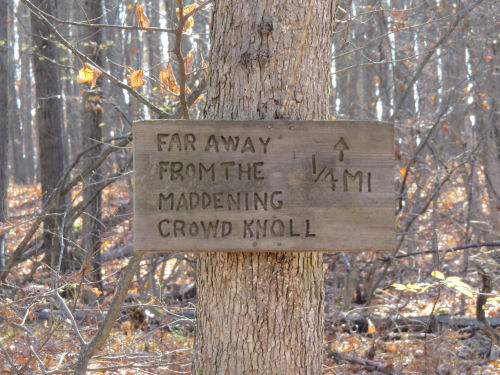
Soon the trail began to climb to the top of the bluffs along the Manistee. This sign has been posted at the first high point since before we had a Chapter to maintain trail. I hadn't been back there for a long time. Actually, I hadn't hiked this section in a long time.
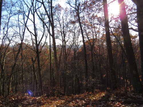
But today I took the short hike out to the knoll (on the return trip- note low sun). Had to pay attention to how to get back to the trail because it's not really marked and has no treadway. Here's the view. Not much to see with the camera, but the eye appreciates the open expanse beyond the trees. It would be nice to camp back there. This whole section is dry (can't really get to the river between Sawdust Hole and Red Bridge-extra mile down Coates Highway), so you'd need to pack water in.
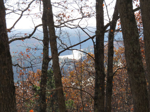
After another long down and another long up there is a nice view of the river looking back. Slight haze and sun made the water just a bright spot between the banks.
More long ups and downs. Most of these are benched into steep hillsides, making the walk really pretty, even when there aren't leaves on the trees. Maybe especially when there aren't leaves on trees.

I reached Coates Road in 2 hours, 55 minutes. I'd been making notes along the way, but decided I'd better pay attention to hiking fast on the return trip, since it gets dark so early now.
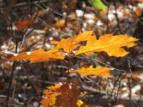
The leaves are almost all down, but as some of the last of them fell they alternately caught the sunlight or shade and it made even brown leaves look like glitter. I watched them dance as I ate my lunch.
Here are some of the closeups I like. A few golden oak leaves.
Beech leaves make me happy in any season of the year. I love their texture, and in this case the alternating colors.

Finally, I just liked the symmetry/geometry of the shapes in this one.

So now I just have to submit my miles and I can get my patch. Not tonight. A long sleep is looking good!
North Country Trail, Sawdust Hole to Coates Highway and back.
 | See Hike 100- previous entry |
| if you like this blog, click the +1
| |
3 comments:
Good work, glad you got that challenge finished! Great weather for it.
Congrats on completing your 100. Nice pix . . . as usual.
Good job on finishing your 100 miles
Post a Comment