So much for a short day. I have to make sure I can access my turnaround point each day with the car, for the next day. Didn't think that was going to be possible for a short hike. (As it turned out, I could not see the trail from the road, but when I walked by, I could see the road from the trail. So I could have done it, but it's fine. More miles are good.)
It turned out to be another nice hiking day. Looking dark out now, but that 100% chance of rain must still be coming up for the evening. It only drizzled on me a little bit.
The fall colors are beginning to pop.

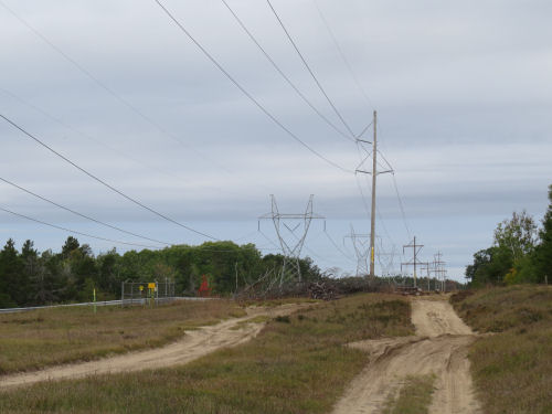
It was another day of hiking on some sort of "road" all day. All natural surface, not too much loose sand. The least scenic was following a hi-tension line for a short way.

The route today was 100% concurrent with the Shore-to-Shore horse trail. But because it's on roads, they don't get torn up by the horses hooves.
I think this was the funniest thing. In two places these huge rocks had been brought it (pretty sure not naturally occurring erratics) and the trail routed between them. In both places the road (two-track) simply went around them in a barely longer walk. Can't figure that one out. The spaces seemed pretty narrow for horses.

Even an occasional oak is getting into the autumn act.

I thought I was going to show you a pretty picture of Seventh Spectacle Lake. But the trail crosses the outlet stream on a bridge below the dam. No view of the water at all. I tried to go take a picture later from the car, but it's almost entirely private, ringed with homes.

And, tada! I think I bring you bobcat tracks. These are smaller than the ones I saw yesterday, but definitely cat. These are small enough they could be a large domestic or feral kitty, but the pad shape makes me think bobcat.

The walk seemed longer than I thought it would be. This was definitely the hilliest day yet. Here, the trail follows a pipeline ROW, and I finally knew I was getting close to my goal. How? See that little tan speck ahead, right in the middle?

When you zoom in so you can see it, there is a "cage" around some sort of access port. These were all along the road where I planned to turn around.

As it turned out, when I got closer, the trail went off the pipeline because there was a wetland ahead, but it was the road I wanted it to be. Turned around and was back at the car at 2:30.
Total miles forward progress: I'm thinking 6.5 It was only supposed to be 6 according to my map and according to the DNR map, but here's the puzzle for the day. I came across a very very new survey marker. Those don't get put in the wrong place. According to that, the trail had made a big loop east of where the maps show it. And that also makes more sense with the topography I was seeing on the ground. It also took me longer to walk than I expected, and I wasn't dilly-dallying, which supports the longer trail theory. I did manage to lop off almost a mile on the return trip by sticking to the power line longer. So total miles walked about 12. Total trail miles to date 115.5
I'm tired. My knee hurts again, and I feel kinda beat up. If I still feel this way tomorrow and/or that rain arrives, I may take a day off or make sure I do a shorter day.
I did get my laundry done when I got back to town and fixed my sandals (I know... for the umpteenth time, but I like them).
 | See Day Fifteen |
| if you like this blog, click the +1 | |
1 comment:
Glad you only saw bobcat tracks and not an actual bobcat.
Post a Comment