Entries to Win Afghan

Sign up to receive the Books Leaving Footprints Newsletter. Comes out occasionally. No spam. No list swapping. Just email me! jhyshark@gmail.com Previous gifts include a short story, a poem, and coupons. Add your name, and don't miss out!
Showing posts with label Fife Lake Loop. Show all posts

Wednesday, June 14, 2017

Fife Lake Loop- Day 3

 
Just 6.6 miles of the loop remained to be hiked. This is the section I'd seen before when it was North Country Trail, but that was in the early winter, so it looked quite different. I did recognize a few spots. On flat terrain, with not too many outstanding points of interest, we moved right along.

Also, it had rained in the early morning hours. We were dry in the tent, but the grass was wet along the trail, and plopping down to rest just made us wetter.

hiker

A little dog knows how to stay dry at rest stops. Just climb on top of a handy pack.

dog sleeping on a backpack

Soon we started paying attention to smaller sights, such as wool sower galls on oak leaves. I'd seen them before, but this one is really large- almost two inches across.

wool sower gall

One nice wet meadow had blue flag in bloom.

blue flag

Let's talk about water. We had found that open water where we camped 0.7 miles south of M 186. There was another wetland with open water about a mile south of that. It was smaller without good access, but you could probably get water there if you were desperate. Can't promise it stays wet all year, though. We had stashed a gallon of water where the trail crosses M 113. It turned out we had plenty still from the morning fill-up where we had camped, so all we had to do was top off our bottles. It seemed a little weird to pour out the rest and crush the milk jug to carry out, but that way we didn't have to go back with the car to get it later. Six miles south of M 186, the trail follows Walton Outlet Creek where you could easily get water again. The day wasn't as hot as Sunday. We started hiking at 69 degrees, and it only barely broke into the 80s before we finished around 3 pm. I think we would have had enough water even without the milk jug stash, but it's always good to be prepared.

Here's Walton Outlet Creek. There is another semi-developed campsite along here which would be a very pretty one to stay at.
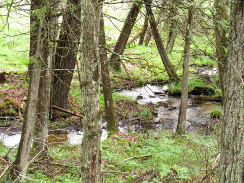
Walton Outlet Creek

We were on a roll. Our feet were soaked, and we could hear a restaurant calling. We stopped twice for snacks and pressed on. We knew we were getting really close to the car when we passed the southern turnoff to rejoin the North Country Trail. (this is looking back)
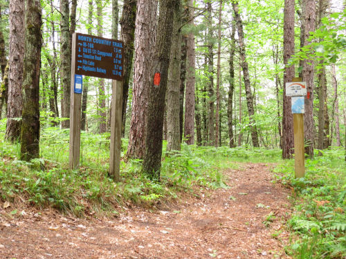
NCT Fife Lake Loop junction

A look downstream reveals the trestle for the Tuscola & Saginaw Bay Railroad (now Great Lakes Central), which is a live track.

Great Lakes Railroad trestle

This brings me to mention a piece of this trail that really should have an interpretive sign. That said, I didn't even think to take a picture when we were walking it. The straight E-W section that's about a mile long, follows the berm of the old Manistee and Northeastern Railroad (Manistee to Traverse City and an associated spider web of spurs). I've mentioned that line before, and another piece of the old bed is part of the NCT near Hodenpyl Dam. This was primarily a logging line, but as the timber began to disappear it carried cherries from Traverse City, salt from Manistee, and potatoes. It was merged into C&O in 1955, and the line was abandoned completely by 1997.

Once again, we were walking along the Manistee River. I just liked this stump.

stump in river

Onward to the car where we had to take a few congratulatory selfies, and then to the North Side Restaurant in Manton for a late lunch. Highly recommended for hikers. The linoleum is peeling and the table tops are delaminating, but we got good, real food and lots of it for very little money.

happy hikers

We had thought our hike was 21 miles, because the text on the map says that. But the very same map (if you add the mileages) only totals 20.1 miles, as does the official NCT web site maps. Well, we probably walked an extra mile to that water pump and looking for not-so-good cache trees. Haha.

Would I go with Sue again? You bet. Time to start plotting another adventure.

If you care, this same piece of trail is part of "The Princess and the P's" chapter in North Country Cache.

Fife Lake Loop Trail, and about a mile of North Country Trail just west of the Old US 131 State Forest Campground near Manton, MI


See Fife Lake Loop- Day 2
See 85.7 and Still Walking for more of the Manistee and Northeastern rail bed
if you like this blog, click the +1   or

Like This!


Tuesday, June 13, 2017

Fife Lake Loop- Day 2

 
Advance warning: lots of pictures.

We started the day with hot grapenuts, one of my favorite trail breakfasts. Sue agreed to let me do the food, so I sent her possible menus and she made some choices.

hot grapenuts

We were hiking by 9 am, with plans to do about 8 miles. It's always neat to see the lady's slipper orchid, Cypripedium acaule, and this one was huge, possibly the biggest I've ever seen. Sue's hand for scale. I don't take many pictures of it anymore. It's not that I don't like it, but really, how many pictures does one need?

large lady's slipper

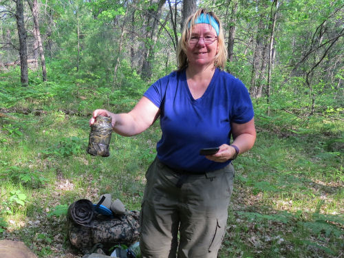
Sue is an avid geocacher. She's approaching signing the logbook on 3400 of them. Several were registering on her map as being nearby. I'd never searched for one, although I have found two by accident. This is the first one she located on this trip. It was a bit tricky because something, probably an animal, had moved it a good 20 feet from where it was more likely supposed to be. She says she no longer leaves and takes a trinket, but just signs the register. Now that you can do them with your phone, I might occasionally remember to see if there are any near where I'm hiking.

geocache

I just liked this tree. See the man-in-the-moon profile face with the bushy eyebrows? Or is it two lovers kissing?

face in tree

The day was beginning to get quite hot, and we took a long break at Headquarters Lake where there was a nice breeze. We had a snack and sterilized water. I took the Steripen on this trip, which uses ultraviolet light to kill organisms. I call it the "magic flashlight."

Sophie occupied herself in a different manner.

dog barking

She was keeping a rascally red squirrel at bay. The squirrel was quite alarmed, and apparently ignorant concerning the inability of (most) dogs to climb trees, since it's decision was eventually to run down the tree to the ground and to climb a different tree. Even so, it was fast, and Sophie did not have squirrel for her snack. She had chicken jerky which she thinks tastes great, but doesn't require chasing.

red squirrel in tree

From there, it was 1.8 miles to the Spring Lake State Forest Campground. We had no intention of staying there, since we wanted to be by ourselves in the woods, which is allowed. But we did eat lunch and fill our water bottles. Note to other hikers, the pump is all the way at the bottom of the campground loop. If you are hiking in from the south you will pass a lot of campsites and the boat access. When you come to the trail kiosk, you have to turn right and go around that camp loop on the north side of the lake. But the water is cold with no sulfur taste. When it's 88 degrees out, it feels extra good to soak your head!

wet head at pump

If you are a casual picture-looking reader, this paragraph might not be of much interest. If you are thinking of hiking the loop, you might like to know this.

We had originally planned to just go another mile or so and find a place to camp. But we both felt pretty good, despite the heat. The big question of the future was water. The west side of the loop is very dry, and this might be our last chance to get water for a while (and an overnight). We had stashed a gallon of water at a road crossing before beginning the hike, so we knew there was water waiting for us 4.3 miles away. However, there is a wetland that shows on the map produced by TrailMaps, 0.7 mile south of the NCT/Fife Lake junction at M 186, and it looked like it had open water. That wetland does not show at all on the NCT online basemap. It does show as open water on Google maps, and also on Sue's GPS unit. We decided to hike till we reached that spot, to check it out. We filled the big extra bottle, just in case it wasn't real, and hiked on.

Next funny story. We took one more short rest stop. As I was lying against my pack looking at the trees... guess what I saw? Another absolutely perfect cache tree- strong horizontal branch about 15 feet off the ground with no nearby brush. Have I mentioned how hard it is to find really good cache trees? I have to tell you that I was seriously interested in making camp there. We didn't know if there was a wetland/lake ahead or not. We had a full dinner bottle. We had gone our planned 8 miles.

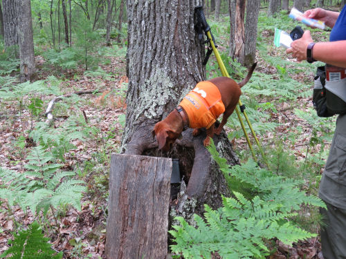
But Sue's an optimist. "There will be other trees," she said. On we went. And guess what. There was another geocache. Sophie helped find this one.

geocache

Let me tell you.... not only was there a wetland, but I suspect this has open water most of the year, and there was pretty easy access. I did wade in a few feet to get clear water, but it wasn't difficult, as it often is, to get water from a wetland, and it didn't taste swampy.

wetland

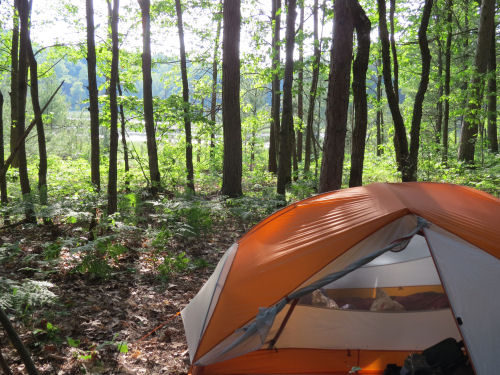
We found a flat space away from the private property signs and made a lovely camp.

campsite

For a while it looked like I'd be cooking in the rain, but the gray cloud passed over without dumping any water. Dinner was beef stew with dumplings. Yum.

beef stew

Surprisingly, as the evening cooled down, the mosquitoes did not appear in force till almost 8 pm, so we sat outside and enjoyed the breeze.

Cuddles are high on Sophie's list.

dog snuggling

Nine miles for the day. Oh, of course, I found a place to hang the cache, but it sure wasn't ideal. Am I sorry we passed up the good one? Nah. This was a beautiful spot. But it's a good thing our food supply only weighed about 2 pounds at this point!

North Country Trail, primitive campsite along Fife Lake Creek to M-186, and Fife Lake Loop Trail south from M-186, 0.7 mile

See Fife Lake Loop- Day 1
if you like this blog, click the +1   or

Like This!

Monday, June 12, 2017

Fife Lake Loop- Day 1

 
I'm starting with my favorite picture from the first day. Here is Sue at our first campsite, which was a serendipitous find. This is a semi-developed campsite that isn't on the map. It has the benches you see, a cleared flat area for a tent, and water access at Fife Lake Creek. (Although down a steep bank which will get eroded if too many people scramble down. I did one unplanned seat-slide).

campsite

Now I'll back up and tell you how we got there. I drove to Sue's house, which is closer to where we were going than my house is. We transferred the gear to her car, and prepared for the hour drive.

hiking gear in car

Sophie LOVES to go hiking, and she was all ready. "Where to this time, Mom?"

dachshund in car

We went to the Old 131 State Forest Campground near Manton, at the south end of the loop. We got there just as a large group of Boy Scouts and some dads hiked in. We chatted with them a few minutes, then got ourselves in harness and ready to walk. I had 33 pounds and Sue had 31.

hikers

We chose to go counter-clockwise and do the North Country Trail side of the loop first. That said, this was the piece I had never seen. The NCT used to be what is now the west side of the loop. However, the Grand Traverse Hikers Chapter did some scouting around and realized that a serious re-route of the trail to the east side of US 131 would result in miles of beautiful trail. The existing miles on the west side were pretty dull, and very dry (not many good water sources). By keeping both sections open, this 21-mile loop was created. The new section opened in 2014, after I had completed my NCT End-to-End. I was really eager to see the new trail.

It was late afternoon when we began, and our goal was to just get a good start- whatever we could do in a couple of hours. The beginning mile is on bluffs high above the Manistee River, with gorgeous views.

Manistee River

We liked the thoughts posted here.

Advice from a River
US 131 is a really busy highway, but at this crossing we didn't need to worry about that. The trail goes under the road, right next to the river. Immediately after this, the trail passes through a roadside rest area. The nice thing about this (other than latrines) is that there is a water pump. Since we hadn't been hiking long we only needed to top off our regular bottles. However, I carry an extra empty quart bottle. I fill it at the last easy water access before camp so we have plenty of water and don't need to worry about finding a campsite with water access. I also don't have to carry that extra water weight for most of the day. As it turned out, there was water where we camped, but getting water at a pump is easy. I'm not opposed to easy!

NCT under US 131

Anyway, we hiked on. Sometime after 6 pm, I was scanning the woods for a cache tree (one with a nice horizontal branch at the right height for hanging the food bag). I found one! But Sue wanted to go a little farther. I teased her pretty good, because finding a really nice cache tree isn't all that easy and this one was perfect. At about 6:30 we signed in at a register box and saw some benches off in the woods. Of course we had to check them out. We quickly realized this was an unlabeled and unoccupied campsite, and we claimed it! See first picture.

I did find a cache tree. Not an ideal one, of course, but it worked OK.

food cache

The benches made dinner preparation really easy, with a place to set things out. You can see my little stove set up. It looks like things are a mess, but we use everything we carry on a backpacking trip, so most of it gets spread around. Then it all gets put back in the packs when it's time to move on.

We were in bed at 9 pm, with 4.4 miles done. We were pretty happy about that because it would shave miles off what we would need to do on Sunday and Monday.

North Country Trail from Old US 131 State Forest Campground north 4.4 miles

See Shamu is Packed
if you like this blog, click the +1   or

Like This!