Entries to Win Afghan

Sign up to receive the Books Leaving Footprints Newsletter. Comes out occasionally. No spam. No list swapping. Just email me! jhyshark@gmail.com Previous gifts include a short story, a poem, and coupons. Add your name, and don't miss out!
Showing posts with label New York. Show all posts

Tuesday, July 22, 2025

The Perils of Pauline and Ray


In honor of Dad's (Ray Leary) 121st birthday, here's a story I've never shared with you before. It needs some buildup.

The silent film series, The Perils of Pauline were mostly filmed in Ithaca, NY. Ithaca was the Hollywood of the silent film era. The gorges, waterfalls, and beautiful Cayuga Lake- all of which I show you pictures of when I go home- created dramatic backdrops for the cliffhanger stories.

Pauline was played by an actress by the name of Pearl White, a native of the Ozarks. The films all had the same plot. Pauline would end up in some sort of mortal peril, and then she would be rescued, usually by a handsome man such as Creighton Hale or Lionel Barrymore. You've probably heard his name at least. Here is Pearl with (maybe) Ted Wharton who with his brother Leo were the big name filmmakers of the era. The 20 Pauline movies were made between 1914 and 1919.
Pauline White actress


Now we switch to a journalist/ author named Arch Merrill. He lived from 1894-1974. If you are from the Finger Lakes area of New York, you are probably familiar with his books. Some are collections of newspaper columns, others were written as books. They are filled with highly readable tales of the history and culture of the Finger Lakes. Some titles are Slim Fingers Beckon, Tomahawks and Old Lace, The Towpath- you get the idea.

In his book Upstate Echoes, there is a chapter about the era of silent films. He focuses on Pearl White, giving this description. "She wore slacks and smoked cigarettes at a time when women just did not do those things." She drove a canary yellow Stutz Bearcat, usually at breakneck speeds. She was arrested in Trumansburg (a town near my hometown) for speeding, paid the fine and swore at the judge.

In that same book is a story which I will quote:
And there's the tale of the teenaged lad who had long worshiped the actress from afar. One day while standing in his yard, he saw the yellow car stop in front of the house and the angel of his dreams step out. She advanced toward him and the boy blushed and trembled. No doubt the actress, struck by his manly beauty, was going to offer him a ride. Disillusionment was swift and complete when his idol called out: "Little boy, may I use your bathroom?"

Dad always claimed that he was the boy. It's possible. The time frame is correct. The house was on the main highway north from Ithaca and just five miles from Trumansburg. Dad was not given to tall tales or bragging, so it wasn't in his nature to make up stories.

Here is Dad on the porch of the house (with his parents). He looks to me to be 14-16 years old, which puts the years at 1918-1921, but it could have been a year or so earlier. The photo is not dated, and Dad always seemed to look older than his years in every picture I have of him as a child. So this would be about when this episode took place.

family sitting on porch 1920

Here he is in what I think is 1922. I think this is his high school graduation picture and he would have been almost 18.

teenager in 1922

At any rate, enjoy the humorous tale. I like to think it was Dad!

Interestingly enough, he died the day before his 71st birthday, or 49 years ago yesterday.

I spent a bunch of time on the computer today and went to the store for supplies. Critter report: We've got ants in the kitchen. I chased a chipmunk out of the house twice today and fixed the loose place on the screen where it was coming in. The woodpeckers are banging on the deck posts, and I'm again fighting the bees.

See The Lake that I Love

Tuesday, July 1, 2025

What We Did in the Adirondacks


Today I finished adding numbers to all the inventory items from the Adirondacks. I came out at 272 entries, but that's not 100% accurate. I may have recorded items that the NCTA doesn't need, and they may want to count some that I didn't number. For example, is a rocky ford of a stream that never had a bridge a "missing bridge," or is it "nothing?" Or... all the really muddy places that never had puncheon don't really count in an inventory. Does a board someone stole from another place and threw down in the mud count as puncheon or not?

Anyway, we recorded a lot. That is an average of 27 items a day. I went into this thinking it would be more like 15 per day. That was my pre-trip estimate. Only about half of what was out there!

We were recording GPS tracks of the trail on 3 different apps: Avenza, OnX Backcountry, and an Apple watch. Then we added a waypoint for every item, and some things that weren't "items" like fords or mud. Here's what that looks like in OnX Backcountry. The light blue dashed line is the track we took up the east side of Jones Hill.

The green balloons are the waypoints. I marked them in OnX, Bill took a photo with NavCam on his phone which embeds the location and time in the picture. Bill recorded info about the item and condition in Avenza, and I filled out a paper sheet with that info as well, in case the digital data went belly-up. I also took pictures with my camera. Hopefully, between the two of us we got pictures and info about almost everything. Occasionally I forgot to take a picture. I lost two pieces of track. Bill lost one. We tried to come back with duplicate data for everything.
OnX track


We did manage to streamline the process a bit, but nevertheless, the whole thing was tedious. It was a joyous thing to me at the same time, because we were collecting data that NO ONE had previously compiled. Next week we are meeting with Matt Rowbotham, NCTA GIS specialist, to get it all in a format that is consistent with the current maps and inventory data. Having 3 tracks means that the line that ends up on the map will be more accurate. There are always inconsistencies between tracks on various apps.

A group called GPS Rangers will take our tracks and go through again adding to info we may have missed and taking yet another track. They can verify our inventory and improve photos that don't capture just what the NCTA needs to know.

In general, I would like to say that Adirondack trails are generally in much worse condition than the NCT standards. This is true for a combination of reasons. The attitude toward backcountry trails in the northeast tends to be more toward embracing the suck because it is more "real." They also don't have enough volunteers to maintain them. That is going to continue to be true of the NCT there, similar to the way it is on the Border Route section in Minnesota. There aren't very many people who live close by to go out and work easily.

Bridges ranged from non-existent or broken to brand new. I shared some of the broken ones, and the missing one that we declined to ford. Here is a brand new one with beautiful rockwork approaches. Occasionally infrastructure does get fixed. Supposedly the missing bridge is going to be rebuilt next year. But no one knows when the broken one we skootched across will be repaired.
bridge east branch trout brook Adirondacks


We took numerous pictures of signs. The familiar brown and gold Adirondack signs are plentiful, and usually in the right places, although mileages are notoriously off. Some are in great shape, some are not.

This is typical, and also in average condition with the trail marker disc missing on the top sign. Trails have red, yellow, or blue discs which may or may not be present in sufficient quantity to actually follow the trail.
Adirondack trail sign


I was thrilled to find at least minimal NCT signage on most of the off-road sections of trail (which was all we inventoried). Here is one of the junctions with the Northville-Lake Placid Trail. The NPT goes N-S and the NCT E-W. They cross and are concurrent for a short way near West Canada Lake
NCT NPT trail junction


Just yesterday, on an Adirondack Trails Facebook page, someone posted a picture of one of the NCT emblems and a blue blaze. They were asking what new trail this was- what those markers meant. This is awesome. New hikers getting acquainted with the North Country Trail.

And the mud. To be honest, we did not see any real solutions to Adirondack mud. It is essentially peat, and it can be 18 inches or more deep at certain times of year. It holds water like a sponge, and once a trail section gets churned up it never really drains. Serious water diversion tactics can be deployed, but then they wash out in heavy rains. We inventoried more damaged culverts than functional ones. Here is an example of serious puncheon that at least stayed in place. These are squared logs about 12" x 14". But someone had to drag those babies in there. That is labor intensive.
log puncheon


I know that when they rebuilt the Sacandaga River Bridge in 2022 the pieces were dragged in on sledges by horses. A lot of work. Many of these locations are far from any kind of road access.

The Adirondackers are in love with their lean-tos, as is almost every trail person. The typical three-sided shelter is, after all, called an Adirondack shelter. I think these are maintained and rebuilt preferentially over actual trail.
Adirondack shelter


The Adirondacks has had a special place in my heart forever. I think I was seven the first time I was inside the "blue line," but my first serious hiking there was in 1966 with my friend Paul.

I've been thrilled to help build NCT trail in a couple of places there in 2020 and 2021, and now to be able to participate in this mapping and inventory project really brings me a ton of satisfaction. We still have the data work to do with Matt, but a date for that is scheduled. There will soon be accurate NCT maps for the Adirondacks!

I mostly did computer work again today. Back to some editing. Did laundry and managed a few minutes in the flower beds. One step at a time!

See Low to High

Sunday, March 9, 2025

Thorne Preserve and Ferncliff Forest

 The day started by going back to the Shooting Club because they have an event each Sunday. We helped with breakfast for two hours.

Then we set off to accomplish one of my personal unofficial goals for this trip, and that was to be up to hiking 5 miles before I got home.

First we went to Thorn Preserve. I believe they are trying to restore it to a prairie, but at this time of year it's just a big mowed field. It's primary feature is the best view of Overlook Mountain in the area. This is part of the Catskills.
Overlook Mountain


Sawkill Creek also runs beside it. Anyway, we walked around on mowed trails and some other places for 2.8 miles.
Sawkill Creek


Then we went back by the club to get some lunch and use the facilites. No work involved. Our next stop was Ferncliff Forest, which has lots of trails. We could have done all our miles there, but Thorne was a new find, and we wanted to check it out. Ferncliff has topography and a LOT of trails. We took the Orange Trail, also called Bridle Trail, but in reality it was a mountain bike trail. That wandered over a lot of small ridges and crossed a small creek. I thought the ice crystals made this log look like a big bug.
ice crystals


That eventually dumped us out near South Pond after we crossed this little rocky ridge outcrop.
South Pond at Ferncliff


You are allowed to camp at Ferncliff with reservations. There are several shelters and some tent pads. This was the nicest shelter.
shelter at Ferncliff


We took the white/Scout Trail back to the parking, but it wasn't quite enough mileage, so we headed out again on the Red Trail and looped around to the Church Trail. We're glad we did! We found two of these structures. This one was rock, and the other was part brick.
Ferncliff root cellar


We found out they are root cellars left over from when there was a farm commune on the land. I've never seen them built with curved roofs like that. Very interesting!

Then we came back to Marie's and repotted a huge plant that she needed help with. I think we did all her projects!

Mini health update: I'm down to 3 ibuprofen a day. I haven't have to sleep with an ice pack on my face since I left home. I wasn't exhausted after the working and hiking today. I'm very pleased! The neuralgia isn't gone, but it's manageable.

Now we have to eat an early dinner and then head for the train station. Sigh. I will be glad to get home, but I hate to leave Marie. Probably one more adventure before I get home. Stay tuned.

Miles hiked in 2025: 40.9.

Thorne Preserve, Zena, NY, 2.8 miles. Ferncliff Forest, Rhinebeck, NY, various trails- 2.4 miles, total 5.2 miles

See Falling Waters- Saugerties

Monday, March 18, 2024

Best Photos of June 2022

   
Here are the best of the pictures I took from June 2022. I'm still working on processing trip pictures.

From June 2022, during the big hike, I've chosen what I think are the 10 best pictures to share. Sunshine makes for more nice pictures, but I still have a ton of marginal ones, or just shots that prove I saw something but won't win any kudos.

I am saying these pictures are "best," not because they necessarily tell the story best, but because I think they are simply the best actual photographs. I've left them full size, so you can click on them and see them larger. That always makes photos look better. Two are cropped a bit, and one had the color saturation increased a tad.

I spent June finishing New York and Vermont, and then drove to North Dakoa and started home.

These are arranged chronologically... it seemed to work.

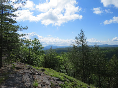
One of the most beautiful places for views on the NCT is Jones Hill. It's not very big by Adirondack standards, but it has the proverbial location, location, location. This is the view to the south with possibly Beech Hill visible across the valley.
south view from Jones Hill Adirondacks


And chronologically, only 20 minutes later, the view to the north from the same Jones Hill across the Blue Ridge Range (the one in the Adirondacks) in some mist. Honestly, it's kind of hard to not show ten photos all from that hill!
north view from Jones Hill Adirondacks


At Crown Point, NY, on Lake Champlain, this is the Colonial era fort with the new (2011) Lake Champlain Bridge in the background. I like the contrast of shapes and time periods.
Crown Point Fort with Lake Champlain Bridge


You know I'm a sucker for texture pictures. How about going from lush, green eastern mountains to dry cracked mud in North Dakota?
cracked mud


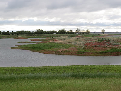
This is some shallows in an arm of Lake Audubon. I liked the various colors of earth and plant material.
Lake Audubon


I believe I have a few nice pictures of yellow-headed blackbirds from the summer I worked in northern Illinois, but I've hardly seen one of them since then. Not a spectacular picture, but decent.
yellow headed blackbird


As you may remember, North Dakota was wonderful for seeing bird life. That doesn't mean I got great pictures, because I'm only a photographer of opportunity. I don't stand around waiting for the right light and spending 30 minutes creeping up on a bird or hoping it will move its head just an inch. Nevertheless, this is the best picture I've every gotten of a northern shoveler duck.
northern shoveler


A thirteen-lined ground squirrel was straining to see far ahead from his burrow. It's not the best picture I've ever taken of that critter, but I like the depth in the shot. It almost looks 3-D.
thirteen lined ground squirrel standing on burrow


This is just some ordinary grass along the canal, but I like the lighting and contrast of textures.
grass against water


Finally, this is one of my favorite shots from North Dakota. I just like the shapes defined by the fence and the hill.
fence in grassland


Well, I counted wrong. I had one more texture picture, but I think it's not as good, and I've been trying to limit these collections to ten.

In other news: I edited and wrote. What else is new? I must be making progress, the word count goes up.

See Best Photos of May 2022

Tuesday, October 10, 2023

Gore Mountain


The afternoon of the day we went to Fort Ticonderoga (September 30), Marie and I did not return to the Celebration on the bus. We played hooky with Larry and went up the Gore Mountain Ski Area gondola. It runs all summer as a tourist attraction, and mountain bikers use the trails too.
Gore Mountain ski lift
people in ski lift gondola


The pictures from the gondola aren't as good because the plexiglas was very scratched, but this is looking down the lift.
Gore Mountain ski lift


There is a total of 1700 feet of rise from the bottom to the top. Needless to say, the ski resort has a number of lifts, but this is the popular one for tourists.

Now this is what I call a view! The blue peaks in the distance are the High Peaks. One of them is Marcy [high point in New York]. I could pick it out in person, but in the reduced size picture, I'm not so sure which it is.
high peaks from Gore


Since we could see Gore Mountain from the Moxham Mountain hike, I asked if you could see Moxham from Gore. The lift operator told me where to look on the way down. I think that cliff standing out by itself is Moxham. You know I love figuring out how I fit into the landscape.
Moxham Mountain


The name Gore Mountain has nothing to do with being bloody. At the Adirondack History workshop I attended at the Celebration, we learned that the whole central portion of the Adirondacks was surveyed not on N-S lines, but at a 45 degree angle to that. So where that area adjoins other areas surveyed in the normal manner, there are triangular sections. If you have ever sewed clothes, you probably know what a gored skirt is... a skirt made from triangles. Gores are also inserted in things like sails. Guess what those triangular sections of land were called. Now guess where Gore Mountain is located. I knew you could do it!

Well, ok... there is probably some etomological relationship between the meanings. They both may hark back to German and Old English where various forms of gehre and gar meant a spear or a spearhead, which are triangular, and the use of such an item to gore someone resulted in bloodshed... to be gory.

I edited in the day, and had a program this evening. That's enough for one day!

See Fort Ticonderoga

Monday, October 2, 2023

Step Two Homeward


Now I have a friend in my hometown who also likes to hike! Diane and I were a few too many years apart as children to really know each other. Now it turns out that we like a lot of the same things.
friends


We had time for a short hike before I had to hit the road, and she took me to see a piece of rail trail so new it's only been open for about 10 days. This was a section of the Lehigh Valley system. Only 2.3 miles are open yet, but it may get extended.
Odessa rail trail


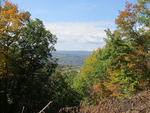
This line stayed high on the hills for frieght. The passenger line had to stay low to go through Ithaca at the south end of the lake, 500 feet lower down. That means there are some great views. This is the valley south of Watkins Glen, and we think the water there is the south end of Seneca Lake.
vista


I liked this one a lot with hills and a farm.
farm in a valley


Then I hit the road and went across western NY. I've shared a lot of views of this drive in several seasons, over the years. All I could get is some drive=by snaps out the windos, but this one is OK. Just the hills I love. Sure, it's not the Adirondacks here, but it's still great. The afternoon light made the trees glow, and the colors are fantastic this year.
new york hills


And I arrived at blogger-friend Ann's house to spend the night.


Odessa, NY. Bruno Schickel Rail Trail. 2.3 miles

See Time to Leave

Sunday, October 1, 2023

Time to Leave


The Celebration ended right after breakfast. A lot of people did one more thing in the area if they weren't pressed for time. Some people hiked a few more NCT miles either in Vermont or New York. I know of 6 people who made a point of hiking in the mile from the road to the eastern terminus at Maine Junction. (Vermont)

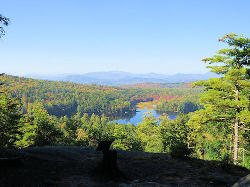
Marie and I walked up to Lookout Point on the camp property. This is a great view to the south, but the NCT is north of here, so I can't show you where that fits. This isn't from the highest point, but it includes a lake, so I liked it better.
view from Forest Lake Camp


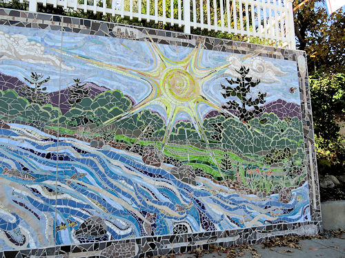
Then we went to North Creek, which has just become an official Trail Town. The link below is the day I walked through there last year. Today, I studied the mosaic more carefully. It's a whole block long with many panels. I'll just show you the sun which I particularly like. There are a couple more pictures in the linked post. The artist said she might try to incorporate a blue blaze on a tree in it since they are now a Trail Town.
mosaic sun


Then we walked across the Husdon River. The light was much nicer than the gray and rainy day I was there last year. This is where the trail crosses the river.
Hudson River


We sure enjoyed how the colors were turning. The reds were especially beautiful this year.
red maple leaves


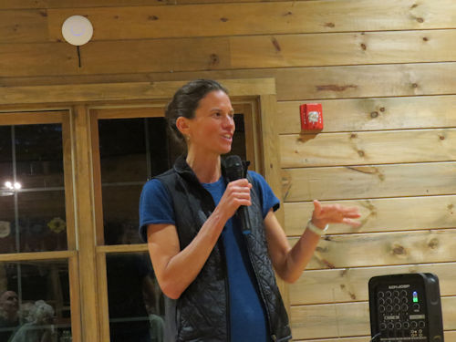
Before I completely leave the Celebration behind, I'll mention that last night's keynote speaker was Jennifer Pharr Davis, renowned hiker and all-around cool person. She came a day earlier so she could go on one of the hikes today on OUR trail. That is a quality "celebrity."
Jennifer Pharr Davis


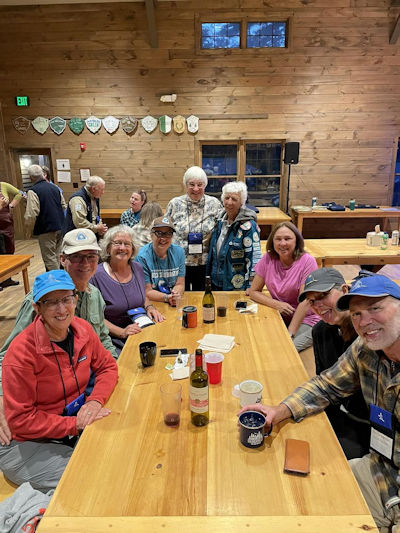
The Spirit of the Woods Chapter of the NCTA had 9 people at the Celebration! I think that's a record for us.
people at a camp table


But, eventually, Marie and I had to say goodbye for now. She is already home and I am back at Dick and Darla's. I made one rest stop on the drive, at a crossing of West Canada Creek. The Adirondacks just keep giving their beauty.
West Canada Creek


Don't be surprised if I end up in the Daks again next summer on some volunteer project for the trail. I just feel like I have a tiger by the tail.

See Across the Hudson