This is stop number 10, and states 13 and 14. This will by my last unique state for this trip. I still have to go through Indiana and Michigan, but I also did them while outward bound. MI, IN, IL, IA, OK, MO, TX, LA, MS, AL, GA, TN, KY, OH
I'm with Nikki at Moondoggie Liveree. I
met her two years ago tomorrow! (when she hosted me and my trailer- and Bill and Denali- on my hike) And look who else showed up. It's Bill! This feels like an amazing reunion.
I had something special in mind for my mid-drive-hike-break. The southern terminus of the Sheltowee Trace trail wasn't out of the way at all. I thought I was going to share some links from when Marie and I hiked a couple other pieces of it when we did our Red River Gorge trip. However, there were no blog posts from that hike. (A real shame, because it was gorgeous) Then I remembered that it was the trip from electronics 7734. My computer fried itself. In fact, that was the computer where I actually lost some of the contents of the hard drive. I think I posted some pics on Facebook from my phone, but then the phone also went belly up. Anyway... That trip had some GREAT hikes, and it was when I discovered this trail.
Sheltowee is the name the Shawnee gave to Daniel Boone. It means Big Turtle. The trail is now 319 miles long and runs through the Big South Fork National River Area, and Daniel Boone National Forest. The turtle on the marker is its logo.
This is a National Recreation Trail. NRTs may or may not be for foot travel. This one is. They do not have the same status as National Scenic or Historic Trails, but they are recognized at a federal level. The primary feature of today's hike was rock walls. Very cool rock walls.
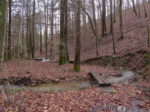
This ran along the banks of the Clear Fork river. I did a loop that was uphill both ways. I'll explain that later. After the day and a half of rain, the river was running high. In some places it was calmer, but in other places the water was turbulent enough to form standing waves over rocks.
All that rain made every small creek run stong, and there were numerous waterfalls that probably don't even happen most of the year.
Here's how the trail was uphill in both directions. The river makes a complete horseshoe bend. I started at the middle of the bend and walked upstream on the west portion. Then the trail climbs the ridge between the two parts of the river. That was about 200 feet higher. Then the trail does go downhill to get to the eastern part of the river. On the way down it follows a little creek.
Once you reach the river again, you are now walking south, but the river is now flowing north because of that bend! So you are walking uphill again to get back to the parking area. Tricky, right? If I had gone the other direction, it would have been mostly downhill. Of course, this is all semantics since it's a loop. The net elevation change is zero, but it feels weird.
I was able to do a loop that included 2.3 miles of the Sheltowee Trace, and then 1.7 return miles on the Burnt Mill Bridge Trail to get back to the car. With the sections Marie and I did in Red River Gorge, I've hiked perhaps 10 miles of the Sheltowee. I might be able to figure it out from my records, but if I ever did hike this whole trail, I'd just do the segments again that we did in 2019 for the continuity. Junctions were well marked, and the trail has been well-constructed, not just thrown across the landscape.
Other highlights include seeing a little garter snake in January.
And, finding American climbing fern,
Lygodium palmatum. I MAY have seen this one in the Red River Gorge, but I'll have to check back through the pictures. At any rate, I haven't seen it very often.
I entered Ohio at dusk on the Simon Kenton bridge. Not a great picture, but I thought the lights were cool.
And early this morning, I discovered I was driving a portion of the Trail of Tears National Historic Trail!
Just one more detail for the day. Owen did not want to be left out. He is Lin and Joe's cat, but he sort of thinks he's a dog.
The weather was wonderful. Warmest day of the trip yet. I hiked in shirtsleeves and it was 60 degrees. When I was with Nikki two years ago, we experienced what turned out to be the coldest temperatures of the entire NCT hike with one morning at -6 degrees!
Sheltowee Trace and Burnt Mill Loop Trail, Tennessee, 4.0 miles