Entries to Win Afghan

Sign up to receive the Books Leaving Footprints Newsletter. Comes out occasionally. No spam. No list swapping. Just email me! jhyshark@gmail.com Previous gifts include a short story, a poem, and coupons. Add your name, and don't miss out!
Showing posts with label Hodenpyl Dam Pond. Show all posts

Sunday, October 26, 2025

More From Yesterday


There are more awesome things to share from yesterday, and today was quite ordinary, so I'll just go with the pretty things. Starting with the sunrise.
orange sunrise


On the way home from the hike, Sue and I drove around Lake Gitchegumee, south of Buckley, and enjoyed the fall view.
lake gitchegumee buckley michigan


But wait! What is out there? It's two adult trumpeter swans with three juveniles! There were four more as well, but they were hanging out with a bunch of Canada geese.
trumpeter swans


We managed to take some roads that were less traveled coming home and enjoyed an extended color tour. One stop for a quick picture at the overlook for Hodepyl Dam Pond. The reflection of the sky in the water was the best.
Hodenpyl Dam pond


Today was a combination rest day and some puttering. I tried to make it more of a rest day, or at least tried to do things that weren't so much of the everyday pressing work. Mowed part of the yard. Last time before winter, I'm pretty sure. About half to go.

I did a little bit of work in my gardens- just moving a few things that I wanted to get fixed this fall.

See SPW at Highbanks Rollway

Friday, October 20, 2023

More Mapping Fun


Today, I went to Traverse City and spent all day working with Matt Rowbotham of the North Country Trail Association. His title is GIS Program Manager. GIS=Global Information System. That means he does all the map data processing for the 4800 miles of trail. (And creating specialty maps. And being the IT guy.)

If you can see the lines and lines of text below the green map section, that is the database where all the information is stored that you see when you click on a trail segment in the interactive map.

You may remember that from time to time I've talked about collecting map data for the Adirondacks. Here's Matt, taking parts of what I've noted and tracked and adding them to the full map database.
man at computer with mapping software


Here's what a few miles of data look like on my phone in the Avenza map as I record it. This was a place where no one could figure out where the trail was supposed to be. It's where Marie and I went back and hiked from the other direction just before the Celebration. Now, it's close to being ready to put on the interactive map on the NCTA web site.

If anyone wonders why it takes so long to get these maps right... the choice of trail route had to be made. Since no one had previously collected GPS data for this, the first line drawn on the map was an approximation, sometimes using a basemap that shows the same trail. But that map was probably made before there was GPS. So now there are two wrong lines. If I (or anyone) collects a track of the actual trail on the ground, that gives Matt better data. But there is still error in those lines. So it's better if there are two or more tracks to create a new trail line. But even one current one is better than the non-GPS guesses. Then Matt has to get all the info in the database about important things- who owns that property, the name of the segment, water sources, permitted use, camping options, hazards, etc. It all takes time. 4800 miles is 25,344,000 feet. And we're trying to get every one of them mapped correctly.
screen of Avenza map


It rained all day, but that made the leaf colors look bright. I took a few pictures on the way home.


Here's a picture of Hodenpyl Dam Pond from the rest area overlook on Rt 37.
Hodenpyl Dam Pond with fall colors


This took all day. I didn't sleep much last night, so I'm probably about done for the day. But this was really exciting to me-- to be a serious part of the effort to make the trail discoverable in the Adirondacks.

See Map Fun

Friday, April 28, 2023

Sunshine - Day 420


This could have been titled "Mary Poppins Day." You know... "practically perfect in every way." For starters, the sun came out! More Manistee River.
Manistee River


There were a few hills, but the miles were generally pretty level. If you must do a road walk, isn't this a nice one? This is actually a private campground road, so it's really nice.
curvy road


The last two-thirds of the day were along Hodenpyl Dam Pond. I've linked below to my last hike in this section instead of yesterday's hike. These are arguably some of the prettiest miles in the LP.
Hodenpyl Dam Pond


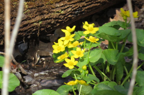
The marsh marigolds are beginning to bloom.
marsh marigolds


My luck getting pictures of birds was zero, but I saw a bluebird, a small hawk (I don't think it was a redtail, but I'm not sure), two male wood ducks, cormorants, and I heard a loon. There were the usual honky geese, robins, redwing blackbirds, and mallards, and some buffleheads.

However, I did see my first turtle of the year. This year, it's a painted turtle.
painted turtle


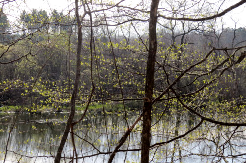
And today! With the leaves bigger and the sun shining, the camera could see the green "Christmas lights" in the trees.
new leaves on trees


Miles today: 10.5. Total miles so far: 4648.3,

See SPW Annual Meeting

Monday, July 19, 2021

Spirit of the Woods Annual Meeting

  Today was entirely consumed by the Annual Meeting of the Spirit of the Woods Chapter of the North Country Trail Association. We ended with an optional hike. I'm posting our destination picture with Monica, Deb & Theresa first just to get your attention. We hiked from Hodenpyl Dam to Porcupine Junction. Porcupine Junction

But first we started with a yummy pot luck lunch at the Big Bear Sportsman's Club near Kaleva. This was a new venue for us, and it worked really well. I managed to forget to take a picture of the food table, but you can be sure that it was loaded with amazing salads and fruits and some quick breads and desserts. The chapter provided hot dogs.

I came away highly encouraged. 25 members attended and one NCTA staff member. We elected new officers, and I am so very happy to tell you that I am not an officer this round. We have some new people who are stepping up to the plate. That's really exciting to me! chapter meeting

Two chapter Honor Awards were presented. One was from 2019 because we didn't have a meeting during 2020. This award was presented to the Shoreline Cycling Club for their quick response in opening the trail between US 10 and Wingleton Road after the big wind event that did so much damage in the Baldwin Area. I've showed you pictures of that damaged area in other posts. Dave McClean accepted the award for the club. Dave MaClean accepting award for Shoreline Cycling Club

Then the 2020 Honor Award was given to Peter Bennett for his untiring work to maintain the section of trail from 76th to 96th St, which includes the Sterling Marsh boardwalks. He also keeps portions of our 80 miles mowed when they need it. Peter Bennett accepting award

After the meeting there was an optional hike nearby (the club is close to the NCT, but not right on it). Eight of us chose to go for a six-mile hike. We did the section from Hodenpyl Dam to Porcupine Junction (just a cross trail at the Northern Exposure Campground, but it's a cute name). This piece of trail is always beautiful, even if the sky and water aren't blue. Pictured are Gary and Peg. hikers by Hodenpyl Dam Pond

We encountered a group of women Med students from U of M who were out doing a 5-day backpacking adventure. They had just started and smiling came easy. It was neat to see how excited they were. backpackers

Just a couple more pictures along the pond. This is a beautiful section. I was talking with people a lot, so didn't get pictures of some of the details of plants or whatever, but strengthening relationships with trail friends is good too. Hodenpyl Dam Pond Hodenpyl Dam Pond

North Country Trail miles for 2021 is at 343.

There is no other news. What with preparations, travel, and doing some extra volunteer stuff after I got home, this consumed the entire day. This is as planned. No complaints.

North Country Trail, Wexford County, MI, Hodenpyl Dam to Porcupine Junction and back, 6 miles.

See More Than a Package of Hot Dogs

Sunday, April 25, 2021

Spring Arrives at Hodenpyl

  Marie and I drove to do the piece of North Country Trail along Hodenpyl Dam Pond today. We waited for a blue-sky day so the water would be beautiful. It was chilly, but the sun was perfect. Hodenpyl Dam Pond

And the real surprise? This is north of me, and yet the wildflowers seem to be ahead of what I see right near home. Well, we are not going to complain!

Dutchman's Breeches dutchman's breeches

Cuckoo Flower
Cuckoo Flower


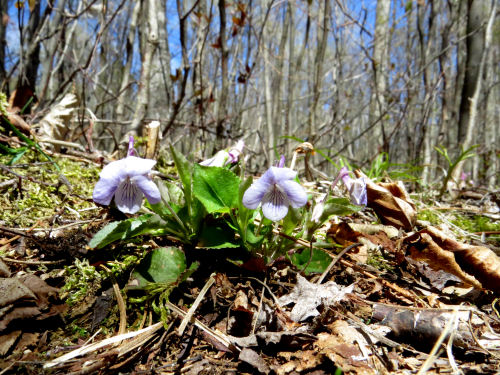
Common Blue Violet (but a very pale one) violets

Marsh Marigold marsh marigold

Shadbush looking like sparkles against the blue water. shadbush

Trout Lily trout lily

And the trilliums are just beginning. This one was the most open that we saw. trillium

But soon, there will be a white carpet- lots of buds! trilliums

The shadows were starting to fall as we finished. See link below for this same view in winter. We also saw Toothwort in bud and a couple other sedges, but pictures aren't very good. Hodenpyl Dam Pond

We went to Porcupine Junction (a trail crossing) and turned around, for a total of 6 miles. Porcupine Junction

What a great hike! This route never disappoints, but so much nicer with blue sky and water.

North Country Trail miles so far in 2021 is 226.

North Country Trail, Wexford County, MI, Hodenpyl Dam east along the pond and back for a total of 6 miles

In other news: We totally goofed off. We played our game, and did a little sightseeing on the way home from the hike.

See Hodenpyl Dam Pond in Winter

Thursday, January 28, 2021

Hodenpyl Dam Pond in Winter

  Loren and I hiked today along Hodenpyl Dam Pond, which is a really lovely stretch of the North Country Trail. I hadn't ever hiked it in winter. Of course, Koa was there too. She loves the snow! Hodenpyl Dam Pond

Warning: This is a picture-heavy post. Just to prove we were happy, here's another goofie selfie. The temperature stayed right around 20 degrees, but both of us had overdressed and had to shed a layer before we'd been out very long. friends

This bridge crosses an arm of the lake that isn't really a creek, it's more of a bayou. footbridge in winter

Here's the view out toward the lake from the bridge Hodenpyl Dam Pond

There was light snow falling almost all the time we were out. However, on our way back it started coming down a little heavier. This picture makes it look like a real white-out! That's kind of funny because the flakes never got really heavy, and it wasn't windy, but it sure softened the view. Hodenpyl Dam Pond

Now for the tree "damage" section of this post.

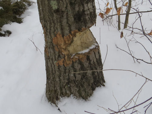
An energetic beaver has been hard at work here. I've seen them try to take down even bigger trees, but this one is certainly a long-term project. large tree chewed by beaver
We found this hemlock tree striped with yellow-bellied sapsucker holes. And here's where I learned something new. After I got home I looked up hemlocks and sapsuckers because I haven't noticed them drilling their lines of holes in hemlock before. Guess I just wasn't paying attention! They love hemlock. Sapsuckers, as beautiful as they are, do a lot of damage to trees. I found a table with the mortality rates for live trees drilled by sapsuckers. It's as high as 67% for gray birch and 51% for white birch (more common here). They also like red maple, red spruce and hemlock. But the mortality for hemlock is only 1%. The hemlock seem to tolerate it better. This tree was completely riddled with their holes, but seemed healthy. hemlock with sapsucker holes

And we saw another interesting burl. With the swirling snowflakes, it almost looks like it has white Christmas lights strung on it! burl

Now for the extended hike section of this hike!

So, we got back to the car after doing 6 miles. I wanted to do a little more. I wondered if I could make it to 10. I looked at the map, and I'd have to go beyond Eddington Bridge and back. Think DOWN to the creek, UP the other side, then ditto on the return. Decided I'd see how I felt. It was neat to look down and see Eddington Creek winding along the bottom of the valley (the wavy dark line in the middle). You can't really see the creek that well in the summer. Eddington Creek

Then up the other side, with a look back at the bridge. (But this is only the very start of the climb.) Eddington Creek Bridge

I had to go all the way to the top of the hill to get to the turnaround point! But I did it. I walked 10 miles in snow and don't even feel too beat. Yeah!

Hike 100 Challenge 2021 is at 46.5 miles.

North Country Trail, Wexford and Manistee Counties, MI, South of Eddington Creek to middle of Northern Exposure Campground and back. 10 miles

Believe me, there is no other news. I'm not whipped, but it was enough. Made a grilled cheese sandwich when I got home. Yum!

See Teeny's First Overnight