Entries to Win Afghan

Sign up to receive the Books Leaving Footprints Newsletter. Comes out occasionally. No spam. No list swapping. Just email me! jhyshark@gmail.com Previous gifts include a short story, a poem, and coupons. Add your name, and don't miss out!
Showing posts with label fire towers. Show all posts

Saturday, April 11, 2026

Spirit of the Woods Hike- April 2026


The monthly hike for April had to be tweaked twice! The plan was for Silver Creek Pathway (not NCT), last week, but it's been mostly underwater for weeks. Still underwater this weekend. So we went north from Timber Creek again.

Even with all the changes, we had about 25 people and three dogs show up.
hiking group


Most of the group did 6 miles or fewer (to 8th St and back). My goal was to do 8 miles again. One other hiker, Eric, wanted to go farther too, so we did! Notice the NCT emblem with black around the central star. That is a really old sticker and it still looks good. I can't even remember when that was changed to have a lighter color. Before 2005 for sure.


So, this is the section I hike ALL THE TIME, and the woods isn't turning green yet, so I struggle to get photos of anything remotely new. But Eric and I went north of 8th St, and then we decided to bushwhack over to the Ward Hills Fire Tower site. That is a favorite place of mine to visit.

Here's the foundation for the keeper's house, again.
foundation of an old house


And the view west from the top of the hill (toward Scottville and Ludington). The trees are all grown up, and the only times you get any view at all is when there are no leaves.
view west from Ward Hills fire tower site


It warmed up nicely by mid-day, and we ended up in shirtsleeves. The sun at least made the green moss glow.
mossy stump


We did a total of 8.2 miles. I feel pretty good, but didn't get a lot more done this afternoon.

Miles walked in 2026: 137.2
NCT Hike 100 Challenge 2026: 39.1

North Country Trail, Lake Co. Michigan, north 3.5 miles, then bushwhack to Ward Hills Fire Tower site, back to NCT via road, back on NCT to Timber Creek. NCT 6.5 miles, other 1.7 miles. Overall elevation range 360 feet.

See Eight Miles for Spring

Saturday, April 5, 2025

Spirit of the Woods Hike- April 2025

 It seems to be one of our standard chapter hikes, to start at the Udell Trailhead on M-55, hike south 3 miles, and then do the short bushwhack across to the Udell Fire Tower. Today we had 19 people and a dog. Several new-to-us hikers!


Once you cut across a short swath of woods, you are on the Fire Tower Road and can see the tower ahead of you.


The day started chilly and damp after the overnight rain, but by the time we got to the tower there was sun and blue sky. Still in the 40s, but that is nice for hiking. Just a view up the tower.


This is a nice find, even though it's not the right season to see when it's most pretty. This is violet-toothed polypore, last year's. When it gets old, it fades to cream and brown. top side:


And the underside. I should have taken a close-up of the teeth on the underside. I could see them enough when I blew the picture up to make the ID, but it's not good enough to bother to show you. I wonder if I go back later in the year if the same log will have it in full color.


Just a glacial erratic that's quite pretty.


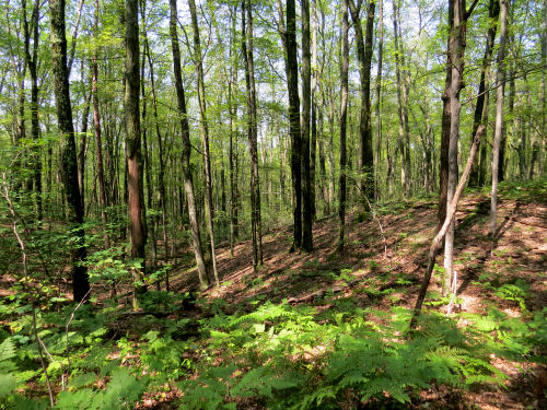
And, you know how I'm always saying it's hard to show the hilliness of the area in photos? This one does a pretty good job because of the tree shadows streaming down the hill. But you can also see that there is not even a hint of green showing up yet.


I hiked 6 miles with a 15-pound pack. I left it at the turnoff to the bushwhack and picked it up on the way back. It was another half-mile to get to the tower and back.

Miles hiked in 2025: 104. NCT Hike 100: 38.5.

North Country Trail, Udell TH, Manistee County, MI. South 3 miles, then bushwhack to Udell Fire Tower and back. Total 6.5 miles

See SPW Hike- Nov 2023

Saturday, November 4, 2023

Spirit of the Woods Hike- November 2023


We had a great turnout for the Spirit of the Woods Chapter hike today. 26 people and 2 dogs.
group of hikers


It was a lovely day in the fall woods. Most of the leaves are down, but not all. The temperature was cool, but perfect for walking. This is a small piece of Udell Fire Tower Road.
woods road in autumn


We did a short bushwhack from the trail to get to the Udell Fire Tower. It's being visited from the trail so often now there is a fairly visible treadway from the NCT to the road shown above.
Udell Fire Tower


There were still a number of colorful leaves on the ground if you hunted for them.
autumn leaves


And in some places where the moss grows thick there are these great gobs of green.
moss on tree


Several new people came on the hike, and also several we had not seen for a while. It was a great day in the woods.

North Country Trail. Udell TH to Udell Fire Tower and back. 6.3 miles

See Udell Fire Tower

Tuesday, August 10, 2021

Ward Hills Again

  Today, a fairly new friend, Monica, and I hiked 6.5 miles. We did a combo of North Country Trail, bushwhacking, and 2-tracks to make a loop and then we added a short out-and-back tail to make it a little longer.

We went to the Ward Hills Fire Tower site. I learned a couple of new things about this. For one thing, this is not only the highest hill in Ward Hills, I think it's the highest base elevation of any of the fire tower sites in the Manistee National Forest. I had assumed that would be either Udell or Red Bridge tower sites which are farther north in a hillier location. But this one is at 1160 feet, and Red Bridge is only 1101. Udell's base elevation is only 1000 feet. This was a 100-foot tower and was built by the Walhalla CCC camp. It was dismantled in 1972. Now you can only see the footings.

I hunted for the benchmark, but I've forgotten exactly where it is. Another reason to go back there. It's a site I like, even though the views are mostly grown in. Ward Hills fire tower site

The best part is the foundation of the keeper's house. I haven't been able to find out a lot of information about specific towers, but this is the only one I know of that had a house provided. Ward Hills fire tower site

I didn't take a lot of pictures. We were doing quite a bit of visiting. But I did snap one of my favorite bowls in this section. The trail snakes around the rim hills

This log was rimmed with a little orange fungus which contrasted nicely with the moss. orange fungus

Another nice find was some Angel Wings fungus. Supposed to be edible, but I haven't tried it. There has been some conflicting evidence on its edibility. I'll stick to the ones I'm certain of, thank you. angel wings fungus

Anyway, we hiked 5.25 miles on the NCT, and another 1.25 on roads. Hoping for more hikes with Monica!

North Country Trail miles for 2021 is at 360. I think Monica has her Hike 100 done.

North Country Trail, Lake County, MI, 8th St to Centerline Rd, and 8th St and Fire Tower access road for a loop and more. 6.5 miles

In other news: I edited, I wrote a chapter, I had a meeting this evening, and did a teeny-tiny bit on the trailer.

See Eight Miles for Spring

Tuesday, May 4, 2021

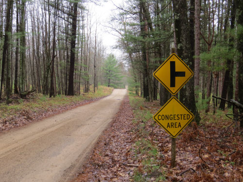
Congested

  I had to laugh at this sign on a dirt road today, especially since I saw no one else at all. However, the day was really full, so maybe it was a warning about that. congested area sign

For starters, I took Denali back to the trail. two people at a North Coutry Trail sign

She started out in the rain, but it stopped in another hour where I was. Hopefully for her too. hiker

Then, I did one of my favorite things- driving home on a back road I've never seen before. It began innocently enough on Fire Tower Road. Fire Tower Road This ended, not surprisingly, at a fire tower. The Udell Fire Tower to be exact. I've shown you this before, but I hiked to it that time.
Udell Hills Fire Tower


After the tower, the road got a lot more iffy. No pictures- I was busy driving. When I got to Forest Road 8180 I turned right. I knew where that crossed the trail. It's really straight, but has some fun rolling hills. Forest Road 8180

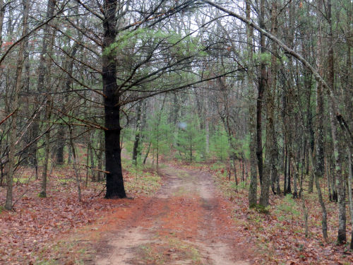
Then I turned on Good Road. Let me tell you how incorrectly that road is named. It started out as a fairly ordinary two track. But then it turned into this. Good Road

Um... that was still pretty good. I didn't take a picture of the last section. Let's say that I should have turned around, but I was almost to- could almost see- the next actual road. I got out of the car and tested the depth of the mud holes with a stick and decided I could get through if I was really careful. Didn't want to have to embarrass myself with getting towed out of a place like that. Well, I thought I might have to make that shameful call. But I did make it through!

Then I met Ramona for lunch since she was down my way. She used to be a forest ranger, so she enjoyed my forest road story. However, it seems that part of what I drove isn't supposed to be open to vehicles at all any more- the part beyond the fire tower! O well, there were no barriers and no signs. It's being driven. But I probably won't feel the need to do this route again. friends

Then my car had to go to the shop (not related to this morning's adventure at all). They called mid afternoon to tell me it would not be done today. So I had to scramble to find a ride to bell choir. Wasn't taking a chance on missing again this week!

What a congested day, but all good. (Except maybe the 10 seconds of "terror" when I thought I was going to get stuck). But as a t-shirt I own says, "Bad Decisions Make Good Stories." Now it's just one more great back-roads tale.

See A Day with Denali
See Udell Fire Tower

Saturday, March 20, 2021

Eight Miles for Spring

  This was a pretty perfect way to celebrate the entrance of Spring 2021. Cathy and I walked for 8 miles on the North Country Trail, and also took a little side trip. I just like the way the trail curls around the shoulder of this hill. This is the hill at the north end of Not Quite Endurance Edition, within the bubble of high land known as Ward Hills.

But very little snow today! You can see that the sky was blue, and despite a chilly start, I was hiking in shirtsleeves before we were finished. Pretty wonderful! hiker on a trail

There were spots of white yet in low areas that don't get the sun as much. This section is fairly hilly, and you can sort of tell that in the picture wooded hills in late winter

The adventure of the day was that we bushwhacked the extra little bit over to the Ward Hills Fire Tower Site. It looks like the last time I was there was three years ago. How can that be? Anyway, the views are better when the leaves are off the trees. The tower is long gone. I'm not sure when it was removed, but long before I ever hiked there. This is looking south, which is the best view. I can't quite identify the ridges, but suspect the farthest one might be a high E-W ridge near Hart, about 30 miles away. The fire tower hill is the highest point in the Ward Hills. view south from Ward Hills

To be honest, my favorite thing about the location is the foundation of the caretaker's house. I love contemplating what it looked like, and how the keeper lived there. foundation of Ward Hills Fire Tower keeper house

With someone else along to snap a picture, I even went down to check out the basement. There were pieces of a broken chair, but not enough to play house. foundation of Ward Hills Fire Tower keeper house

We did all our goofing off on the way outbound, covered 4 trail miles, turned around and came part way back before stopping for lunch. There was some neat moss on a nearby log. moss on a log moss on a log

My NCT Miles for 2021 is at 117. Cathy is going for the Hike 100 Challenge, and her total is at 22 miles.

North Country Trail, Lake County, MI, Centerline Road south for 4 miles and return, with a side trip to Ward Hills Fire Tower Site. Total miles 9.2

In other news: When I got home I hunkered down and spent some serious time on an editing job.

See Ward Hills Fire Tower Again

Saturday, April 25, 2020

Teeny's First Overnight - Day 2

 
Day two was warmer, although it still felt raw enough that I kept a jacket on until about the last hour. I'm going to start with the very last picture I took before arriving back at the car. The sun had just come out. This is the same place where I took the picture that was the first on yesterday's post. However, the sunshine makes the view across Leitch Bayou come alive.

Leitch Bayou

The trailing arbutus finally got its act together and agreed to open! Such a delicate little blossom.

trailing arbutus

Here's another lycopodium. I saw three kinds on this hike. This one is Shining Clubmoss, Lycopodium lucidulum. There are two that look something like this, with downward pointing leaves, but this one is shiny. It looks like it's made of plastic.

shining clubmoss

This was a neat surprise for day 2, because I hadn't noticed it poking through on the first day. I saw two clumps of this. It's Lousewort or Wood Betony. Leaves can be this beautiful maroon or dark green. And the flowers can be either yellow or maroon. The leaves will get much larger, of course, about 6-8" long.

Wood Betony

I see this every once in a while, but now I know what to call it. I haven't really gotten into studying mosses. But I believe this is Common Fern Moss, Thuidium delicatulum. At any rate, it's nifty looking.
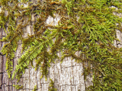
Common Fern Moss

On this piece of trail, the views across the Manistee River are always hiding behind branches. It's really hard to get a clear view of anything. However, I did find one place where you can really see the twin peaks of Caberfae Ski Resort. And the lingering snow on the slopes verifies that's what it is. They are about 7 miles away. I have hiked here on late winter afternoons when you could see the lights for night skiing. Then you can really identify it!

You can also see Briar Hill, the highest point in the Lower Peninsula, but I could not find a single place where you could get a clear shot of it through the branches. I'll have to keep hunting. Now that I know what to look for, I keep seeing it from "everywhere." This is the third place.

Caberfae Ski slopes

And this is a nifty find, sort of hiding in plain sight. I'd noticed it before, but then I was with a group. This time, I got up there (only a few feet off the trail, but above it, so it's easy to miss). This is the foundations for the Red Bridge Fire Tower. I haven't yet found any more information about it, except that it existed.
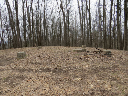
Red Bridge Fire Tower foundations

There are 10 good hills in this section. The biggest one climbs about 200 feet. There is one picture I regret not taking. And this is the time of year you'd need to do it. Makes me want to go back before the leaves come out. On a lot of those hills, moss has grown on the vertical part of where the trail is benched into the hill, so as you wind in and out of the crenelated bluffs you can see the green line of the trail tracking and climbing or falling around the head the valley ahead of you. The grade is quite uniform. I'm really impressed with the planning and execution of the trail building accomplished here. A lot of people don't like this side of the loop- the Manistee River Trail is on the other side of the river. There are more open views of the river, to be sure. But I like this side just as much. It's very quiet. The hills are a challenge. The valleys and folds of the sandy hills are pretty amazing. Some of them seem steeper than one might expect of their natural "angle of repose." There are old roads that wander through the valleys. I like to wonder who built those and what was their use.

Teeny did great- She didn't rub any raw spots. I did get a tiny "stich" in my left supraspinatus muscle. I think this can be cured by me getting in better shape. Since I had plenty of time, I made myself take a longer lunch break and read a chapter in the book I had with me. That was a good idea. I usually take a short rest (5-7 minutes) every hour. Marie and I have found this to be a great way to keep from over-taxing joints and muscles. I'm trying to stretch the walks out to 1.5 hours. Each of these two days I did 3 walks of 1.5 hours, and then two of one hour or less in the afternoon as I got more tired. I'm satisfied with my stamina in this regard.

Anyway... I had a great time. I met 6 hikers in the two days. I'm sure there are more over the weekend. This is a very popular section.

Total NCT Miles in 2020 - 168

In other news: Today I worked mostly on some of my many projects.

North Country Trail, Manistee County, Michigan, Sawdust Hole to Eddington Creek and back, 28 miles

See Teeny's First Overnight - Day 1