Entries to Win Afghan

Sign up to receive the Books Leaving Footprints Newsletter. Comes out occasionally. No spam. No list swapping. Just email me! jhyshark@gmail.com Previous gifts include a short story, a poem, and coupons. Add your name, and don't miss out!
Showing posts with label Big Sable River. Show all posts

Wednesday, July 29, 2026

Vince Smith Connections


Today was SO amazing!

Over and over, you've seen pictures of the Vince Smith Memorial Bridge that carries the North Country Trail over the Big Sable River. You might remember that the Forest Service and our trail chapter took out the old wooden bridge and replaced it with a fiberglass reinforced polymer bridge. That was in 2016. (The Forest Service wanted a bridge that didn't have footers in the river.)

The question of the day is, "Who was Vince Smith?" The answer, as we knew it, is that he was a key volunteer with the North Country Trail Association in the early days, before we were a chapter. We knew he spent a lot of time working on trail in the Manistee National Forest, and that the bridge had been named in his memory after he died of cancer. There was an article about him in the North Country Trail Association Newsletter (it wasn't even called the North Star yet) after he died, with a very useless, grainy picture.

The chapter had one tenuous connection. One of our charter members, Gordie Wilkes, had worked with Vince on the trail before he passed away.

Today, I got to meet his daughter Maureen (Mo), and nephew Craig, and their spouses. Here are Mo and Toby, Robin and Craig, on the end of the new bridge with the refurbished sign showing as well.
people on a bridge


We got Mo and Craig down on the level with the sign.
Vince Smith family by memorial sign


Mo has sent me some newspaper articles, and this picture of Vince taken from the Ann Arbor News in 1991 is the best we've ever seen.
North Country Trail volunteer Vince Smith


After visiting the bridge, we all hiked farther. Craig and Robin had their dogs Ila and Tanner with them. Here's Ila cooling off in the river. I guess I didn't get a picture of Tanner.
dog swimming in river


And we visited the "Blue Hole," a spring on the edge of the river.
blue spring


Mo, Craig, the dogs and I hiked 6 miles on the trail plus the 0.3 to access the cars. Then we all went for ice cream at the Sweetfern Cafe.

This fills out a very incomplete story for me and our chapter that we've always wanted to know more about. I'll be writing an article for our chapter newsletter. And we had a great time!

Here is the original bridge the summer after our chapter formed. This is in 1999.
Vince Smith Bridge in 1999


And here it is on one of our chapter hikes in 2015, the last year of the wooden bridge.
Vince Smith bridge in 2015


Miles walked in 2026: 263.8
Hike 100 Challenge: 98.7 (really close!)
Onekama Challenge: 75.6 (met the weekly goal)

North Country Trail, Lake Co., Michigan. South from 5-Mile Road, 3 miles out and back plus walk to car.

See Trail Adopter Training Day

Sunday, February 1, 2026

A Heat Wave


It was 22° today which felt really warm. Cathy and I went for a hike. It turned out to be a fairly tough hike.

I knew this section of the trail had been walked, and we chose to go in boots. Should have taken the snowshoes.

We started at 5-Mile Road and went south. Not only was it in the 20s, but the sun was shining!
trail through snow


We went just a little past the Big Sable River.
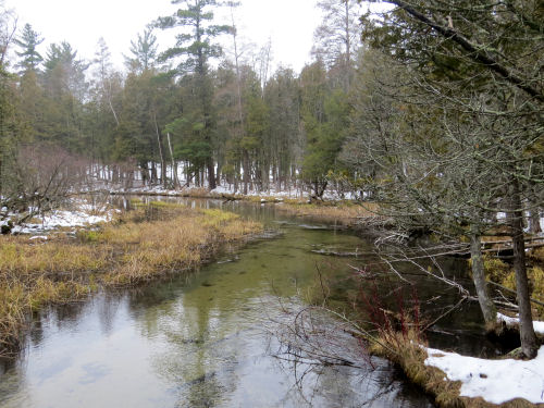
Big Sable River


The Vince Smith Bridge was sporting a big load of snow. Kind of interesting that it hadn't been knocked off.
Vince Smith Bridge


There were interesting little snow worms crawling along the rails.
snow melted on a railing


I have a bit of a sore knee, and this was tough going, but we were glad to be outside. And I really overdressed. Guess I'd gotten used to the cold, so I was really warm!

The trail is broken for some distance beyond the bridge, but snowshoes are recommended. Even compacted it's still deep. We kept breaking through. (If you park on Mac Road, please park on the west side. The property owner on the east side is not friendly and will have your car towed.)

I didn't accomplish a whole lot else today. Well, a couple of little things that are parts of other things. But they feel like "nothing."

Miles walked in 2026: 27.5
Hike 100 Challenge 2026: 9 miles.

North Country Trail, Lake County, MI. Mac Road to south of the Vince Smith bridge and back 2.3 miles

See To McCarthy Lake

Saturday, April 12, 2025

Trail Adopter Training Day

 Today, the Spirit of the Woods Chapter of the NCTA held a training seminar for those who have or might want to adopt a section of the trail.

We started out with classroom time in the morning with Kenny Wawsczyk, the Michigan Regional Trail Coordinator for the NCTA.
people watching a power point


Then we were treated to lunch provided by the Chapter but assembled by Pete, our Trail Adopter Coordinator. We had yummy things, but I was so busy talking with people I forgot to take a picture.

Anyway, after lunch we went out to the trail for some simple demonstrations. Pete and Dan cut a tree that was blocking the trail, and they talked about "pinch points" to help make decisions on how to cut something like this that is leaning.
two men cutting a small fallen tree


We all posed for a picture at the Vince Smith Bridge. Yes, where I was only yesterday.
people standing on a bridge


Kenny demonstrated some proper techniques for lopping. In this instance, he's explaining that small trees to be removed should be cut down flat to the ground so they don't leave potentially dangerous pointed stubs.
lopping a sapling


We took a very short side trip to a place called the "Blue Hole," a spring near the Big Sable River that is about 25 feet deep.
blue spring


That really took all of the day. We had good amounts of time to talk with others about trail-related things. The Chapter has upcoming officer elections in June, and we're trying to get a full slate lined up. There are projects that need to be discussed, and lots of people had questions. All in all, a really excellent day. Not to mention, the weather was gorgeous!

When I got home, I did a tiny bit of yard work. There was also a tiny bit of walking on the trail, but it was so little, I'm not even going to count it.

See To McCarthy Lake

Tuesday, April 23, 2024

Big Sable Reference Points

  You know one of my hobbies is to follow local rivers. I've showed you a couple of places on the Big Sable River a lot of times: the Vince Smith Bridge, where the NCT crosses it. Hamlin Dam, where it is dammed to make Hamilin Lake. And the outlet at Ludington State Park.

But I have another reference point from my back road explorations yesterday. This is about 7 straight-line miles downstream from the Vince Smith Bridge. That's probably at least twice that many river miles. This is along Taylor Road. Point #3 on the map.
Big Sable River from Taylor Rd


Here is point #2 on the map. You've seen this in every season because this is where the North Country Trail crosses the river.

Big Sable River from the Vince Smith Bridge

And this is the headwaters at point #1 on the map. From here, oddly, the river flows north and goes around a loop before heading south and west. photo label

I left the map large, so you can click it to see things better.
map of the upper big sable river


I can see that there are a couple of small bridges between points 2 and 3. Guess I'll need a river exploration day!

I worked really hard today- editing and then on the book. I got some formatting cleaned up and did my 100 miles of campsites.

See At the Vince Smith Bridge
See Snow on Big Sable Headwaters

Tuesday, July 27, 2021

Even Seeing Water Makes Me Feel Cooler

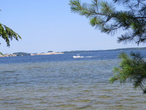
  Cathy and I hiked familiar trails at the State Park today. The best thing about it was all the views of the water. The humidity was brutal, and seeing all the blue just made us feel cooler. I think it actually was cooler than at my house. Usually is. We walked out to Hamlin Lake. You've seen this view a lot of times now, but it's still refreshing. Hamlin Lake

We took a short break on a bench at Inspiration Point. An eagle soared right in front of us, but I couldn't get the camera aimed fast enough. Ditto with a blue heron. That would have been a neat picture because we were above it, but that one didn't happen either.

Here's Hamlin Lake just above the dam. This is full summer at Ludington State Park. Lots and lots of people out enjoying the water in so many ways-- motor boats, tubing, paddleboards, kayaks, fishing. I went out of my way to try to exclude them from the pictures. Hamlin Lake

And the dam. Hamlin Dam

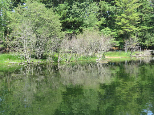
Just below that the water becomes the Big Sable River again. Now we have green instead of blue. We saw some fairly big fish, but my pictures aren't worth showing you. The reflections were nice, though. We did not walk as far as Lake Michigan. Big Sable River

How hot and muggy was it? Even the deer were hunkered down, resting. Two bucks in velvet sharing a small valley. This one has four points. buck in velvet lying down

This one has eight! buck in velvet lying down

About a five mile hike. Hilly.

In other news: I edited all morning. I fussed with the trailer, still with no results except information gathering. Since I got home I've been writing. About half done with the next chapter.

Ludington State Park, MI. Piney Ridge Road to Hamlin Dam to footbridge over Big Sable River and back. 5 miles.

See Views of Hamlin Lake

Tuesday, April 20, 2021

Ludington State Park with Cathy and Marie

  Today was a typical non-stop Tuesday. All good. Marie and I met Cathy at the State Park after lunch, and we set out on the Coast Guard Trail in a biting wind and 37 degrees. hikers on trail with dune grass

That trail goes east-west across the park, but our goal was to get to Lost Lake. Today we walked up the west side- not a view I've showed you recently. It's a very pretty lake, and there are boardwalks all along this side. Ludington State Park Lost Lake

At the north end, this view across the lake is the same one I've shown you at least twice from the top of the bluff, but this one is at water level. Ludington State Park Lost Lake

There are already early spring paddlers out! canoeist

From there, we connected with the Island Trail- one of my favorites- and headed back. This tree root is on its way to becoming driftwood. Kind of artistic. bare roots of tree

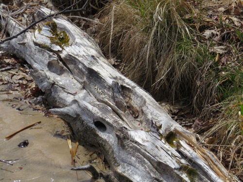
This log is only a couple of seasons away from really being driftwood. Lots of textures there. whitened log

The sun tried to come out, just briefly, but it made light patterns on the water. dappled light on water

We arrived back at the entrance and the outlet of the Big Sable River at Lake Michigan. Big Sable River outlet

Three happy hikers! friends

Total distance- about 5 miles, probably a little more, but I forgot to turn on the app, and the trail maps don't have the mileage of every segment listed.

Ludington State Park, Ludington, MI, Lighthouse Trail to Coast Guard Trail, to Lost Lake Trail, to Island Trail, to Sable River Trail. About 5 miles

In other news: We cooked a big casserole for some meals over the next few days, hiked, did grocery shopping, and had bell choir practice. Next stop- rest time!

See Friends and Footsteps

Thursday, March 18, 2021

Not Quite Spring, but No Snow

  Today, Loren and I did the same hike we did at the beginning of January (link below). However, it was much easier today with almost no snow on the trail. We started at 5 Mile Road and went south to cross the Big Sable River on the Vince Smith bridge. The boardwalk is the approach to the bridge through the floodplain wetland. You can see the bridge in the distance. hiker on a boardwalk

There is always a beautiful picture to be had of the Big Sable River. Big Sable River

The river and bridge are the best features of this stretch. From the river you climb about 100 feet to the top of a wide ridge and then drop back down again to 3 Mile Road, and just past that McCarthy Creek and Lake (beyond where we walked). So this section should also be remembered as one with a big climb and downhill no matter which direction you hike. Here is Loren starting down the slope in a valley toward 3 Mile Road. hiker in the woods

I was trying hard to find things that weren't just brown and gray. You may recall that March is my least favorite month of the year. Well, I found a puddle of bright yellow-green moss on a stump. moss on a stump

The symmetric pattern of the bark flowing around the roots of this tree is intriguing. bark texture

Moss and lichen in a repeating pattern. I found this oddly appealing. moss and lichen on a log

And a true hint of spring- also good with comparison to a year ago- Trailing Arbutus. Tiny tight buds. I compared them with the picture from a year ago, and they are just a little bit tighter than those. However, this is also 15 miles farther north, and spring "travels" about 15 miles a day. And we are still 4 days earlier than my pictures from last year. So, perhaps, everything is about on a par with 2020. trailing arbutus

North Country Trail, Lake County, MI, 5 Mile Rd to 3 Mile Rd and back 7.5 miles total

North Country Trail miles in 2021 = 109

In other news: When I got home, I settled in and did some more editing, and also started reading a good book.

See 5 Mile to 3 Mile

Thursday, January 14, 2021

5 Mile to 3 Mile = 7.5 Miles

  Loren and I did an out-and-back hike today on the North Country Trail starting on 5-Mile Road. We were feeling strong, so we kept going. We went to 3-Mile Road and turned around. All together, this is 7 miles on trail and an extra 0.5 mile to get to the car. All the trail miles were in wet snow. Well, I'm a little stiff, but not too bad! It was a challenge.

Here's Loren on the new (at least 4 years old now) Vince Smith bridge. Vince Smith bridge

The bridge takes the trail across the Big Sable River. This is the river that is dammed to form Hamlin Lake and runs through Ludington State Park. Big Sable River

It always seems to be picturesque in any season. Big Sable River

This is the former Michigan East and West Railway. Link below for a summer picture. The trail just crosses it and moves on. Michigan East and West Railway berm

I thought this was interesting. A pileated woodpecker has been doing its thing on this dead tree, and this year from the looks of the hanging shreds of bark. And yet, those polypore mushrooms sprang up around the holes. I don't think I've seen fugus move in around the woodpecker holes so quickly before. They usually just dry out and appear as a naked line of ovals on the tree.
pileated woodpecker holes with fungus


The proof we were there. hikers

And just a little still life in oak leaves on snow. We didn't see a pileated woodpecker, but we did see a red-headed one and a hairy. Snow fleas, lots of deer, and rabbit, and squirrel tracks. oak leaves on snow

Hike 100 Challenge for 2021 is at 18.5 miles.

North Country Trail, Lake County, MI. 5 Mile Road at Mac Road, south to 3 Mile Road and back. 7.5 miles

In other news: I may have one of the other issues with companies fixed. Two down, two to go. (It started out as a total of three, but one of them really had two parts.) You know how much time those kinds of things take. I did not do a couple other things I should have. What else is new?

But, I did do this after I blogged last night. Cathy had loaned me a jigsaw puzzle that was in a baggie with no picture. Now, you need to know that I think this is cool! No clues to help. We thought it was another Coke memoribilia puzzle because of some of the pieces, but we weren't positive. So, I dumped it on the table, and thought I'd just do a little bit. puzzle dumped on table

Ha! It was pretty easy, and it was fun. I kept thinking I was tired and should go to bed, but I could. not. stop. Voila! coke sign puzzle

I certainly seem to be on a puzzle jag.

See Michigan East and West Railway
Big Sable River in summer and the old bridge