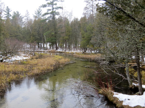
But I have another reference point from my back road explorations yesterday. This is about 7 straight-line miles downstream from the Vince Smith Bridge. That's probably at least twice that many river miles. This is along Taylor Road. Point #3 on the map.
Here is point #2 on the map. You've seen this in every season because this is where the North Country Trail crosses the river.

And this is the headwaters at point #1 on the map. From here, oddly, the river flows north and goes around a loop before heading south and west.

I left the map large, so you can click it to see things better.
I can see that there are a couple of small bridges between points 2 and 3. Guess I'll need a river exploration day!
I worked really hard today- editing and then on the book. I got some formatting cleaned up and did my 100 miles of campsites.
 | See At the Vince Smith Bridge
See Snow on Big Sable Headwaters |


2 comments:
That third picture down is quite interesting with the trees falling in all different directions.
Java Bean: "Our Dada is big on following rivers! He says that when they saw the old 'Blair Witch Project' movie he and Mama kept telling the people lost in the woods, 'Just follow the stream! It will lead you to a river, and that will lead you to a town or city!' But the stupid people never took their advice."
Lulu: "In the stupid peoples' defense, the movie was already finished and they couldn't hear Mama and Dada shouting at them."
Post a Comment