I'd been told that's where I would end up, but it was still awesome, because I'd never seen it from this side. Look sort of above Maggie along the far "shore" and you will see orange floats. Those are for safety, above the dam.
Now look the other way, up the lake. It looks narrow and smallish.

But it's not. Everything you see in these pictures is in Ludington State Park. But the Lake is not small at all. This end, very near the dam, narrows down, but here's a map to give you perspective. Check out the mileage legend. The big blue space to the left is Lake Michigan, of course. The dam is located at number 3.

So, before we go any farther, let me show you the dam. Think about the size of this lake. It covers 4992 acres (surface area), and has a maximum depth of 78 feet. That's a pretty big lake. Now take a look at the dam.

Too bad there was no one else there so I could put a person in for perspective. The dam is only about 8 feet tall, yet it creates that huge lake! Isn't water amazing? It was built during the logging era (about 1900) to create the lake for floating logs. The dammed river is the Big Sable.
OK... what are all those numbers on the map? I thought I'd show you where some of my other adventures have been.
Point 1: Big Sable Lighthouse- Two Lighthouses and a Trail
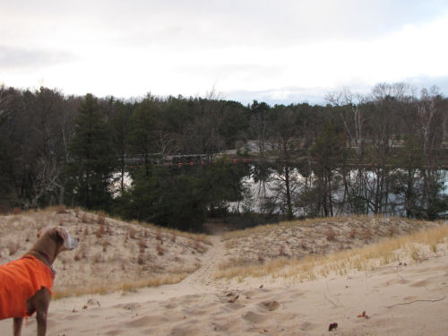
Points 2-3: Yesterday's hike- A New Trail to...", and A Day for Friends (the posed picture at the end was taken on the other side of Hamlin Dam)
Points 4-5: Where I swam across the lake in August- So Slow, But Undaunted
Point 6: Where the Big Sable River enters the lake. I don't have a picture from that exact location, but it's been featured upstream in Interesting Intersection but No Train and Cinq Rivieres
Point 7 (and surroundings): Nordhouse Dunes, where you've seen many adventures- Ellen and Joan Find Treasures at Nordhouse, or Ducks of the Day (on the little round lake to the right of the 7), or A Tale of Nor-Dunes
Point 8: Victory Park- Orange, location of the Orange Mist cooler in the woods
Point 9: The end of Larch Drive- Overheard on Hamlin Lake
That's plenty of info for one day, but I thought it would put some perspective on some of the adventures where I've dragged you along! Work day tomorrow- who knows what I'll find?
 | |
| if you like this blog, click the +1 | |
8 comments:
All of your posts make me homesick. I have been working on discovering the "local loop" down here though. There are some cool things going on.
have you found the Society of Les Voyageurs? Go to 411 Longshore Drive and tell them I sent you.
Oh, I do not aware that I have gone through so many points.
Thanks for the tour! I love maps and the pictures are very helpful. So the swim was right at two miles? I might have made thirty yards, providing the last fifteen were back toward the shore.
That was a happy surprise. That's a huge lake on the map. The pix don't do it justice.
you sure do cover a lot of territory. And lucky us getting to go along on the adventures
Well worth the wait, I'd like to think the dam was used to produce energy.
John- I forgot to put your name on my comment to you above- have you found The Society of Les Voyageurs?
rainfield- you have traveled far with me!
vanilla- I like maps too. One boat measured it at 1.8 miles.
Chuck- certainly not the pic from that day. Some views from the state park, or the swim show its size better.
Ann- I love having you come along!
Carole- I don't think so, it powered a sawmill in its "youth." There was a tiny village called Hamlin that was wiped out when the dam broke in 1912. Now it's all state park land.
Post a Comment