OK, I've been reluctant to talk about this hike because it's a bit of a stretch for me, and I'm not 100% confident I can actually do this. But I know you'll be rooting for me if I let you in on the plan.
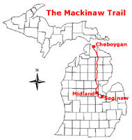
There is an historic Native American route from approximately Midland, Michigan to the Straits of Mackinac. The Boy Scouts set about restoring this route to some degree of walkability a number of years ago. It's now called the Midland to Mackinac Trail. Here's a small locator map that shows the route starting in Saginaw and going to Cheboygan. The "new" M2M trail goes from just north of Midland to downtown Mackinaw City.
There are also not enough people who can put in the time to help maintain it. The friends I hiked with last week, Connie and Jerry, are two of the people who spend countless hours clearing brush, painting blazes, and attempting to preserve the trail for humans instead of beavers.
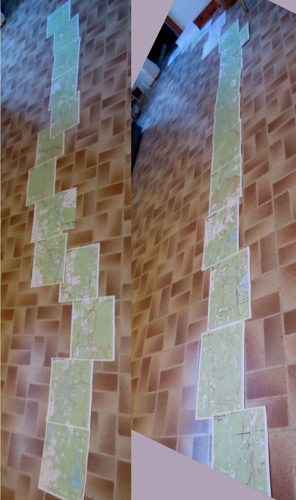
If you've been around this blog or me for a while, you know I always print a set of USGS topographic maps for every major hike I take and try to become familiar with the route ahead of time. I mark the roads, the trail (as best I can determine), water sources, etc. I create an itinerary with campsites that I hope to make each night.
Here's a sample of about 1 1/2 of them for this trip. This is from the south Trailhead. (extra dotted line in case re-route needed)

Then, as you may know, I like to spread them out with the orange line connecting. Well! Usually my hikes are one room length long. This one is two-plus lengths. I put the two strips together in one picture. I'll hike from the bottom to the top of the left strip and two pages more on the right strip. Then Connie and Jerry are going to pick me up for a day off to resupply and get cleaned up, and then put me back out the next day to finish the right hand strip.

Why might I not be able to? Well, you all think I'm in great shape, and OK... I'm not in bad shape, but this will be the longest solo trek I've taken. It doesn't worry me that I'll be alone, but sometimes two people can encourage each other and keep up the pace. I'm also nursing a knee that I stretched a month ago. It's close to 100%, but if it decides to go south on me, I might have to bail out. That would not make me happy, but I'm not interested in really damaging something.
Also, the trail may present me with surprises. It's not hiked in its entirety very much. For example, Jerry has already scouted out a beaver problem area and I know before I ever start that I will need to take a road walk around a flooded area that there is no way to hike through. If I discover other places like this as I go, the solution will probably involve backtracking, finding alternate routes and then connecting back to the trail. All on foot.
The last three days are pretty easy on rail-trail, so if I make it to Waveland (don't bother to look it up, it's a defunct railroad town), I should be golden to finish!
I do need to get up to "speed" for carrying about 38 pounds. That would be a maximum weight on each "first day" with all water bottles full and 8 days of food. I'll eat about 1 1/4 pounds of food per day.
I'm really imposing on Connie and Jerry for tons of advance planning help. They keep telling me they like to do it. Hope so, because I'm rather an obsessive planner. But I seldom have big issues once I'm out there.
There is a lot to do to get ready in addition to spiffing up some of my gear. I'm sure you'll be hearing about it!
In other news: I wrote a chapter in Dead Mule Swamp Mistletoe and walked to do some errands. (And sort of cleaned the kitchen floor so I could lay out those maps!)
 | See I Have Maps |
| if you like this blog, click the +1
| |
6 comments:
WOW! What a great adventure! Oh, I wish I could join you on the open trail. But, if not in person, then in spirit. I will be thinking of you and sending you positive vibes to carry on! I am excited to hear all about your adventures.
Be Safe! Have Fun!
Awesome!!! I pray you make the whole way.
You can make it! It sounds like a really fun trip. I wish I could go too. :)
Hi Joan,
That sounds like a very interesting hike. That is the kind that would need a lot of planning.
I would suggest hike your own pace and don't try to hurry.
Ed
Ah, so this is what all the new gear has been for. That's some hike but if anyone can do it you can. Like Lin, I'll be with you in spirit cheering you on.
Thanks, everyone! Don't worry, I'll keep you posted.
Post a Comment