You could say the hike was defined by Goodhue Creek. We had a little trouble finding the trail on the east side, but we found the crossing, and had to wade.
![wading Goodhue Creek](https://blogger.googleusercontent.com/img/b/R29vZ2xl/AVvXsEjgeaRXitQigXLviuuMN-aiq1u7uWAhpc9oQ8mEgMLj5dDWWA68ly-LZAwlJE3lTCzaWTpFlhvfmpn4Hm_6RQH5LRk1DOJyAtpRJO1rDv2UyRcU0E3qbRIHSugfSZpUWXo-kPtAEyCnk6g/s500/NY2021-18GoodhueCreek.jpg)
This is the view downstream.
![Goodhue Creek](https://blogger.googleusercontent.com/img/b/R29vZ2xl/AVvXsEhuFlIPzRc7sDhh2lVBUnhoaXwn7rFZI3Xc23jNNe2nAoObDZg4isyTMmQA6fiaknI28bRvQuBbuUkn2hjbbVHg2C8hmqZryVyj1iHwhSWyvZOD0jZzYIGN69ZWdbLnPSjOgKllBf_cdCo/s500/NY2021-19GoodhueCreek.jpg)
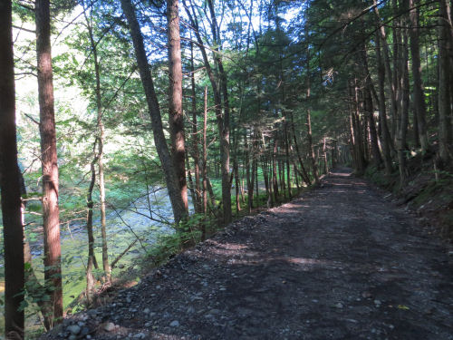
After that, the trail followed the creek on an access road for about half a mile. The creek is down on the left.
![Goodhue Creek](https://blogger.googleusercontent.com/img/b/R29vZ2xl/AVvXsEgA1XQohx6HMGfBH3Qy9sC94TpbnDwgwLRLaoL7R8j-0yN58Zwx0oz6268Yl9QD_8nED0ZIFW_pRbU0vkEFDlBRL-BcJ157wViXBOkCtfxbOjXT6MsOKkYMtoldoMvUkNlqOqLgzXH-tjw/s500/NY2021-20GoodhueCreek.jpg)
Other treats include New England Aster with Turtlehead in the background.
![New England Aster with Turtlehead](https://blogger.googleusercontent.com/img/b/R29vZ2xl/AVvXsEiH85kRUdfNLS20cP7UUUimvjN6NAbc7sNKvwooL4pkCyFOT7Ugr3eAt4rbe66QbIwlNcsAZ5YS00W107QlN4N-Df54588XUlnDdSvm52q06OAJ7eJkEB2jb-XCwi9gIIvuQ8YprX5CcF0/s500/NY2021-16AsterTurtlehead.jpg)
And some bright orange fungus growing on stumps.
![bright orange fungus](https://blogger.googleusercontent.com/img/b/R29vZ2xl/AVvXsEg4fmufs_SGo0kV9fCvENHnR2rwYHO6TaXcfMPE-Uq0V6TlwoQmTtXaWNVx_KkSeOSjZxhjMKzcz4VkKTSkoVU_teraWyOi7otKYOXBldB9rsKeE4LLImbY4kyXTAahislJqCfc6eJ1VQQ/s500/NY2021-17OrangeMushroom.jpg)
We finally got to the falls known as Little Niagara. It was part of a park on Goodhue Creek. There were some campsites, and benches and a little viewing platform. This is looking down on the top.
![LIttle Niagara Falls Steuben County](https://blogger.googleusercontent.com/img/b/R29vZ2xl/AVvXsEj1zqtjOXbdmK0Qw7fCJLPRmREJN6YkK2JRsGRr6oQTsjNFP9CU1SQqFyCaFEZLuLpCsYjv16NopXjpEcHQGEUjlWQngf4VFuFcoKqwMz95Hq5KqB3Zry4rJ9e2fEjDwt40jVkhseeQC1A/s500/NY2021-21LittleNiagara.jpg)
I crossed on a log bridge to be able to get to the bottom and take a better picture. It's really nice!
![LIttle Niagara Falls Steuben County](https://blogger.googleusercontent.com/img/b/R29vZ2xl/AVvXsEgDHq5Sc6OZVes8hWg-K1I0143InUVAqzrfq1kq-VTxctVekN_q-pp0pFVzskD6IEe0QJnd7F4OMPM3IpzpBYdWVw7u8tpv68K6O_IO6c3EHAjC52sSq8jXB62s0tKezi22GwA36ATLds0/s500/NY2021-22LittleNiagara.jpg)
We closed the loop by using the same route we bailed out on yesterday. Forward progress on the trail 3.9 miles. To the falls and back 0.6 miles. A side trip to a gravel pit when we both missed seeing a turn blaze 0.4 miles. Closing the loop 1.3 miles. Total hike= 6.2 miles.
Chicken alfredo and salad for dinner!
Crystal Hills Branch of the Finger Lakes Trail. East of Addison NY to the junction of Beemer Hollow and Troy Roads. 3.9 trail miles, +2.3 miles side trips.
![]() | See Crystal Hills - Rain |
2 comments:
That first picture takes me back to when I was a kid. There was a nearby creek that we used to wade in all the time.
Ann- It can be fun when you have the right shoes!
Post a Comment